
Babia Góra - all trails. For children and more
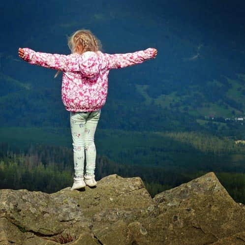
Babia Góra with Diablak (1725 m above sea level) - the highest peak of the Żywiec Beskids, is a gem in the crown of Poland's highest mountains and the Crown of the Polish Beskids, rightfully called the Queen of the Beskids. On the other hand, it is a famous Capricious Lady, which can surprise with unexpected weather changes, gusty winds, and storms. The unique nature of the ridge and slopes of Babia Góra is protected by the Babiogórski National Park. There are many routes leading to the summit, both from the Polish and Slovak sides, and the views are breathtaking!
Trails to Babia Góra
Easy and challenging, fast and scenic - there are many routes leading to the Queen of the Beskids. Which trail will you choose?
Babia Góra - how to reach the summit fastest?
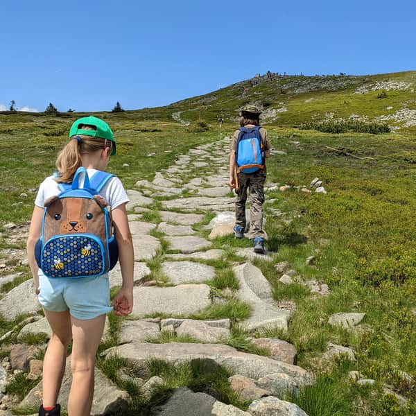
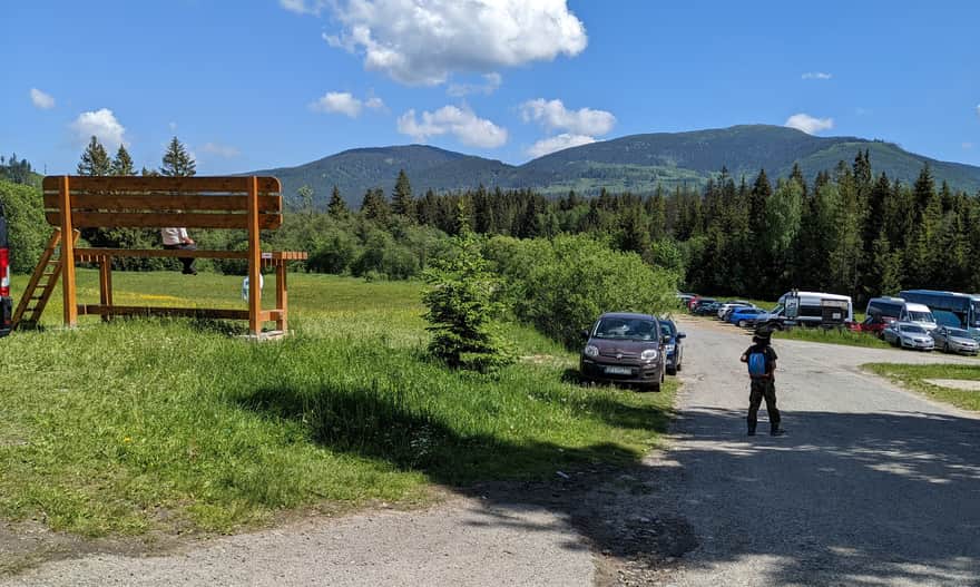
The fastest way to reach Babia Góra is by taking the red trail from the parking lot at Krowiaki. The official time to reach the summit is 2.5 hours (our experienced 10-year-old hiker needed less than 2 hours), so the round trip can be completed in less than 4 hours.
Yes: it will be steep, there will be views, and there will be crowds...
Difficult
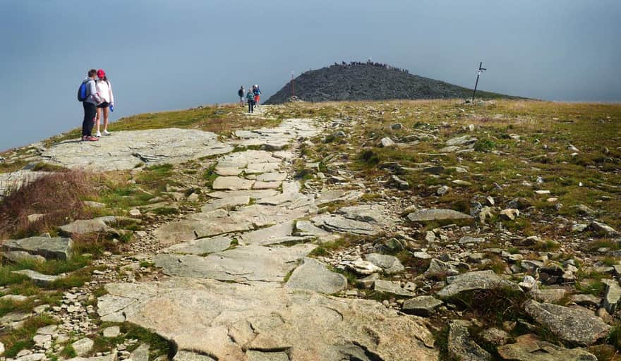
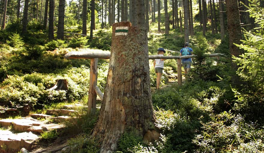
Red Trail: Krowiarki - Babia Góra

The most popular trail: loop to Babia Góra from Krowiarki
Most people choose the following route: they ascend to the summit of Babia Góra on the red trail, then descend through Przełęcz Brona to the Markowe Szczawiny shelter, and return to the parking lot on the blue trail:
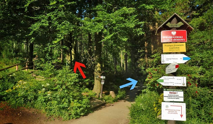
We ascend to Babia Góra through Sokolica on the red trail, and from the summit, we head towards Mała Babia Góra. We descend from Przełęcz Brona to the Markowe Szczawiny shelter (warm meals, souvenirs, and a stamp for your booklet!). From the shelter, we return to the parking lot at Krowiarki on a comfortable path along the blue trail.
This is a beautiful scenic route (which is why it is so popular):
Difficult
Babia Góra - loop from Krowiarki through Markowe Szczawiny

Babia Góra from Zawoja Markowe
If you don't want to hike in crowded places, risk not finding a parking spot at Krowiarki, and at the same time want to tackle a more challenging, steep, and longer route, you can start your hike to Babia Góra from Zawoja Markowe.
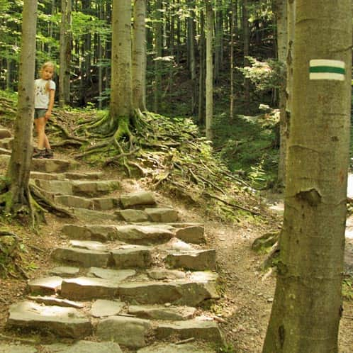
First, we take the green trail to reach the Markowe Szczawiny shelter:
Medium
Green trail Zawoja - Markowe Szczawiny

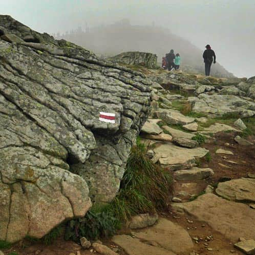
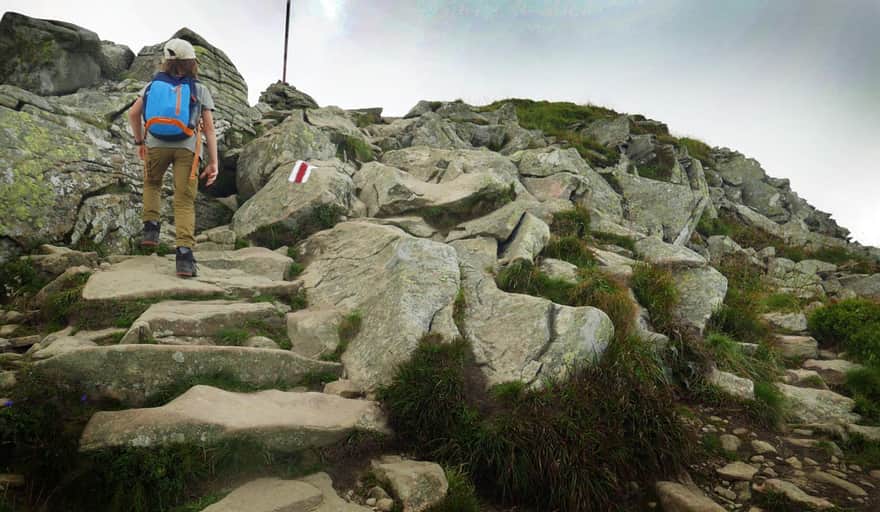
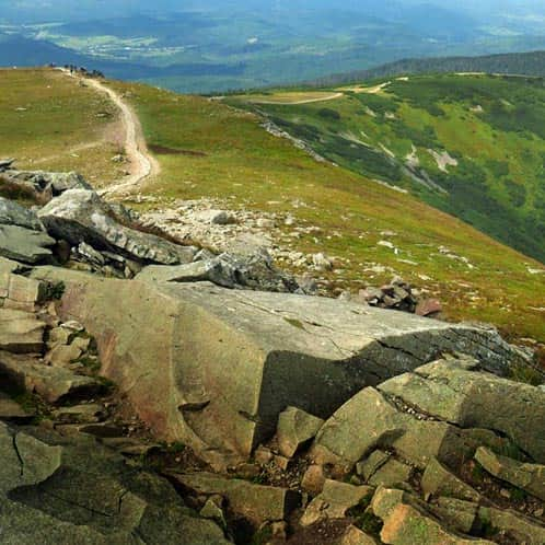
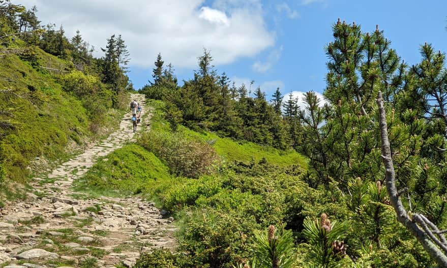
Then, we climb the red trail to Przełęcz Brona and from there to the summit of the Queen of the Beskids.
In total, it takes about 3-3.5 hours of climbing and a total elevation gain of 1000 meters.
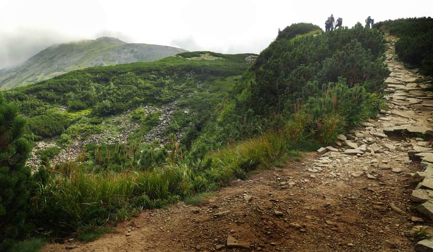
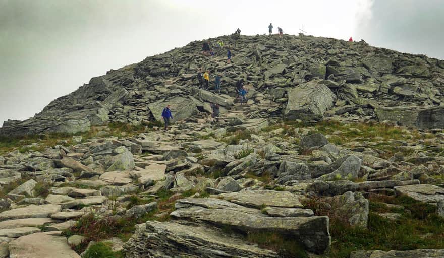
And we will be climbing to the summit through this rocky terrain:
Babia Góra with a dog - from Slovakia
It is worth considering hiking to the summit of Babia Góra from the Slovak side. There are many reasons for that: among others, it is the only way you can legally hike with your four-legged friend. Besides, it will be much quieter and easier. We describe the trails and loops from Slovakia to Babia Góra here:
Babia Góra - Trails and Loops from Slovakia
Table of ContentsWhy should you hike to Babia Góra from Slovakia?Hiking to Babia Góra with ChildrenTrails to Babia Góra from SlovakiaYellow Trail ...
From Slovakia - the easiest trail to Babia Góra
Are you looking for the easiest route to the summit of Babia Góra? We recommend the yellow trail from Slana Voda in Slovakia. The trail is long, with an elevation gain of 1000 meters, but there are no major terrain difficulties. The trail has excellent infrastructure - numerous shelters and benches along the way:

Difficult
Slana Voda - Babia Góra. Yellow trail

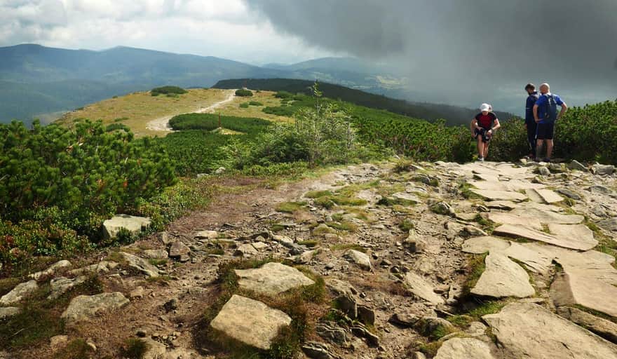
Loop through Mała Babia Góra
This will be a long hike, perfect for a beautiful full-day excursion.
It has many advantages - it is not crowded, there are no long steep ascents (like on Sokolica, for example), or climbing over large rocks (like when approaching from Przełęcz Brona). Along the way, you will enjoy the most beautiful views - both of the Tatra Mountains and the Beskids panoramas.
Difficult
Babia Góra from Slovakia - loop through Mała Babia

Babia Góra - the green trail
The green trail also passes through Babia Góra, and you can access it from Zawoja or from the south - the so-called Pańska Droga (2.5 hours). It is said to be less crowded but much longer (the route from Zawoja-Czatoża is yellow, then black, and finally green - 4 hours) - if you know it, please share your experience!
...and there is also the Perć Akademików, a one-way yellow trail with chains and ladders. You can read about it on forums and websites for more experienced mountaineers.
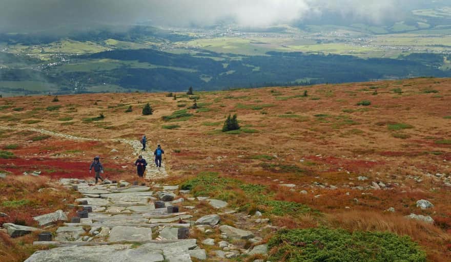
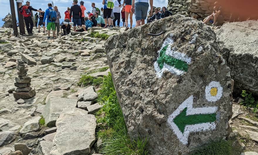
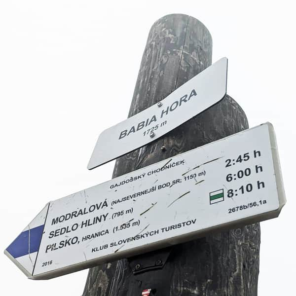
At the summit of Babia Góra
However you reach it - congratulations! You have conquered the highest peak of the Polish Beskids!
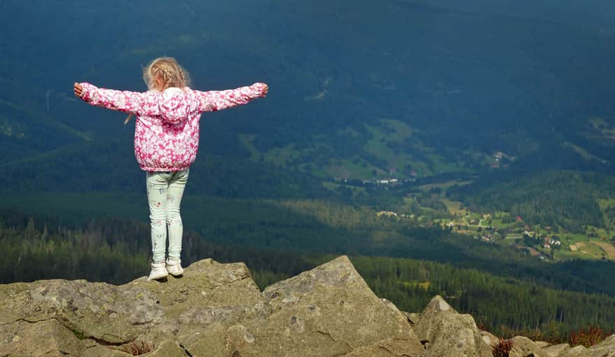
Did you know that Babia Góra, the Queen of the Beskids, is called the Capricious Lady? This is because the weather here can change very dynamically: you can hike the entire trail in fog, and suddenly the clouds clear at the summit (...or unfortunately, the opposite).
Attention! It is always windy on Babia Góra - even in summer, it is worth bringing jackets and hats!
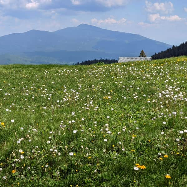
Panorama from the summit of Babia Góra
...and here is the view from the roof of the Beskid world: all the subjects of the Beskids at the feet of their Queen:
Babia Góra - facts and trivia
Do you know everything about Babia Góra? Check it out!
Babia Góra - Interesting Facts and Curiosities
Discover fascinating facts about Babia Góra: Babiogórskie records: the "most" and "number one" and historical facts related to conquering its summit over the centuries. ...
Babia Góra - legends, stories, and secrets
Where does the name Babia Góra come from? What secrets does it hold, and what legends surround the Queen of the Beskids? Discover the most important ones! ...

Publish Date:
Last Updated: