
Turbacz - all trails, shelter, attractions
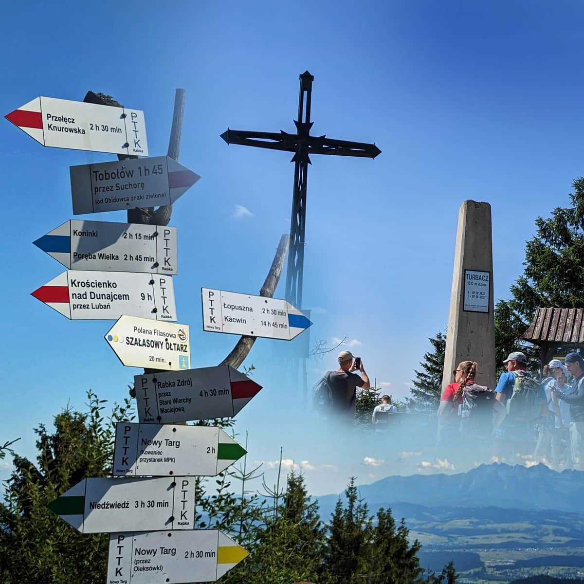
Turbacz (1310 meters above sea level) is the highest peak of the Gorce Mountains, famous for its stunning views of the Tatra Mountains. The summit is part of the Crown of Polish Mountains and the Crown of Polish Beskids. The PTTK shelter on Turbacz, named after Władysław Orkan, serves as a popular tourist base and a hub for trails leading to other peaks and interesting points in the Gorczański National Park. There are many trails leading to Turbacz from nearby towns such as Nowy Targ, Rabka Zdrój, Koninek, Ochotnica Górna, Łopuszna, and Obidowa.
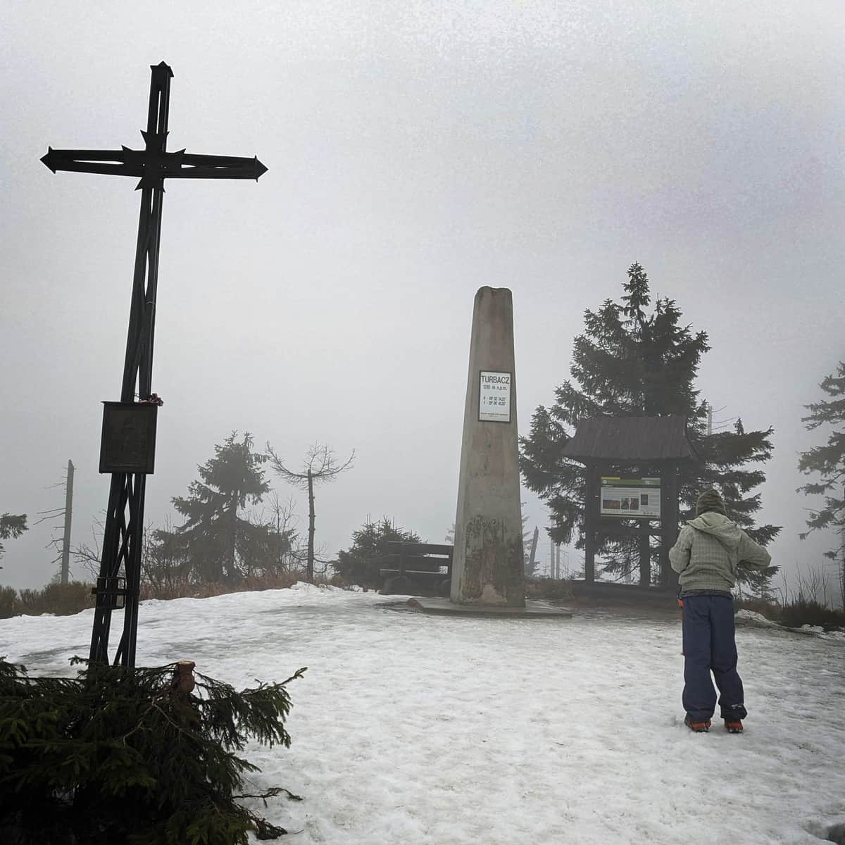
Turbacz - 1310 meters above sea level
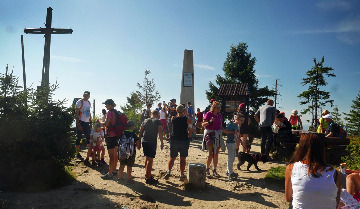
At the top of Turbacz, you will find a distinctive obelisk and several benches... and a view of the Tatras!
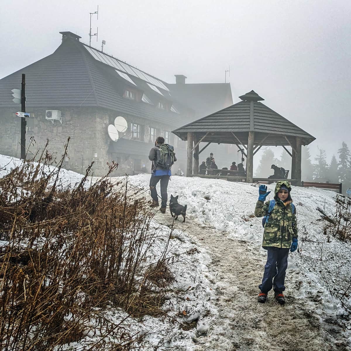
The summit of Turbacz wouldn't be as attractive without the nearby PTTK shelter:
PTTK Shelter on Turbacz - named after W. Orkan
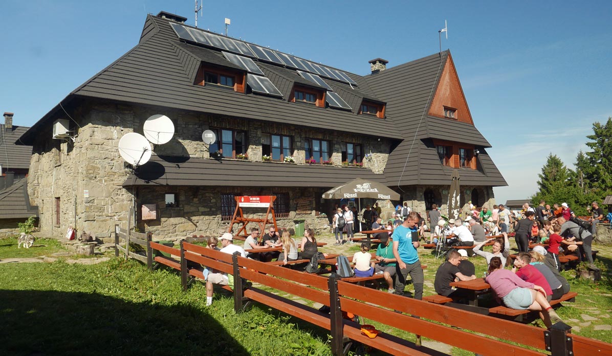
The shelter on Turbacz is one of the largest tourist bases in the region. In addition to providing a large number of accommodations, it offers warm meals in the restaurant on the first floor and snacks (sweets, drinks) in the café on the ground floor.
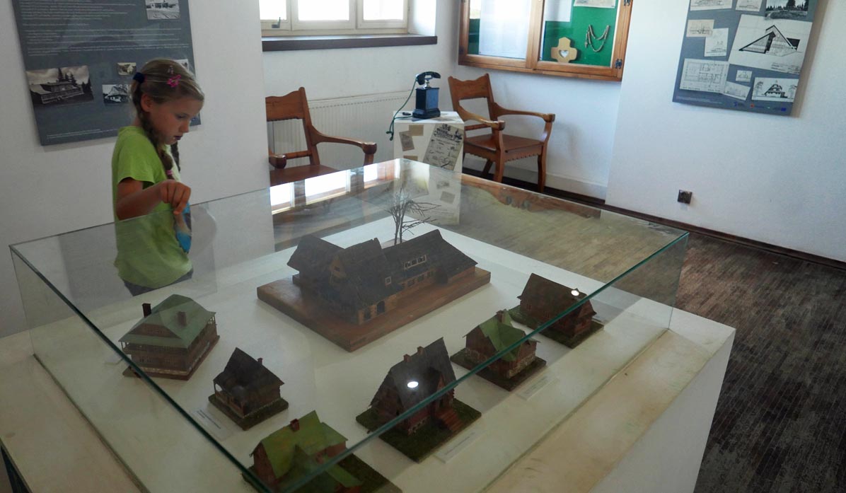
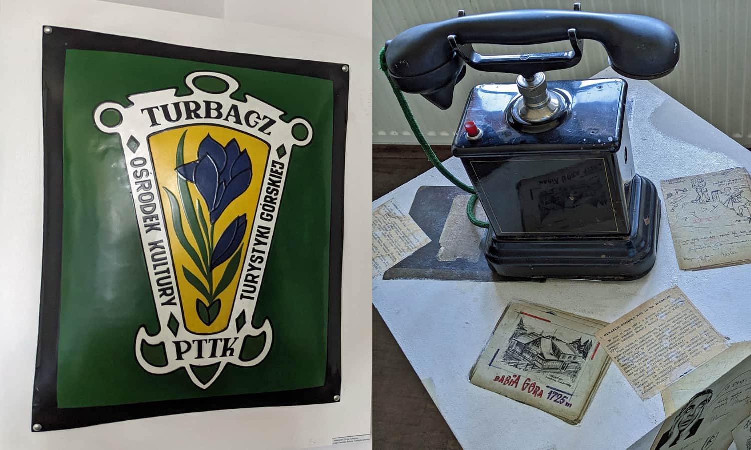
Museum on Turbacz
One of the rooms in the shelter houses a small museum exhibition. Here you can see models of mountain shelters, display cases with interesting memorabilia and documents related to the shelter on Turbacz and its history. Admission to the museum room is free.
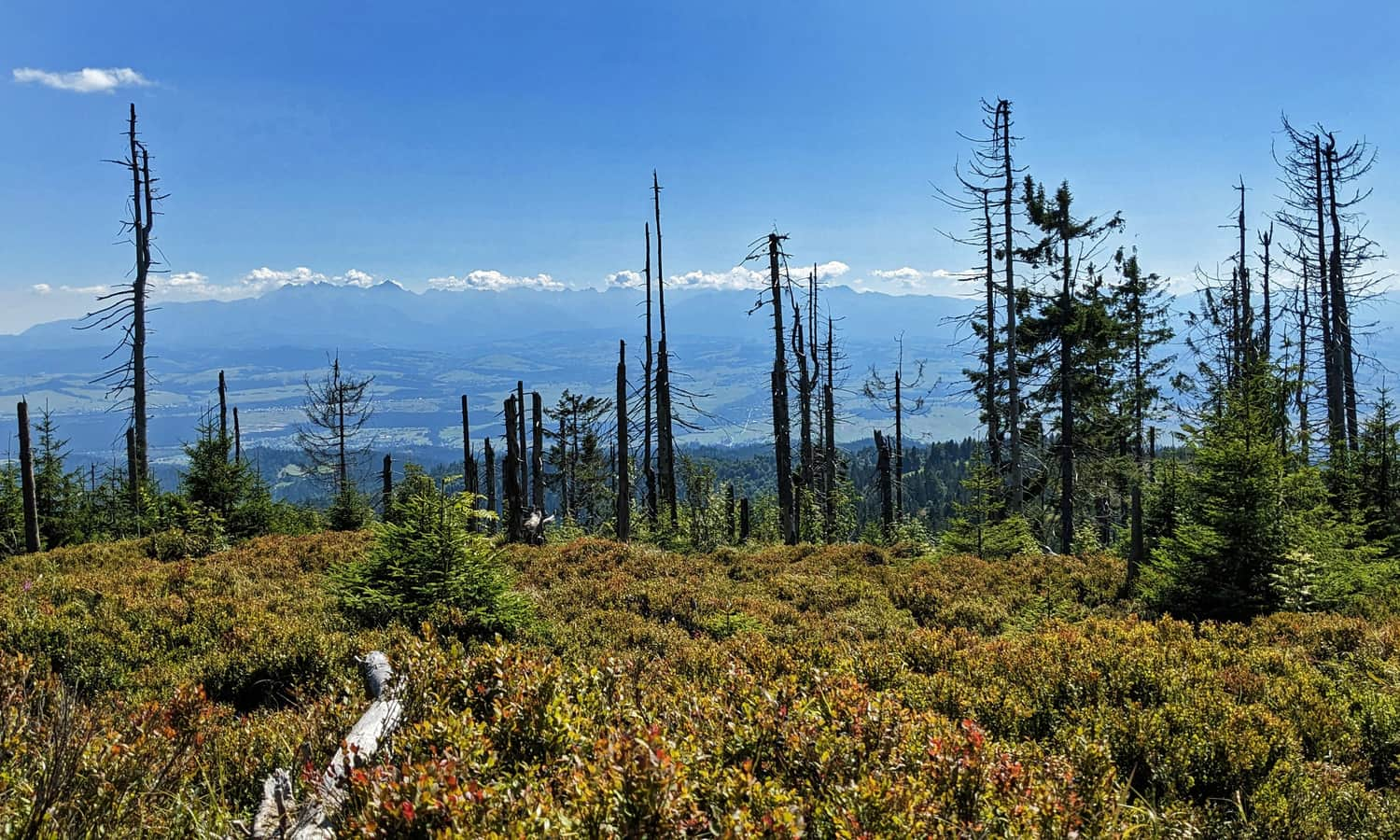
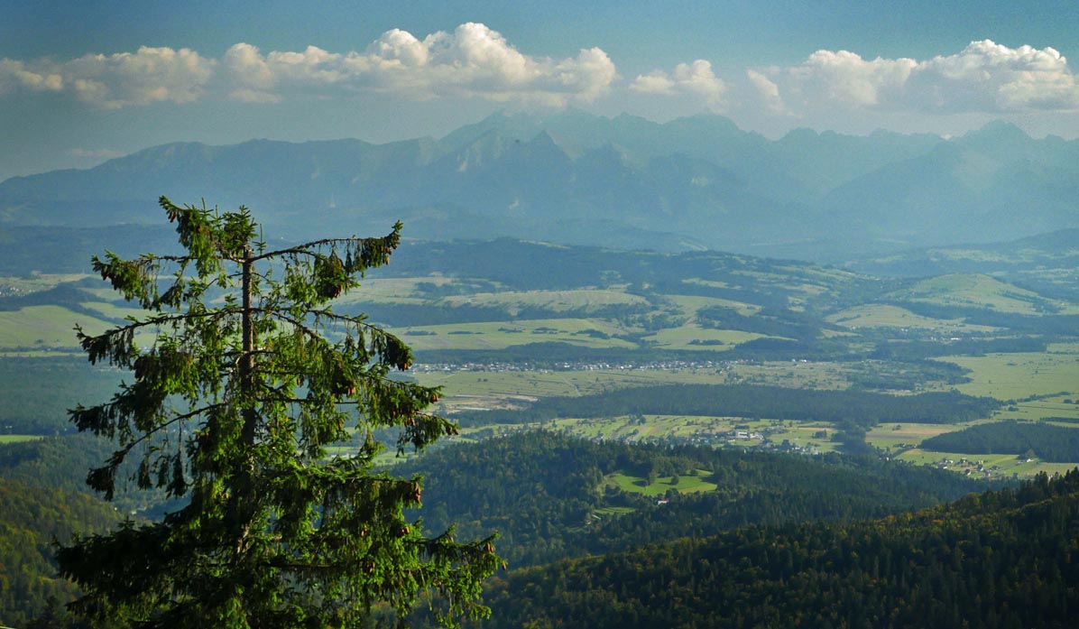
Views from Turbacz
However, the greatest attraction is the view: a beautiful panorama of the Tatra Mountains at any time of the year and day.
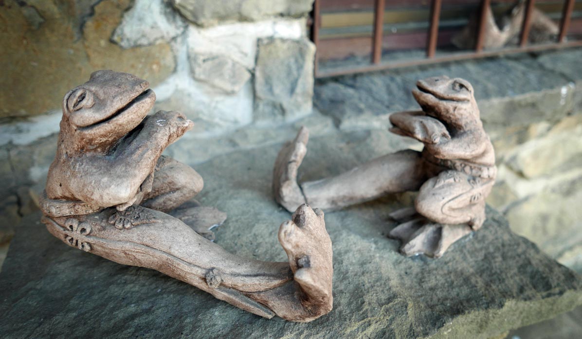
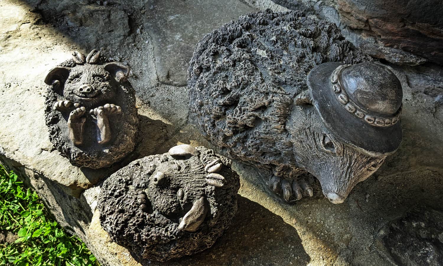
Wooden animal figurines near the shelter on Turbacz
Children will surely enjoy the charming wooden sculptures of animals in highlander costumes - look for them around the shelter. Can you recognize all the animals? How many can you find?
Turbacz - facts and trivia
Around the summit and the shelter, you will find several interesting places - it's worth discovering their secrets!
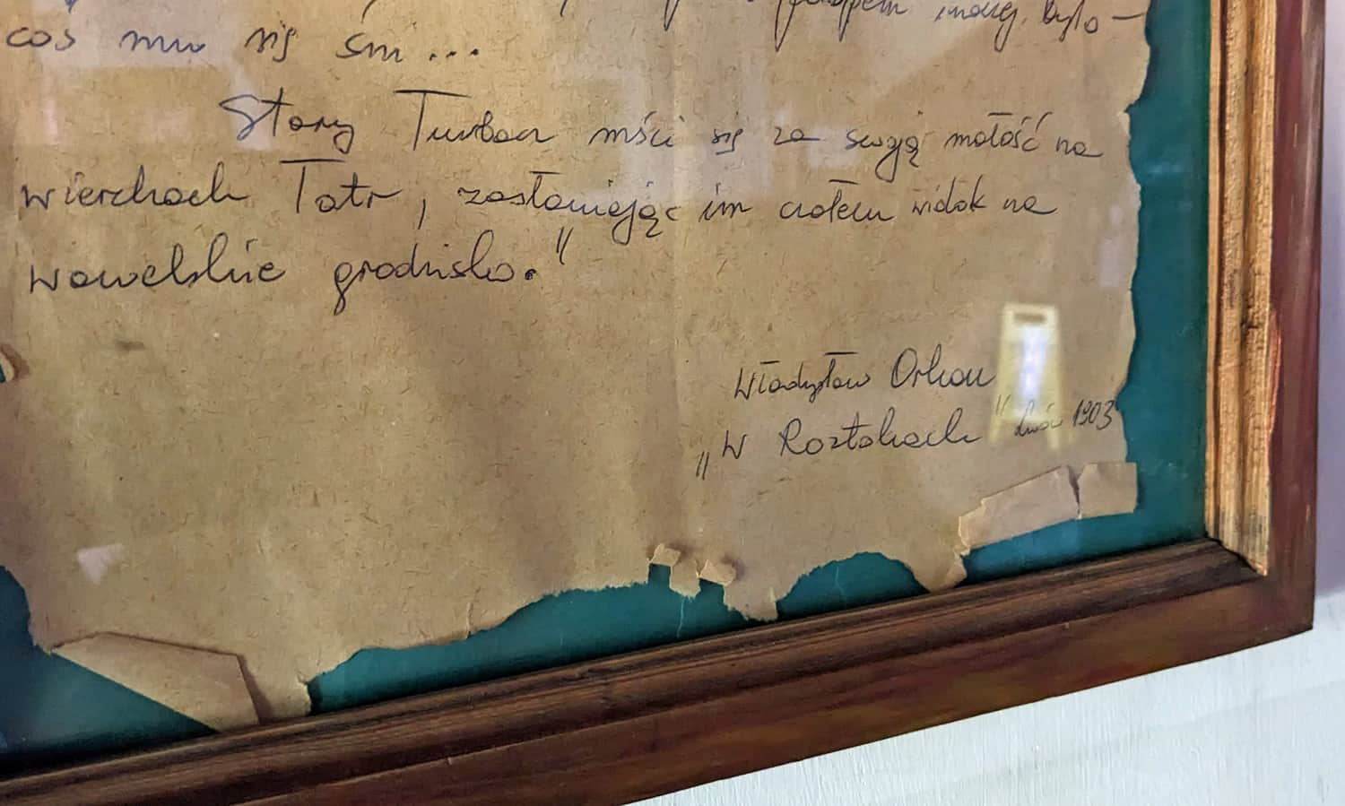
Does Turbacz obscure Kraków from the Tatras?
The patron of the shelter, Władysław Orkan, wrote about the area, stating that "Stary Turbacz takes revenge for its smallness on the peaks of the Tatras, obscuring their view of the Wawel Hill." You can find the manuscript describing the summit and the area on the ground floor of the shelter on Turbacz.
What is the small house next to the shelter?
Next to the shelter, you will find a small wooden building that used to house the Cultural Center for Mountain Tourism. The exhibits have been moved to the shelter, and you can see them in the mini-museum on the first floor.
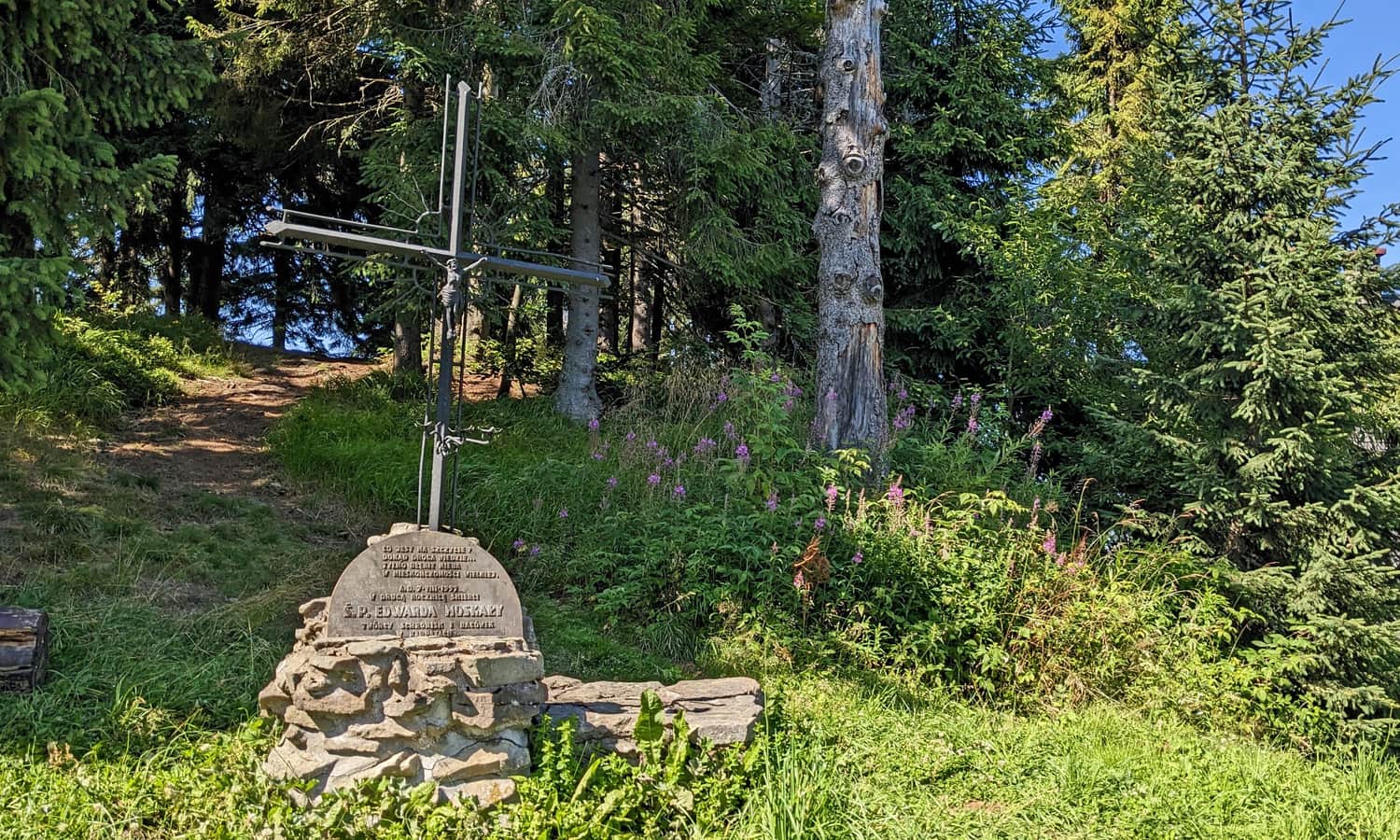
Grave on Turbacz?
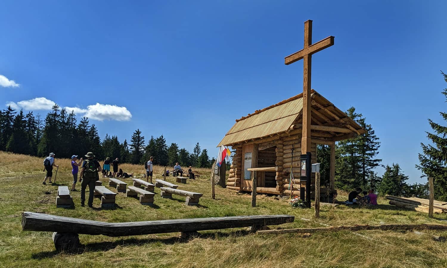
The cross next to the shelter is not a real grave but a symbolic tombstone for Edward Moskała - a tourist activist, author of many guidebooks, maps, and mountain panoramas, and the initiator of building a network of small shelters called "bacówki" (including the one on the neighboring Maciejowa peak).
Turbacz, Kluczki... or Niedźwiedź?
About a hundred years ago, the locals called the highest peak of the Gorce Mountains "Kluczki." The name "Niedźwiedź" (Bear) appeared on Austrian maps and was a result of a mistake. Initially, Turbacz referred only to the stream flowing from the Czoło Turbacza, then to the mountain pasture below the summit, and finally to the summit itself.
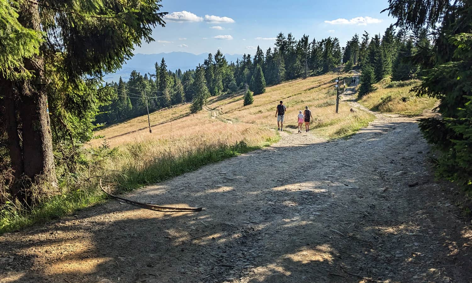
Turbacz - attractions near the summit
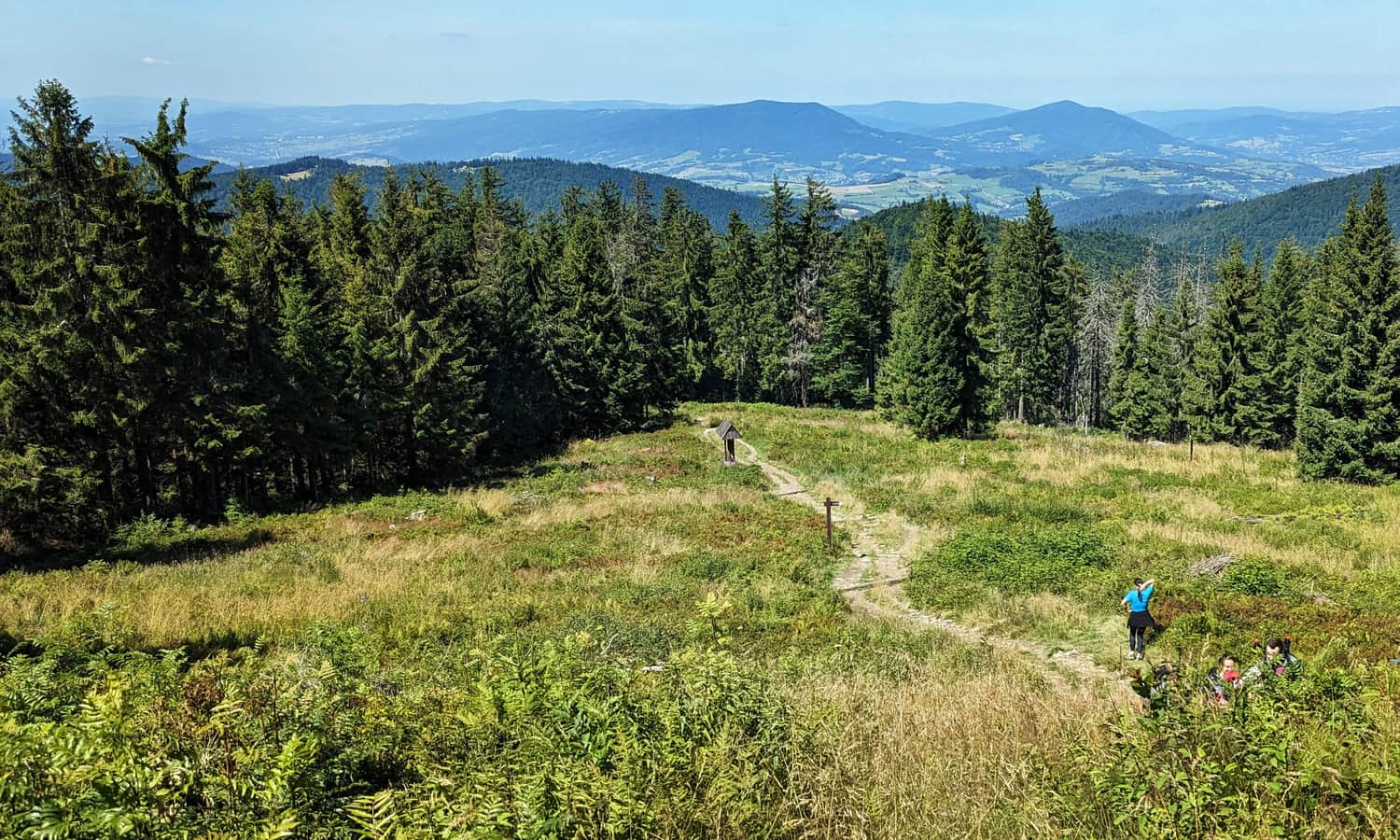
The main attraction of Turbacz is the view: panoramas of the Tatra and Pieniny Mountains, especially from the scenic clearings along the green trail from Nowy Targ.
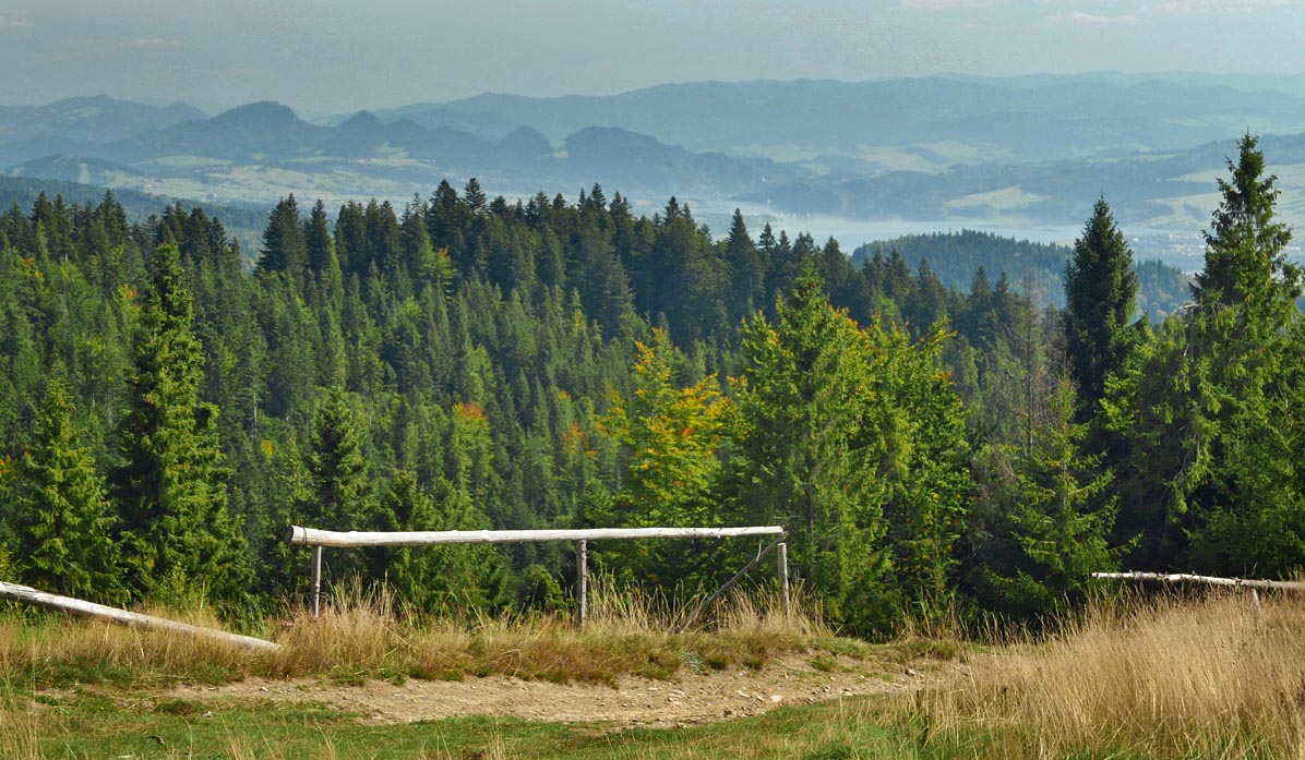
The slopes of Turbacz are also known for numerous spacious clearings - perfect for a longer rest and a picnic!
Chapels and altars on Turbacz
In the vicinity of the Turbacz summit and the shelter on Turbacz, you will find several chapels where regular masses are held, including the "Szałasowy Ołtarz" (Papal Altar) on Hala Turbacz:
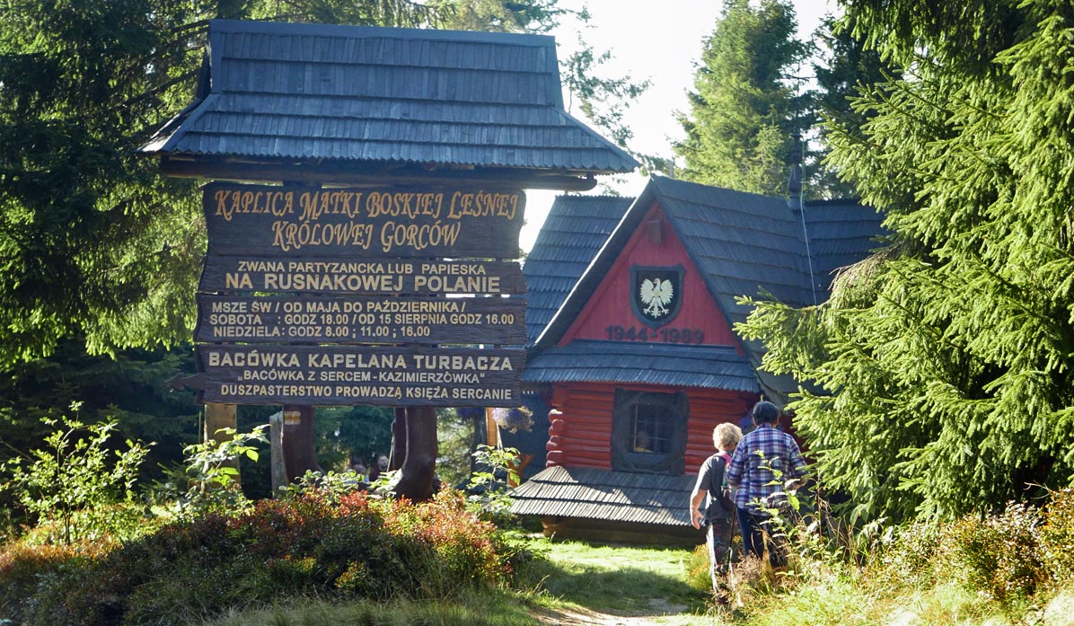
...and the Chapel of Our Lady, Queen of the Gorców Forest, on Rusnakowa Polana (on the yellow trail from Nowy Targ, about 20-30 minutes below the shelter).
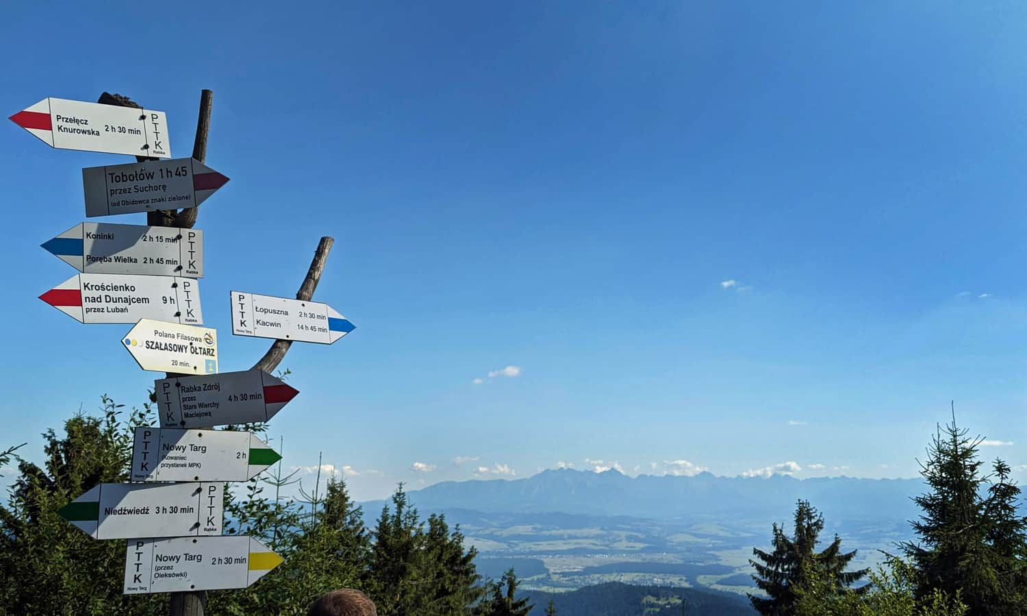
Trails: how to get to Turbacz?
There are many routes and trails leading to Turbacz, of various colors, difficulties, lengths, and durations. Here is a list of all the routes to Turbacz that are less than 15 km (one way):
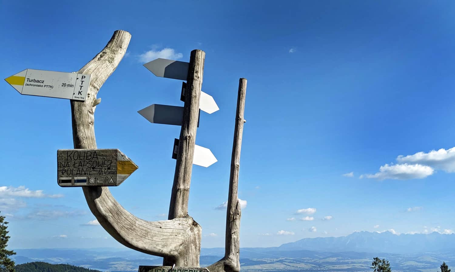
- from Nowy Targ: yellow trail via Bukowina Miejska (7.5 km), green trail via Bukowina Waksmundzka (7.6 km), green trail via Bukowina Obidowska (11.5 km, 760 m elevation gain, 4 hours), and blue trail via Koliba on Łapsowa Polana (12 km, 770 m elevation gain, 4.5 hours).
- from Obidowa: via Stare Wierchy (8 km) and via Bukowina Obidowska (9 km).
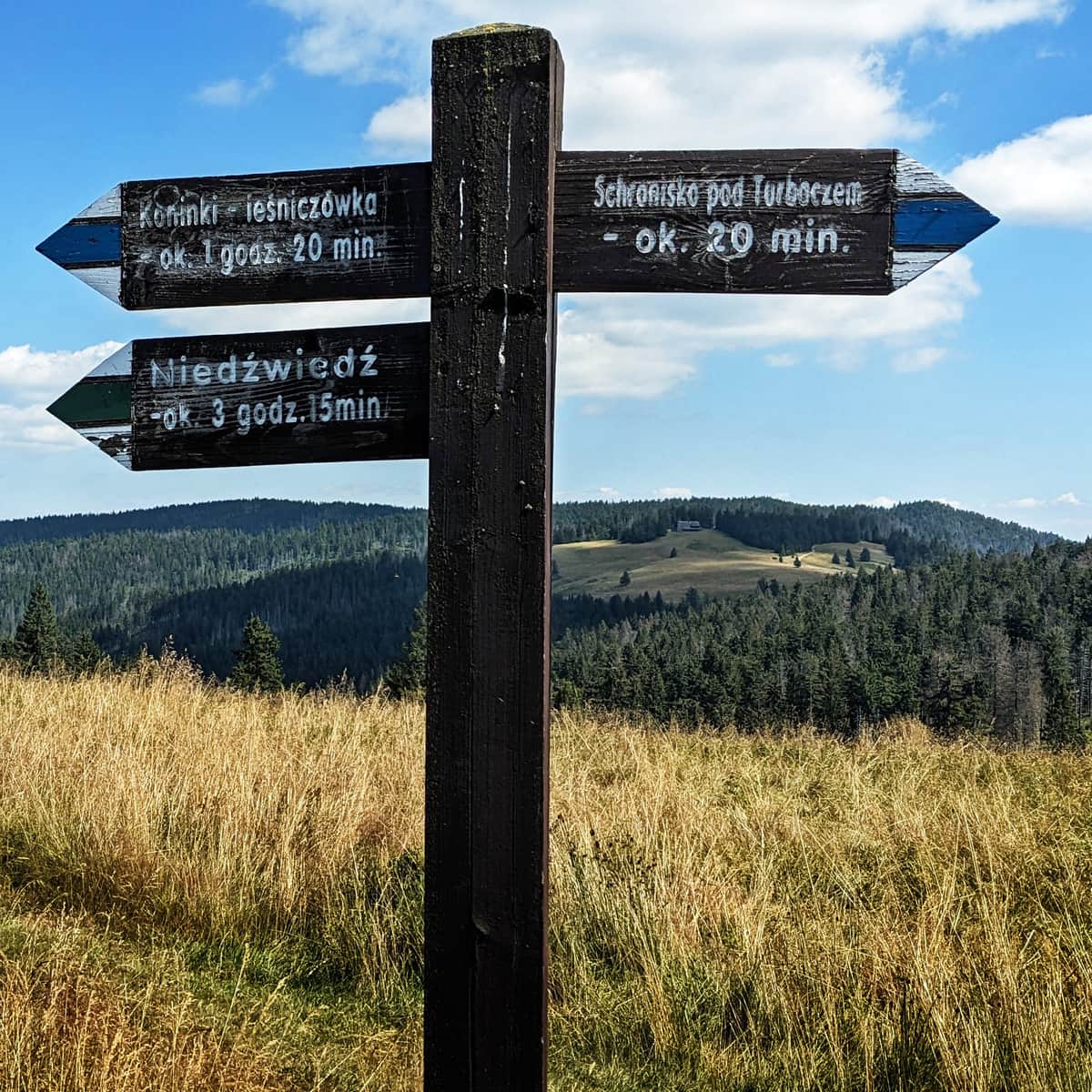
- from Koninek: blue trail via Czoło Turbacza (6 km) and via Tobołów and Obidowiec (6.5 km).
- from Rabka Zdrój: red trail via Maciejowa and Stare Wierchy (15 km, 950 m elevation gain, 5.5 hours).
- from Ochotnica Górna: yellow trail from the center of Ochotnica Dolna (15 km, 950 m elevation gain, 5.5 hours), GPN path from Ustrzyki (9 km, 720 m elevation gain, 3.5 hours), and red trail from Przełęcz Knurowska (9 km, 630 m elevation gain, 3.5 hours).
- from Łopuszna: blue trail (10 km, 760 m elevation gain, about 3 hours and 45 minutes).
- from Ostrowsko: black trail (9.5 km, 750 m elevation gain, about 3.5 hours).
- from Klikuszowa: (13 km, 725 m elevation gain, 4.5 hours).
- from Kułakowy Wierch (gas station on Zakopianka road) - (12 km, 625 m elevation gain, about 4 hours).
- from Lubomierz-Rzeki: yellow trail (13 km, 900 m elevation gain, 5 hours).
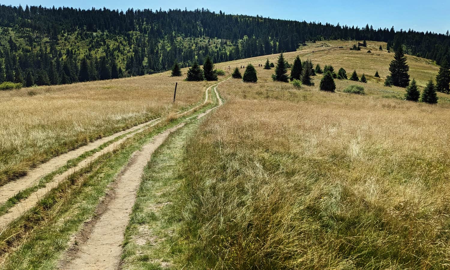
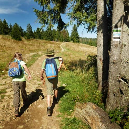
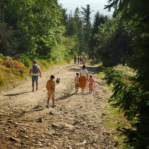
Most popular trail to Turbacz - green from Nowy Targ
Very scenic (but quite sunny), with a few mini-bars along the way during the season. The trail is outside the Gorczański National Park and allows dogs.
Medium
Green Trail from Nowy Targ to Turbacz

Yellow trail from Nowy Targ to Turbacz
When combined with the green trail, it forms an interesting loop "Nowy Targ - Turbacz - Nowy Targ." The trail is outside the Gorczański National Park and allows dogs.
Medium
From Nowy Targ to Turbacz: the Yellow Trail

To Turbacz by cable car? Trail via Obidowiec
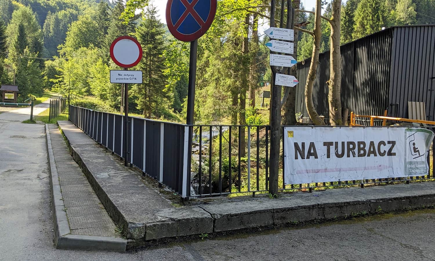
You can take a chairlift from Koninek to Tobołów. Then, there is a walk along the Obidowiec ridge (with some stairs and climbing):
Medium
From Koninki to Turbacz through Obidowiec

Blue trail from Koninek to Turbacz
Quite a long trail with three scenic clearings along the way. Together with the trail via Obidowiec, it forms a loop "Koninki - Turbacz - Koninki."
Medium
Blue Trail from Koninki to Turbacz summit

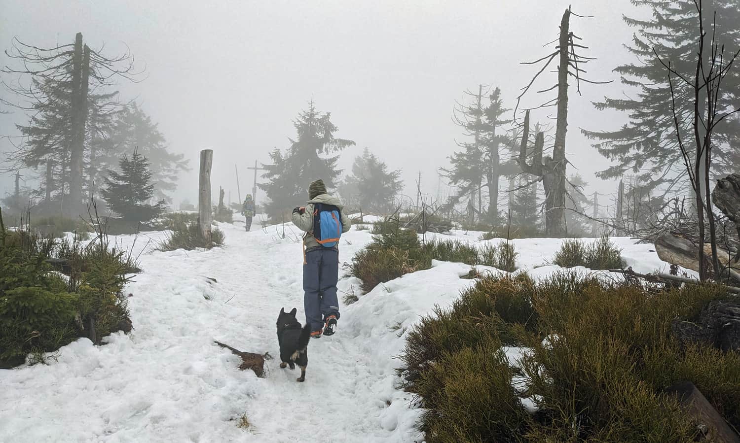
Shortest trail to Turbacz from Obidowa
The fastest way to Turbacz is from Obidowa, taking about 2.5 hours. The trail is outside the Gorczański National Park and allows dogs. We happened to hike there in winter.
Medium
From Obidowa through Stare Wierchy to Turbacz - winter

Turbacz from Obidowa - loop trail
From Obidowa, you can also make a 5-6 hour loop to Turbacz. Take the trail via Bukowina Obidowska and Bukowina Miejska:
Medium
Turbacz from Obidowa in Winter

...and descend via the aforementioned trail through Stare Wierchy. In total, it's about 17 km, with less than 700 m elevation gain, plenty of views, and two shelters along the way!
Other trails to Turbacz
Have you hiked to Turbacz using a different route? Maybe from Łopuszna? We are very curious about your experiences! Write to us at konkurs.trasadlabobasa@gmail.com!
Turbacz with a dog
Both the summit of Turbacz and the shelter on Turbacz are located near the border of the Gorczański National Park, where dogs are not allowed. If you want to bring your four-legged friend on a hike, you need to choose trails outside the national park's boundaries, such as the trail from Łopuszna, the green and yellow trails from Nowy Targ, or the trails from Obidowa (described above). Therefore, trails from Koninek, Ochotnica, Lubomierz, or Rzek are not suitable.

Publish Date:
Last Updated: