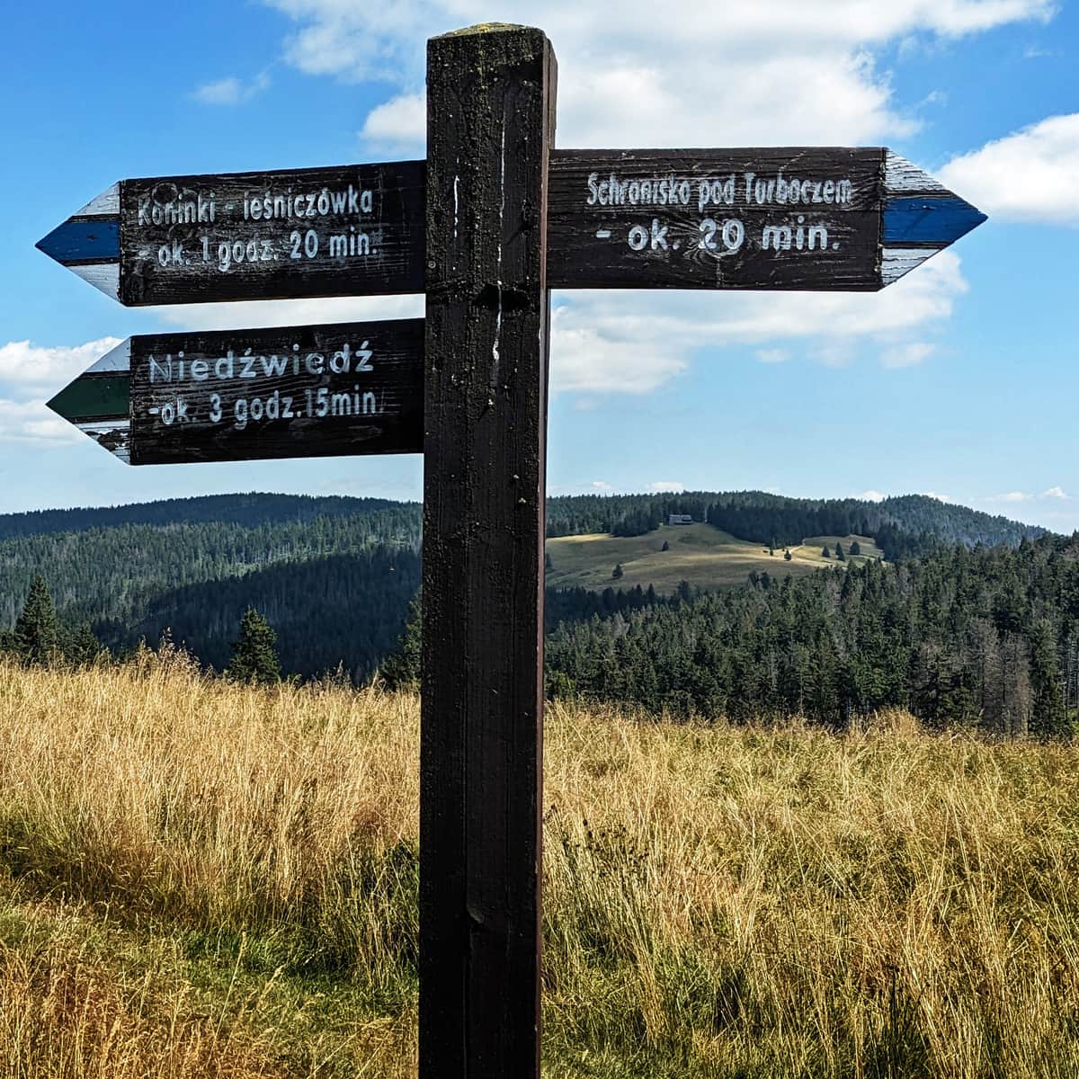
Blue Trail from Koninki to Turbacz summit
Town: Koninki Nearby: Rabka Zdrójbeach_access Route in the shade
restaurant Restaurant or bar nearby
directions_car Access by car
directions_bus Can be reached by bus
wc Toilet along the route
warning No dogs allowed
The Blue Trail to Turbacz from Koninki is a popular and scenic route to the highest peak of the Gorc Mountains. The path mainly leads through the forest, but we also pass several clearings, including the most picturesque one: Hala Turbacz with the Shepherds' Altar.
Beginning of the Blue Trail in Koninki
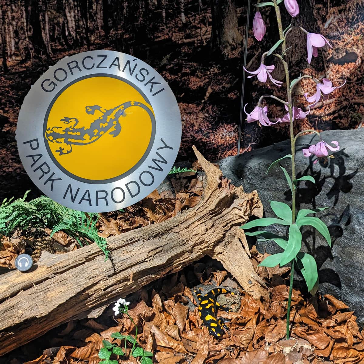
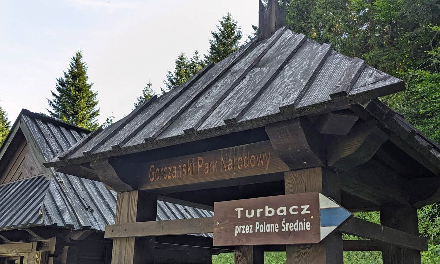
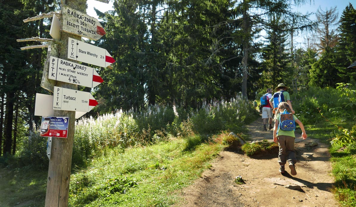
The Blue Trail starts in Koninki, to the left of the large parking lot of the ski resort. At the ticket office, you need to purchase an admission ticket to the Gorczański National Park. Remember that dogs are not allowed here!
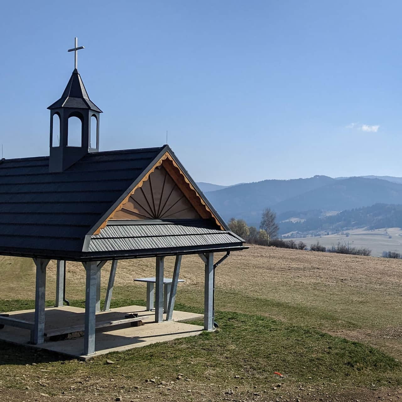
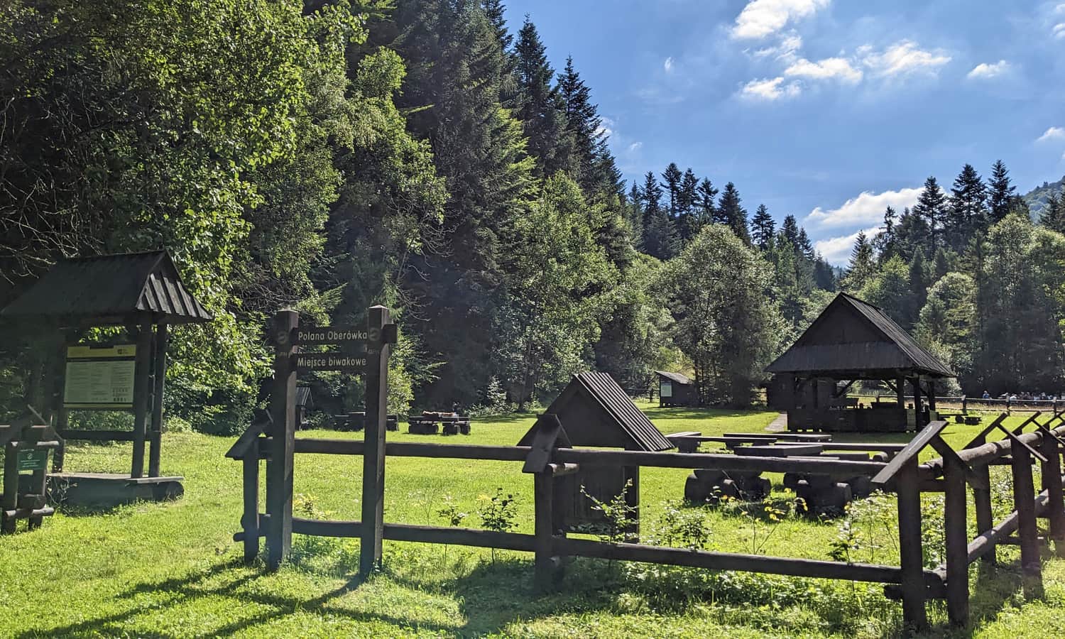
Initially, it follows an asphalt road, and then a well-maintained dirt road. Along the way, we pass a camping area called Polana Oberówka. Here, you will find several tables, benches, a covered shelter, as well as a "water eye" and a place for observing amphibians.
After about 15-20 minutes, the path turns into the forest, and the ascent begins through a wooded slope. The trail is quite steep and shaded in the first half (which can be a big advantage on hot days)!
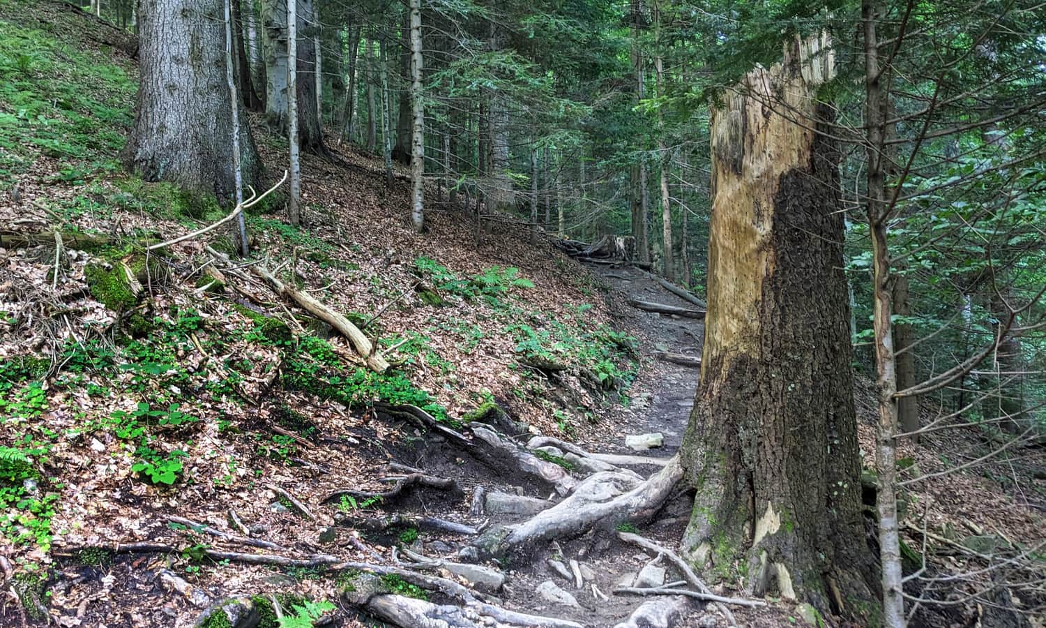
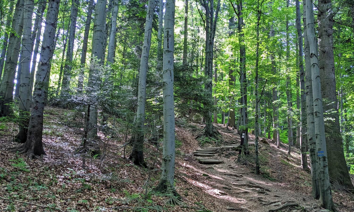
Did you know that this is one of the oldest preserved natural fragments of the Gorc forests? Even before World War II, the "Turbacz" reserve was established here, which later became part of the Gorczański National Park.
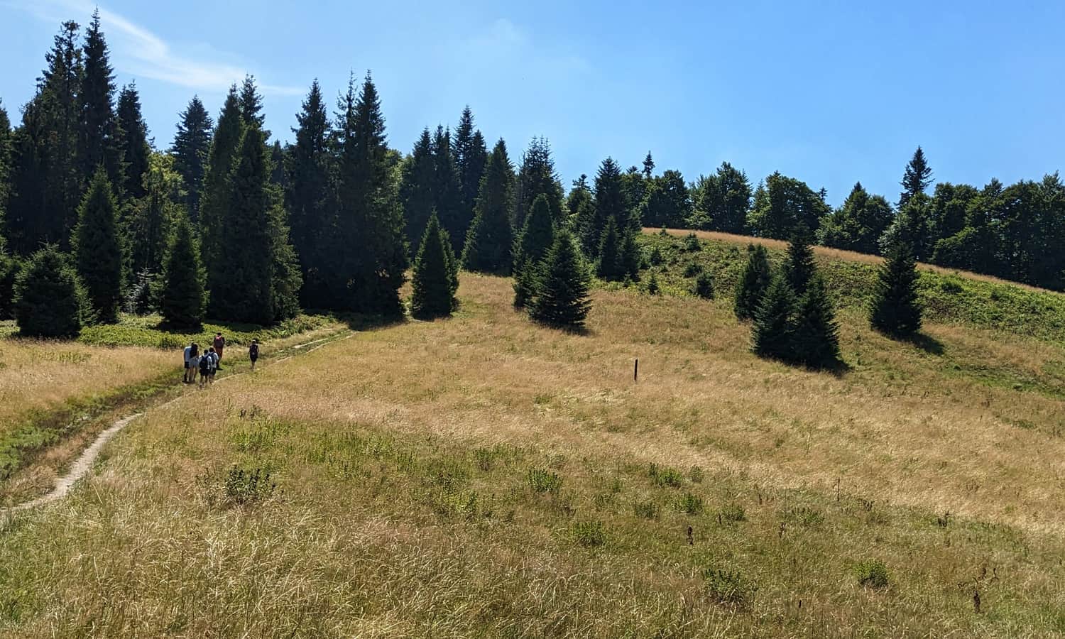
Polana Średnie
After less than 2 hours from starting in Koninki, we reach the first scenic clearing: Polana Średnie.
As indicated by the information board at the upper part of the clearing, there should be a wide view of the Beskid Wyspowy:
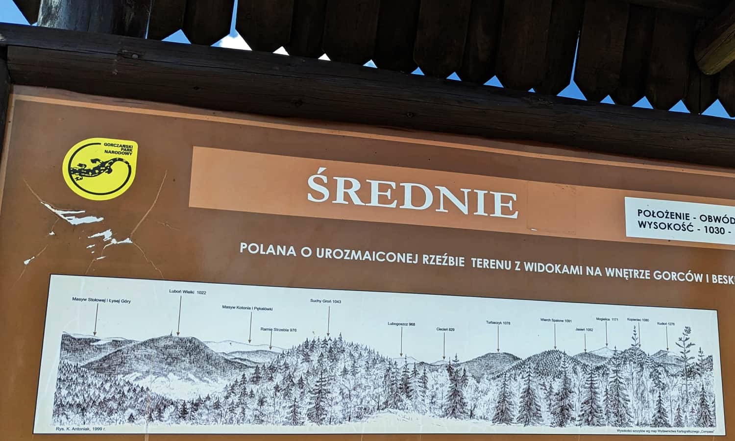
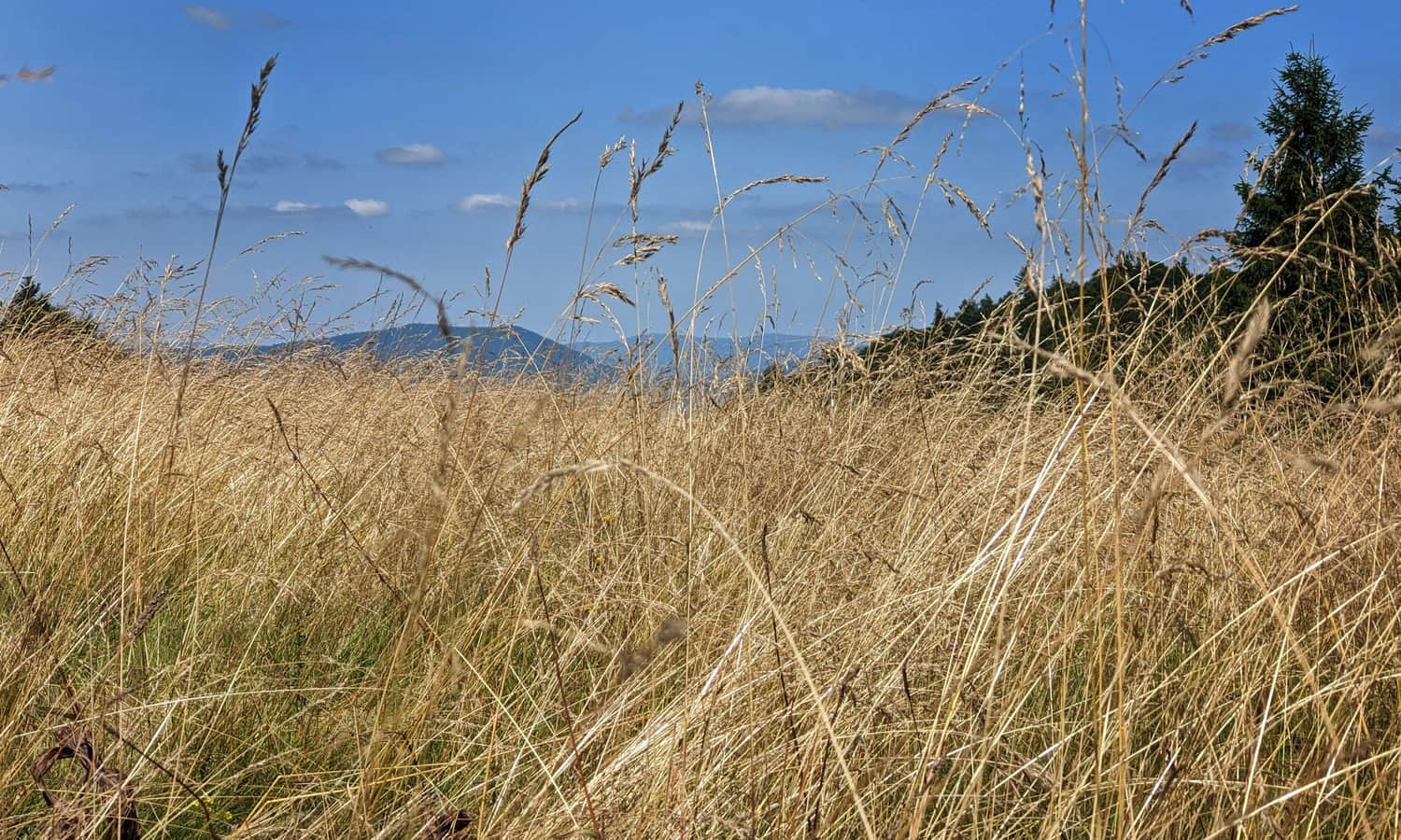
In reality, most of the view is obstructed by trees... However, you can still catch a glimpse of the scenery!
According to local legend, it is on Polana Średnie that Saint Nicholas meets the Gorc wolves every year... They determine how many forest and farm animals the wolves can eat in the coming year.
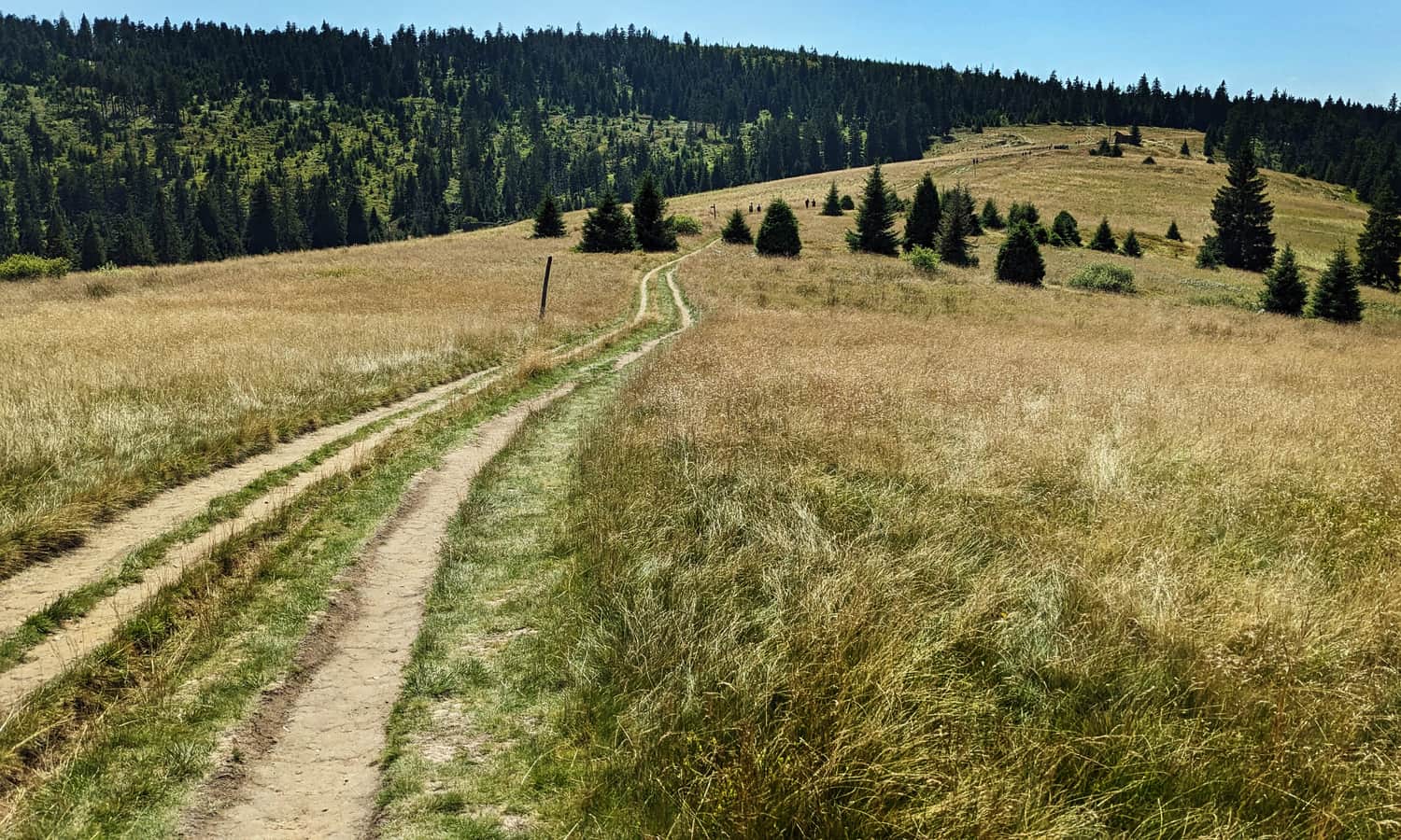
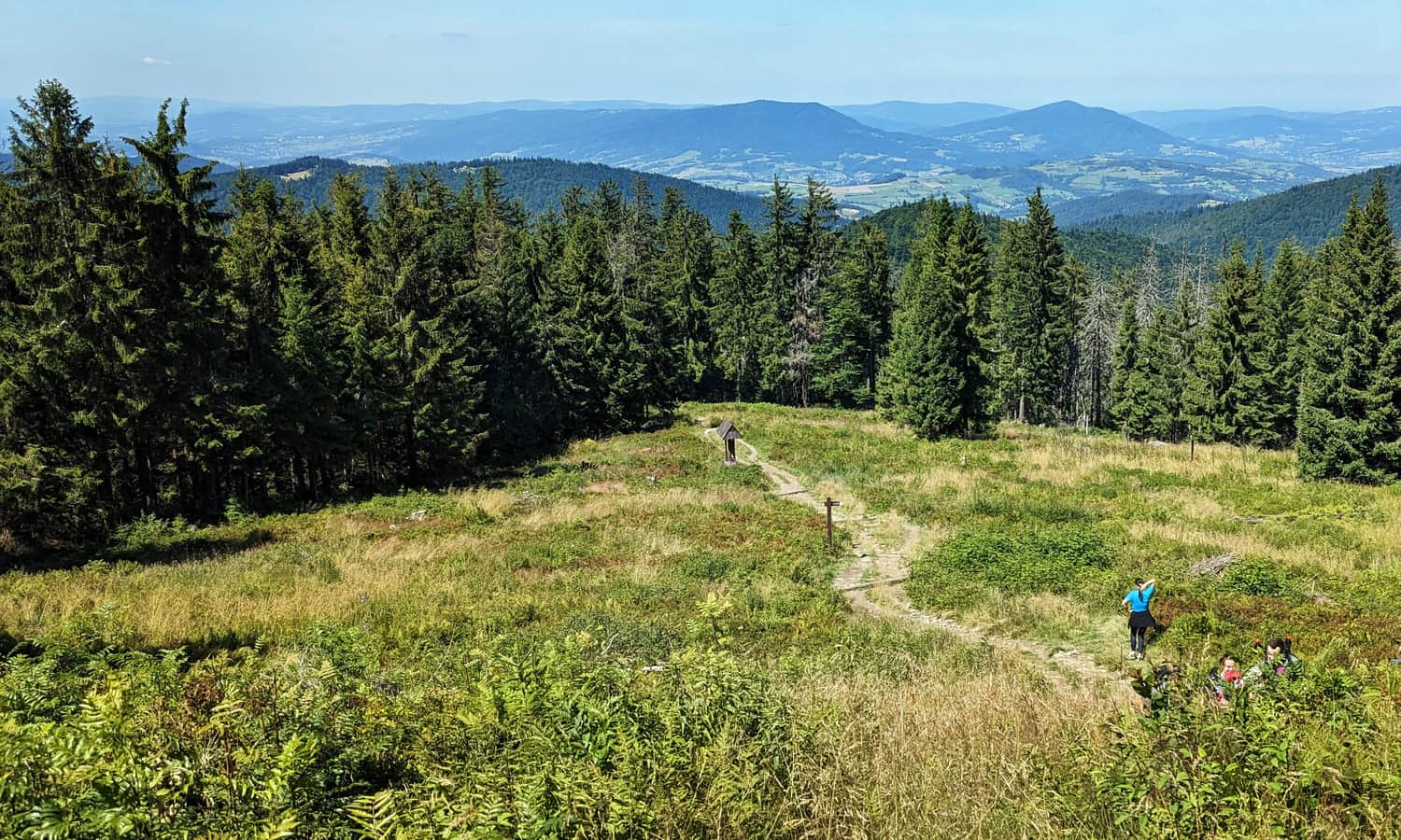
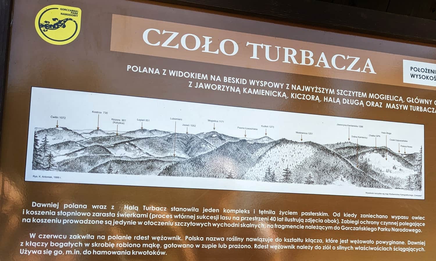
Czoło Turbacza
After Polana Średnie, we enter the forest again and after a while, we reach a steep ascent to the summit of Czoło Turbacza. The steps on the sunny clearing called "Szyja Turbacza" are the most challenging part of the trail:
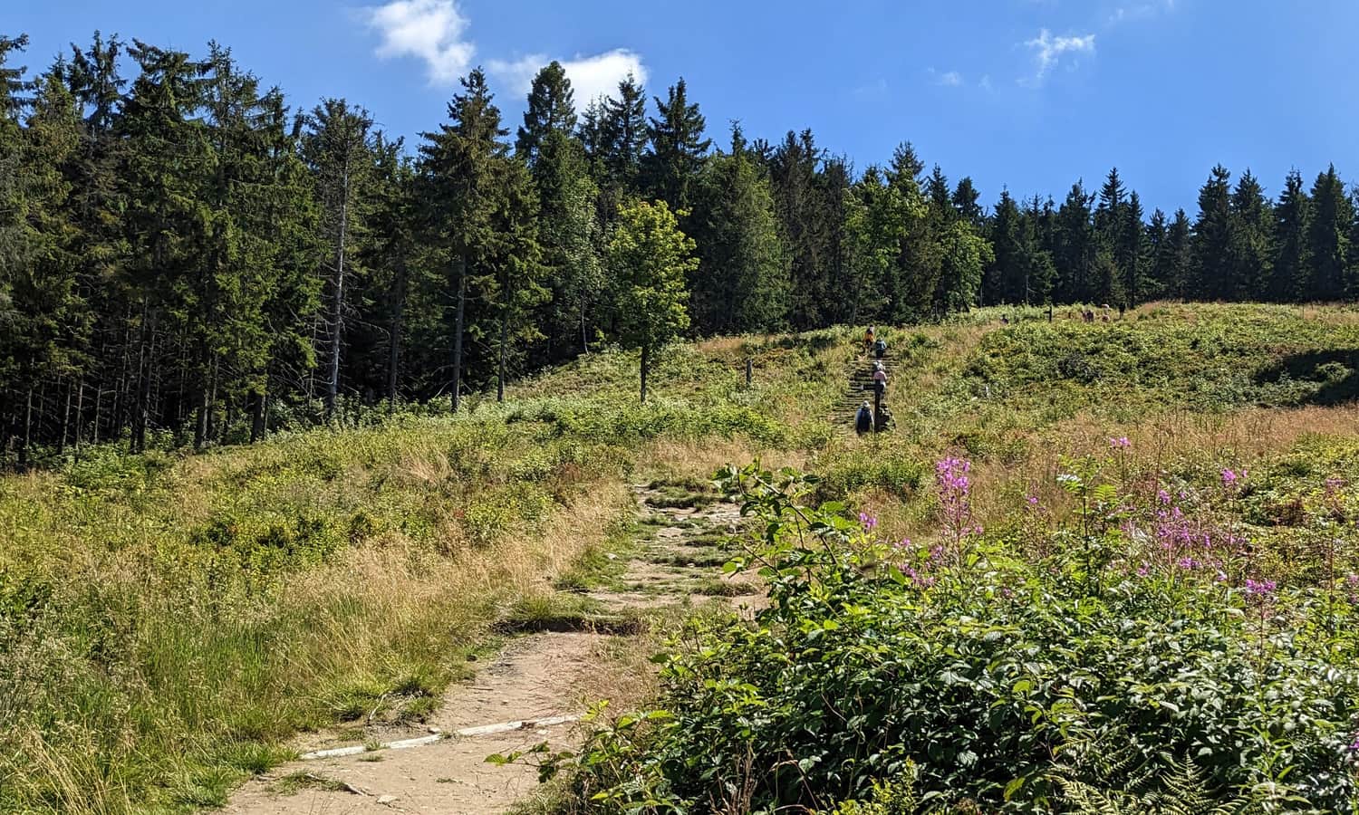
...but as we climb higher, the view to the north becomes more and more beautiful!
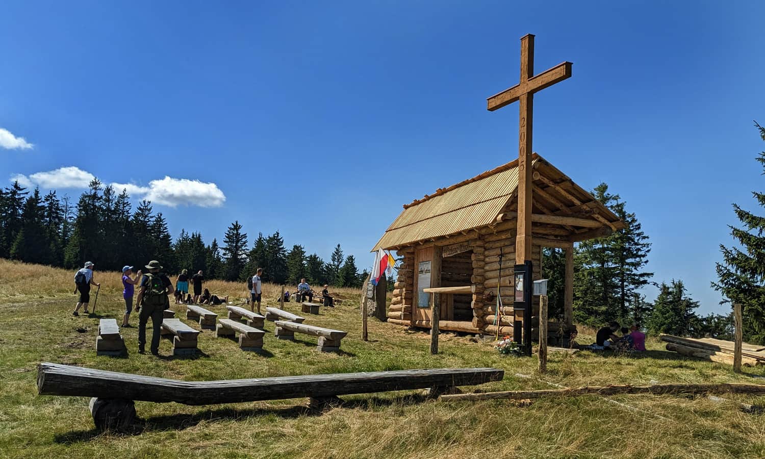
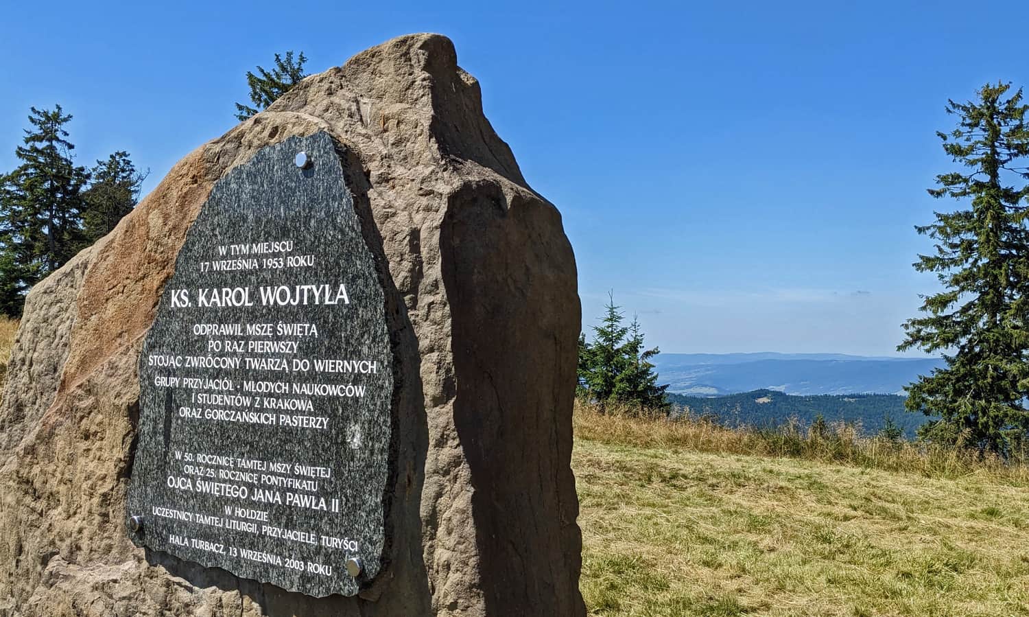
Hala Turbacz - Views and Shepherds' Altar
After reaching the summit of Czoło Turbacza (1259 m above sea level), we will walk through the extensive and very scenic Hala Turbacz. Before entering it, let's look for a rock with a plaque commemorating the mysterious inscriptions of the GOPR rescuers - some of them are over 100 years old!
In addition to wide views of the neighboring Gorc clearings and peaks, the Beskid Wyspowy, Makowski, and Żywiecki Mountains (with Babia Góra), the main attraction here is the Shepherds' Altar, which is associated with Karol Wojtyła.
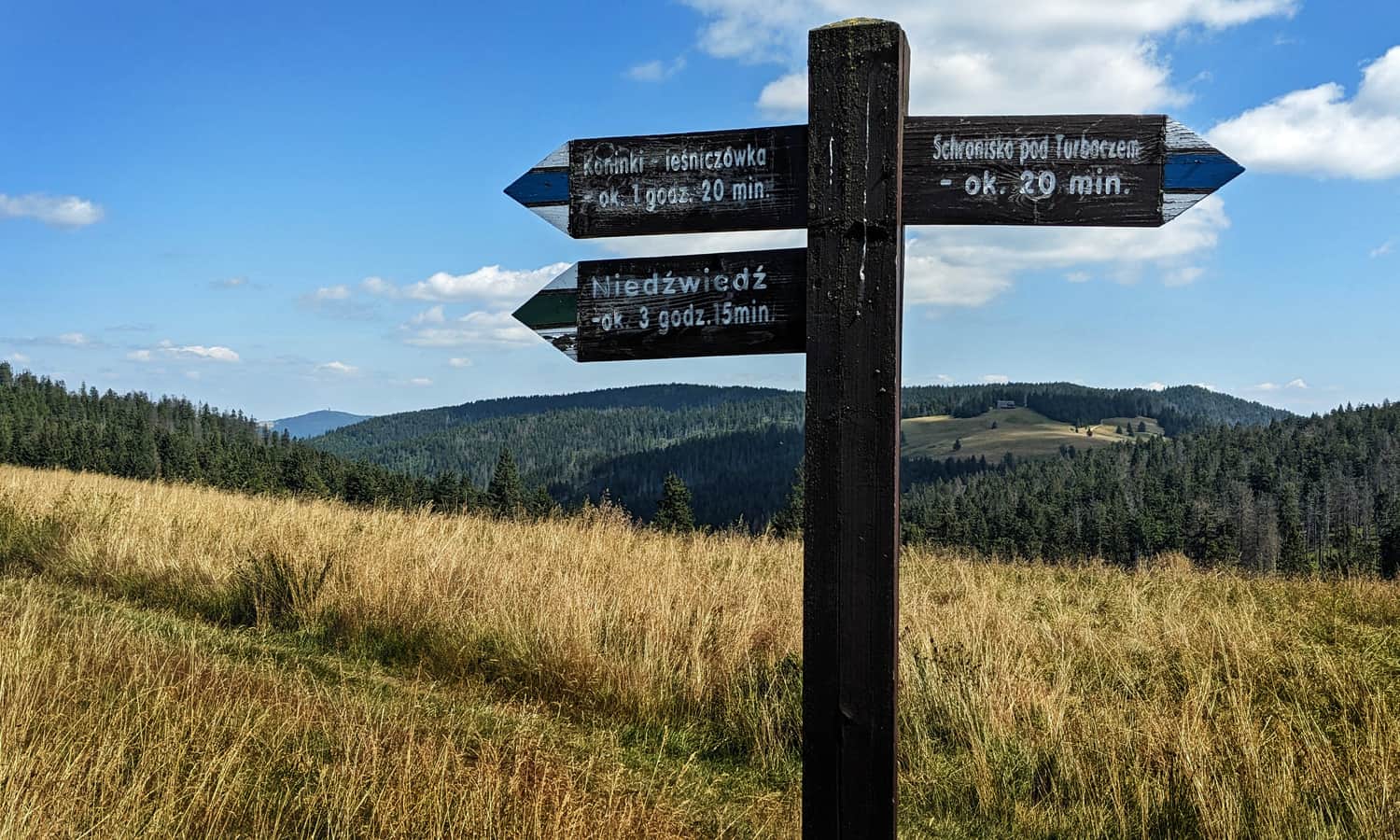
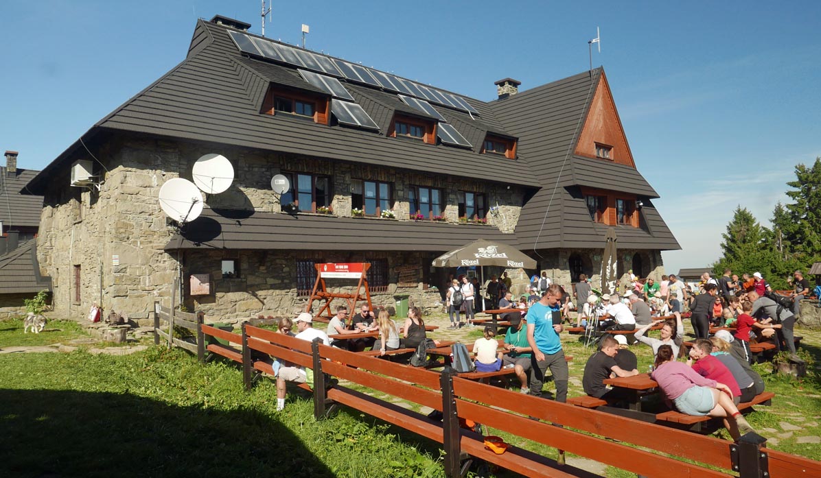
From there, after about 15-20 minutes across the wooded slope, we will reach the mountain shelter. Here, a terrace with a view of the Tatra Mountains awaits us, and inside the shelter, there is a restaurant, a café, and even a mini-museum.
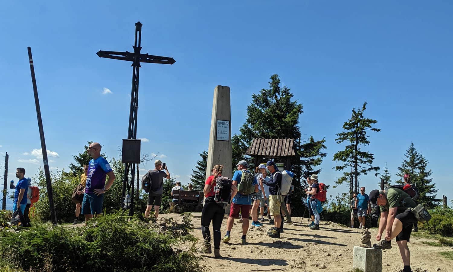
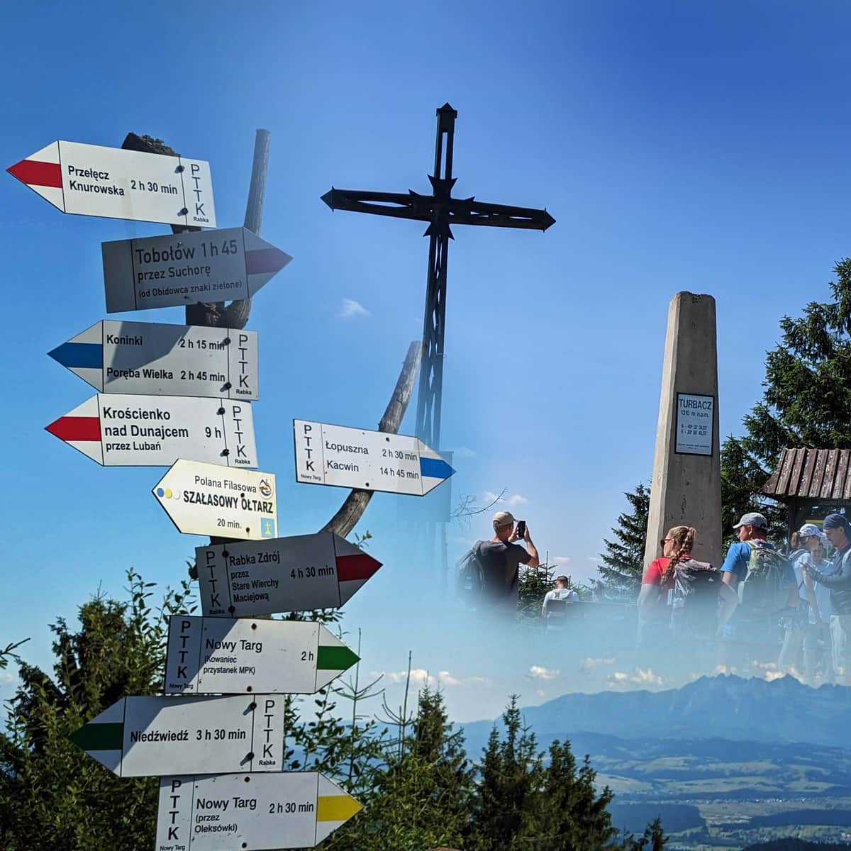
Turbacz, 1310 m above sea level
From the shelter, we still need to walk uphill for about 15-20 minutes along a moderately steep and wooded path:
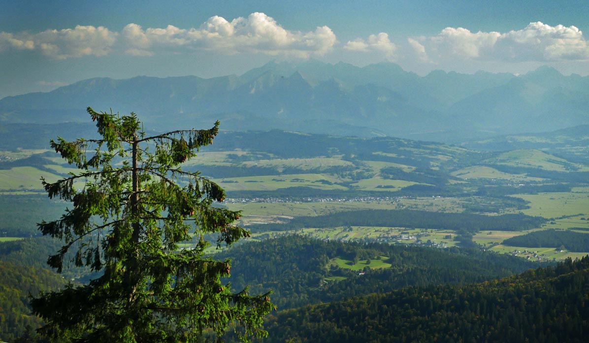
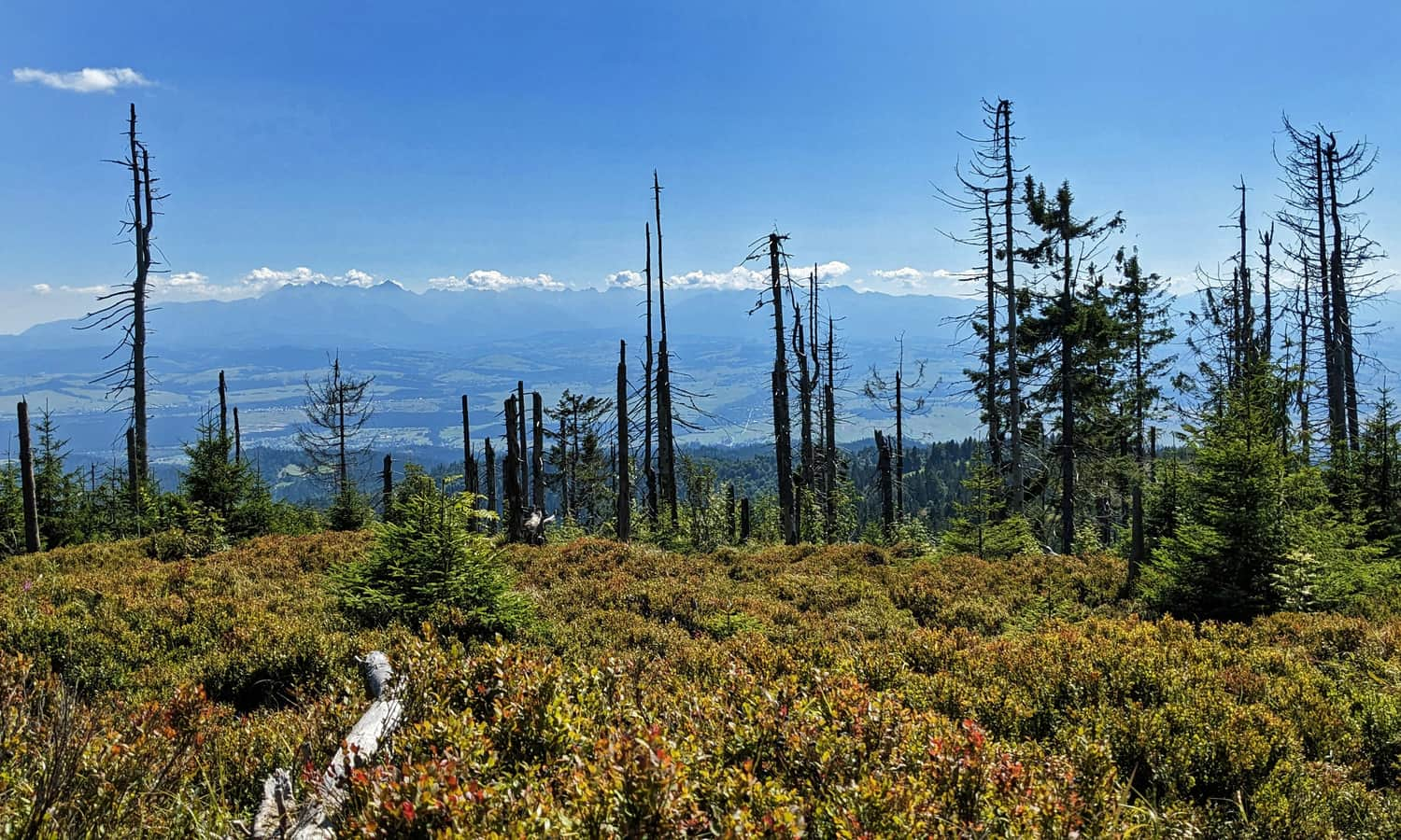
...and we are at the summit! Among the damaged spruce trees, we can see the Tatras, Babia Góra, Beskid Żywiecki, Makowski, and Wyspowy Mountains:
Return from Turbacz to Koninki
We can return to Koninki the same way (about 2 hours), or for variety, we can take the Red and Green Trails through Obidowiec (route information here), which also leads to the parking lot in Koninki. In this case, we will have to descend a lot of high forest stairs from the summit of Turbacz and Obidowiec, but we can also take the chairlift from the Tobołów clearing to Koninki:
Medium
From Koninki to Turbacz through Obidowiec

NOTE! The Blue, Green, and Red Trails are located within the Gorczański National Park, admission is charged, and dogs are not allowed.
P.S. You can also reach Turbacz bypassing the Gorczański National Park from the Nowy Targ side (green trail) or (yellow trail) - in this case, you can hike with a dog.
More about Turbacz
You can find more information about the views from the summit, the mountain shelter, and other trails to the highest peak of the Gorc Mountains in this article:
Turbacz - all trails, shelter, attractions
Turbacz (1310 meters above sea level) is the highest peak of the Gorce Mountains, famous for its stunning views of the Tatra Mountains. ...

Publish Date:
Last Updated:
More in the Region Gorce (Gorce)