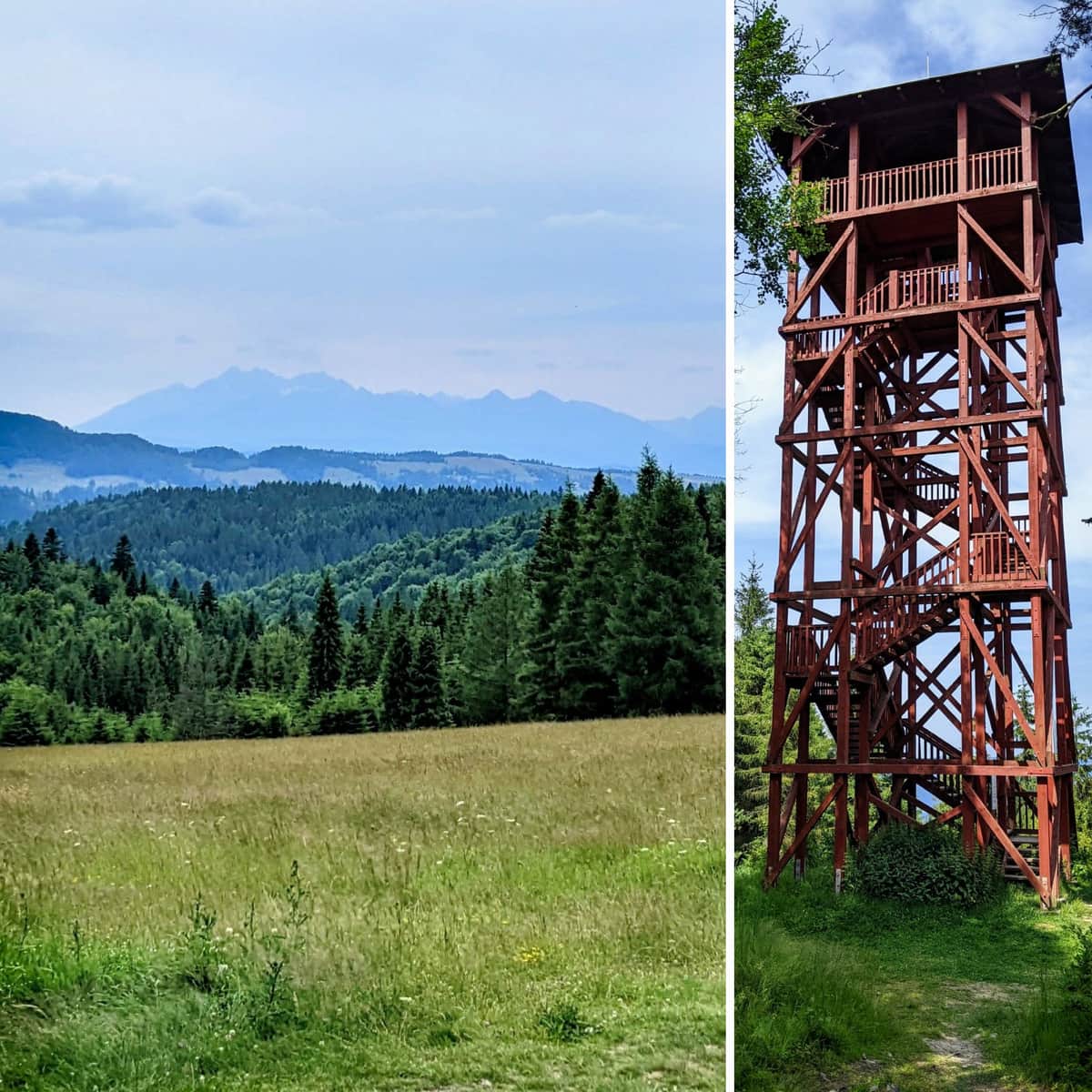
Eliaszówka Peak (1024 m) - trail map, views from the tower
check_circle Outdoors
check_circle Sloping terrain
Eliaszówka
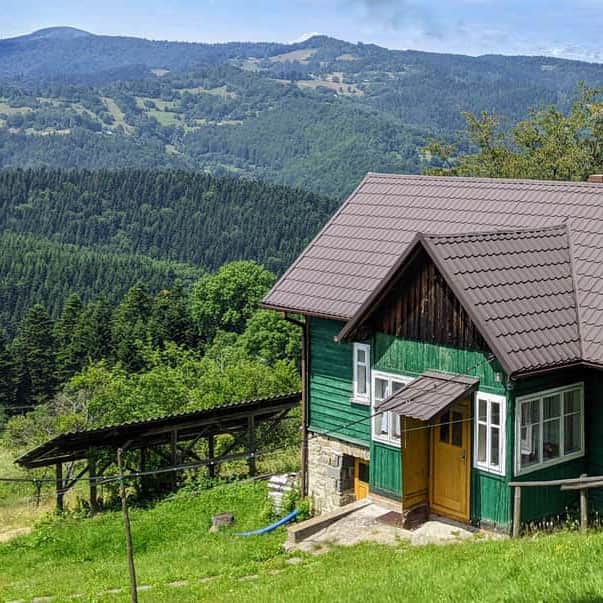
Eliaszówka (Slovak: Eliášovka), at an altitude of 1024 meters, is the highest peak of the Lubowelskie Mountains located on the Polish-Slovak border near Piwniczna-Zdrój.
On the northeastern slope, there is a popular ski resort called Sucha Dolina. On the southern slope, in the Lemko village of Litmanowa, you will find the Sanctuary of Our Lady of Litmanowa, which is a destination for many pilgrims.
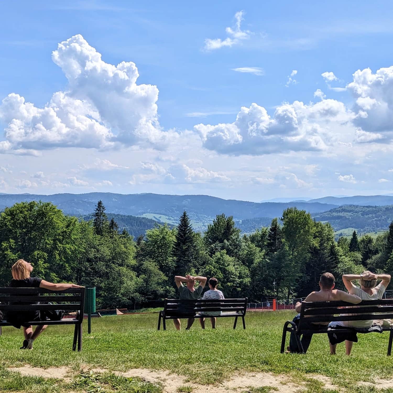
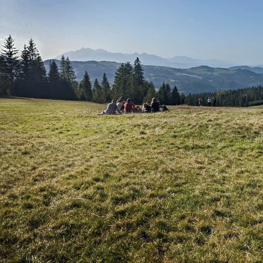
In the past, the slopes of Eliaszówka were treeless and used as pasture areas. Currently, the summit is covered with forests, which somewhat reduces its scenic attractiveness. During World War II and after the war, the vicinity of Eliaszówka was a popular crossing point for couriers of the Polish Underground State.
It is also worth mentioning that until 2007, there was a tourist border crossing between Eliaszówka and Eliášovka, allowing crossing the border between Poland and Slovakia in this area.
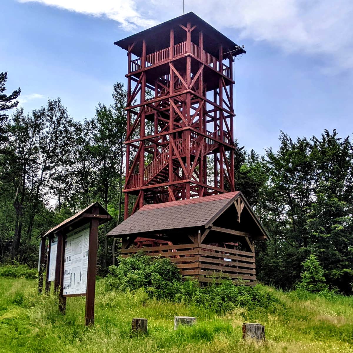
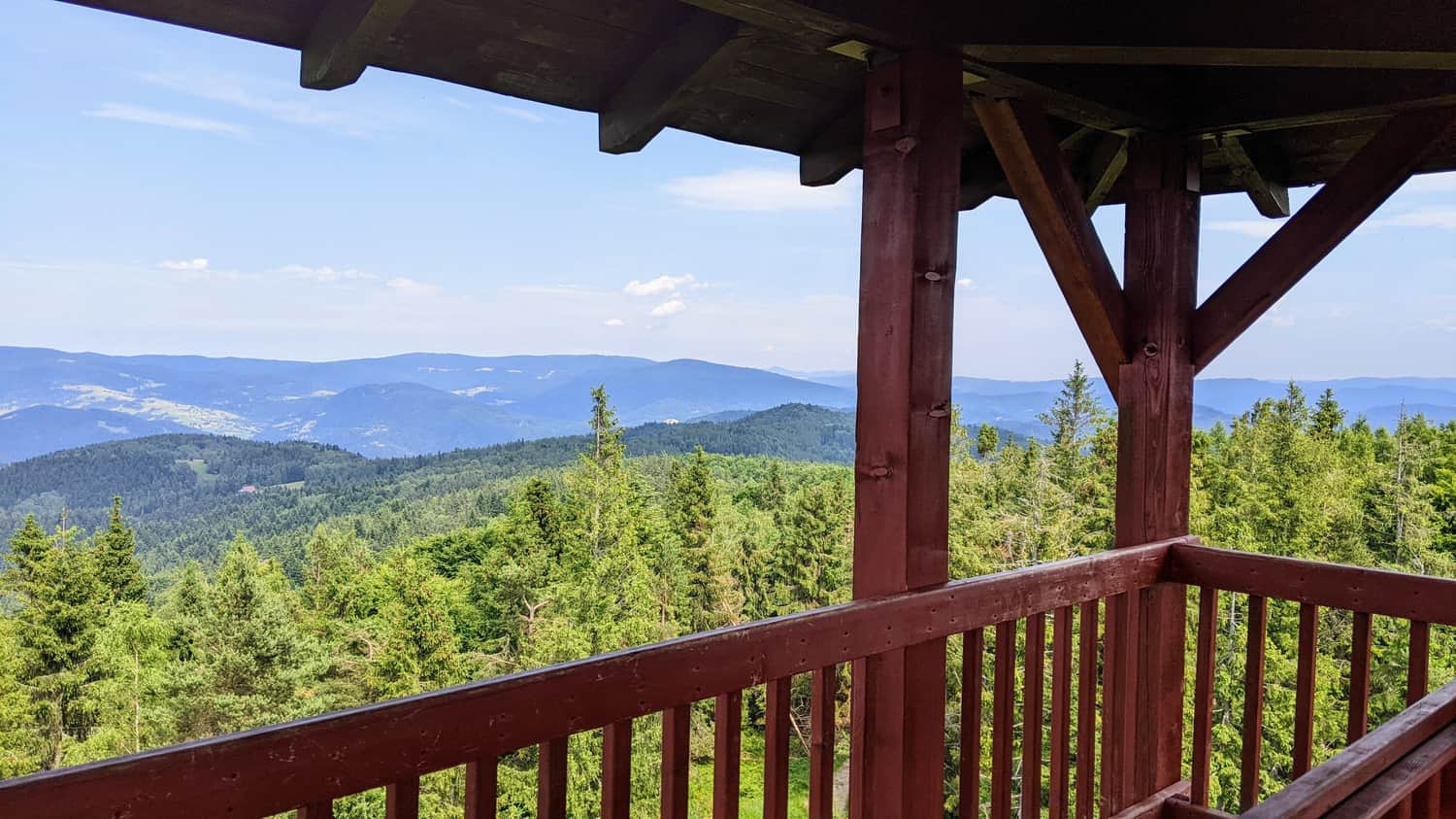
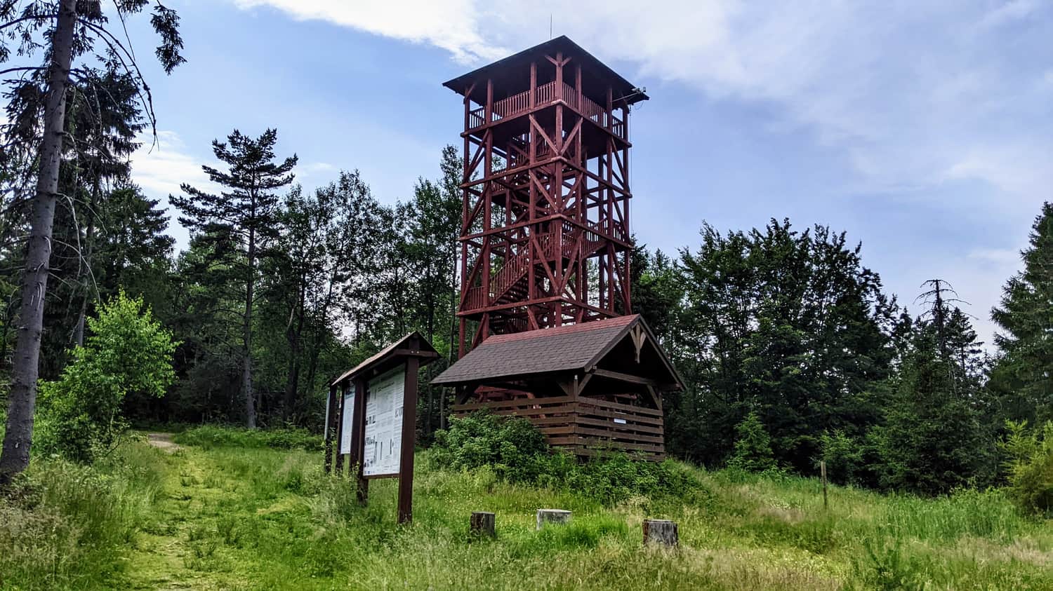
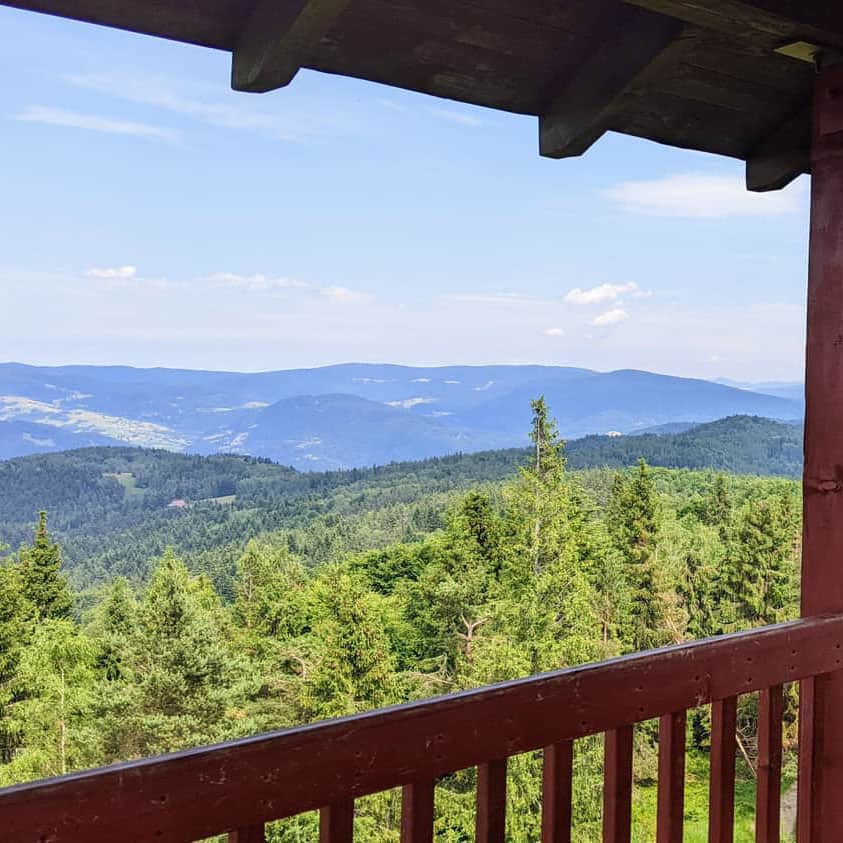
To enhance the tourist appeal of the summit, a 20-meter wooden observation tower, a covered gazebo, a place for bonfires, and a cycling obstacle course have been built.
Trails to the observation tower on Eliaszówka
1. Shortest trail to the observation tower on Eliaszówka
The shortest and easiest way to reach the observation tower on Eliaszówka (1024m) is to start the expedition from the Obidza Pass (908m), which can be reached by car. The advantage of this trail is the small difference in altitude, and it is relatively short, making it an excellent choice for people, for example, with children, who prefer easier and shorter hikes.
Easy
Shortest Trail to the Lookout Tower on Eliaszówka

2. Scenic route to Eliaszówka from Jaworek
The red trail from Jaworek to the observation tower on Eliaszówka will lead us to the destination through numerous scenic clearings: the so-called Ruskie Łąki, the clearing under Ruski Wierch, and the Litawcowa Clearing on Obidza.
Medium
Scenic route to Eliaszówka from Jaworek

3. Jaworki - Eliaszówka, via Biała Woda
The trail from Jaworek to the observation tower on Eliaszówka mainly goes through the forest. Compared to the alternative route on the red trail through Litawcowa, it has slightly fewer inclines to overcome and more sections where we walk on a relatively flat terrain.
Medium
Jaworki - Eliaszówka, through Biała Woda

4. Eliaszówka - green, border trail from Piwniczna-Zdrój
The trail offers beautiful views and open clearings. If you plan a trip on a hot day, it is best to start early to spend the hottest hours in the cool forest.
Medium
Eliaszówka - green, border trail from Piwniczna-Zdrój

5. From Piwniczna Zdrój through Niemcowa to Eliaszówka
This is a long, demanding, but scenic and varied trail. It can be combined into a loop with the green border trail for a full-day trip: in total, it will be around 23 km, 7-8 hours of hiking, with 1000 meters of elevation gain.
Medium
From Piwniczna Zdrój to Eliaszówka via Niemcowa


Publish Date: