
Jaworzyna Krynicka - trails, mountain hut, cable car, and views

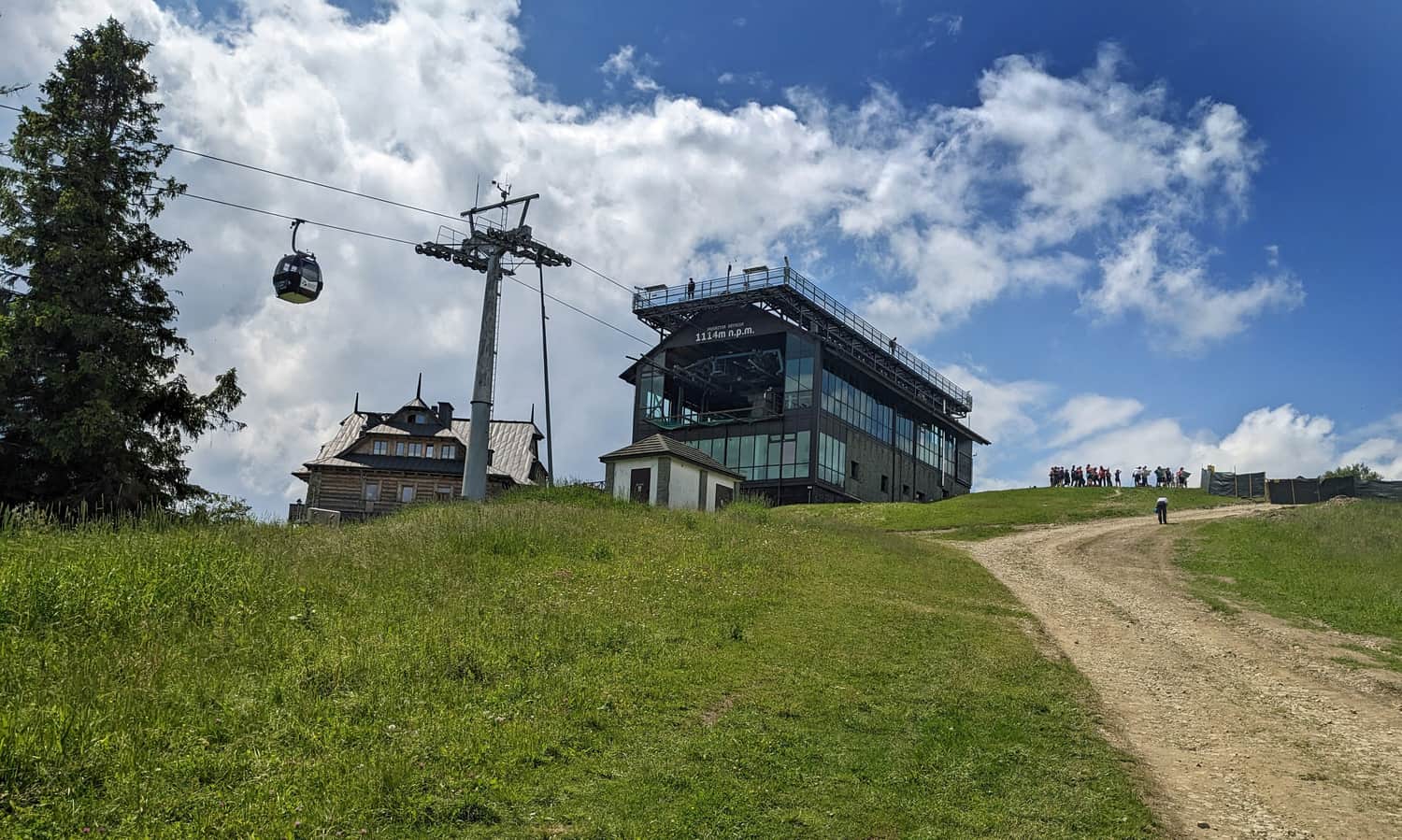
Jaworzyna Krynicka (1114 meters above sea level) is the highest peak in the eastern part of the Sądecki Beskids, overlooking Krynica-Zdrój, and is known as the Jaworzyna Krynicka Range.
Jaworzyna Krynicka - attractions
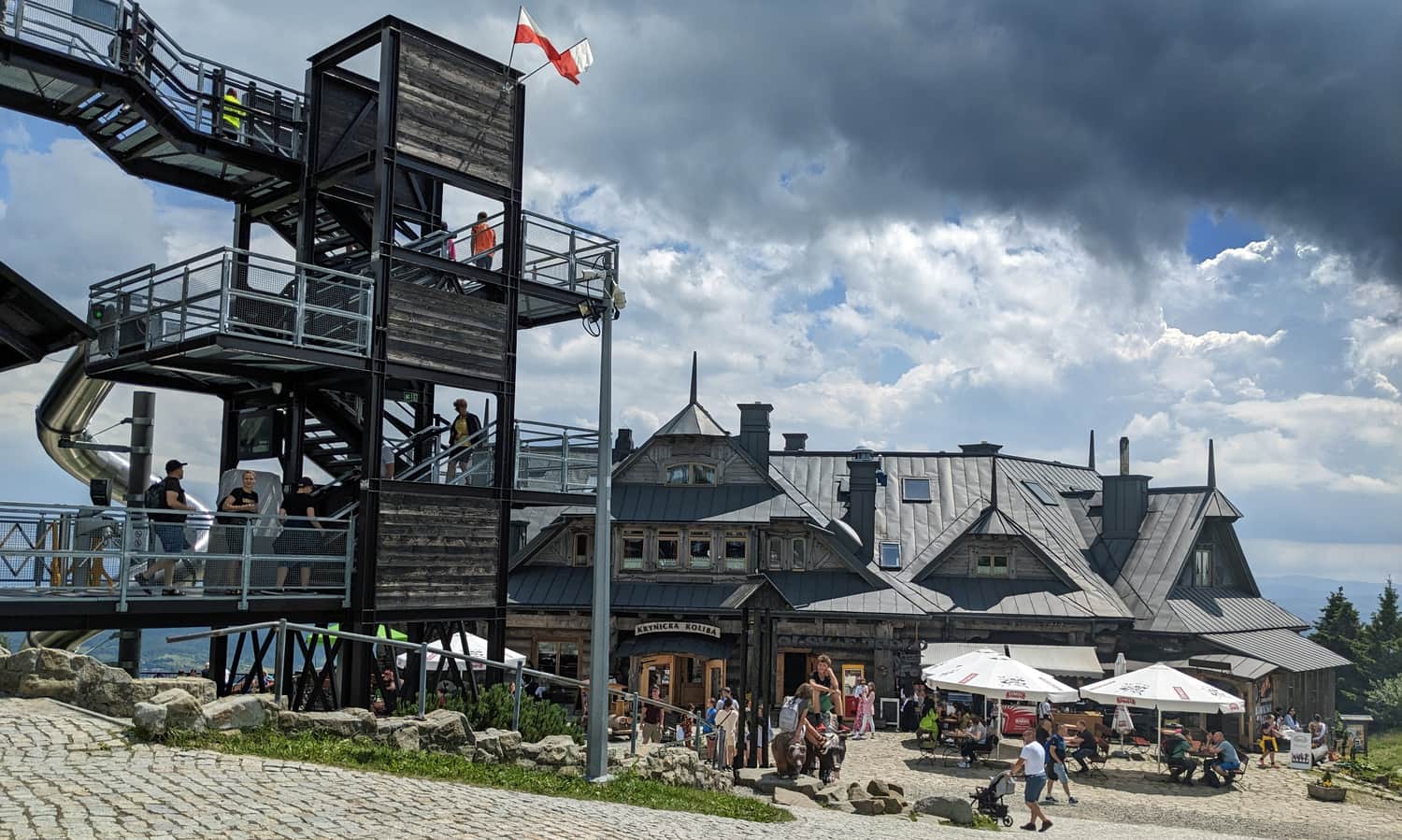
At the top of Jaworzyna Krynicka, you can enjoy beautiful views in all directions, as well as a viewing terrace, a slide, a restaurant, hiking and cycling trails, and even additional seasonal attractions!
Views from Jaworzyna Krynicka
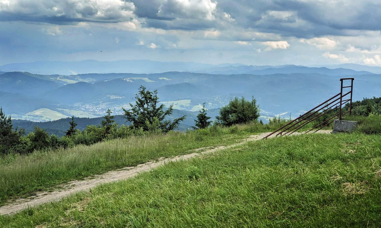
From the summit of Jaworzyna Krynicka, we can observe a wide panorama in all directions.
We can see the entire Jaworzyna Krynicka Range on which we are standing, the neighboring Radziejowa Range, as well as other Beskid ranges: the Low Beskids to the east with the highest peaks of Lackowa and Busov, and even the Bieszczady Mountains on a clear day! To the west, we can spot the Gorce Range and the sharp peaks of the Tatra Mountains.
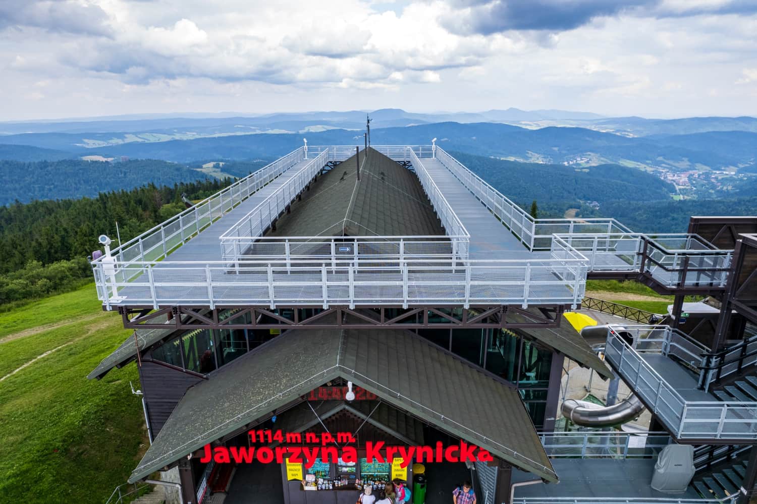
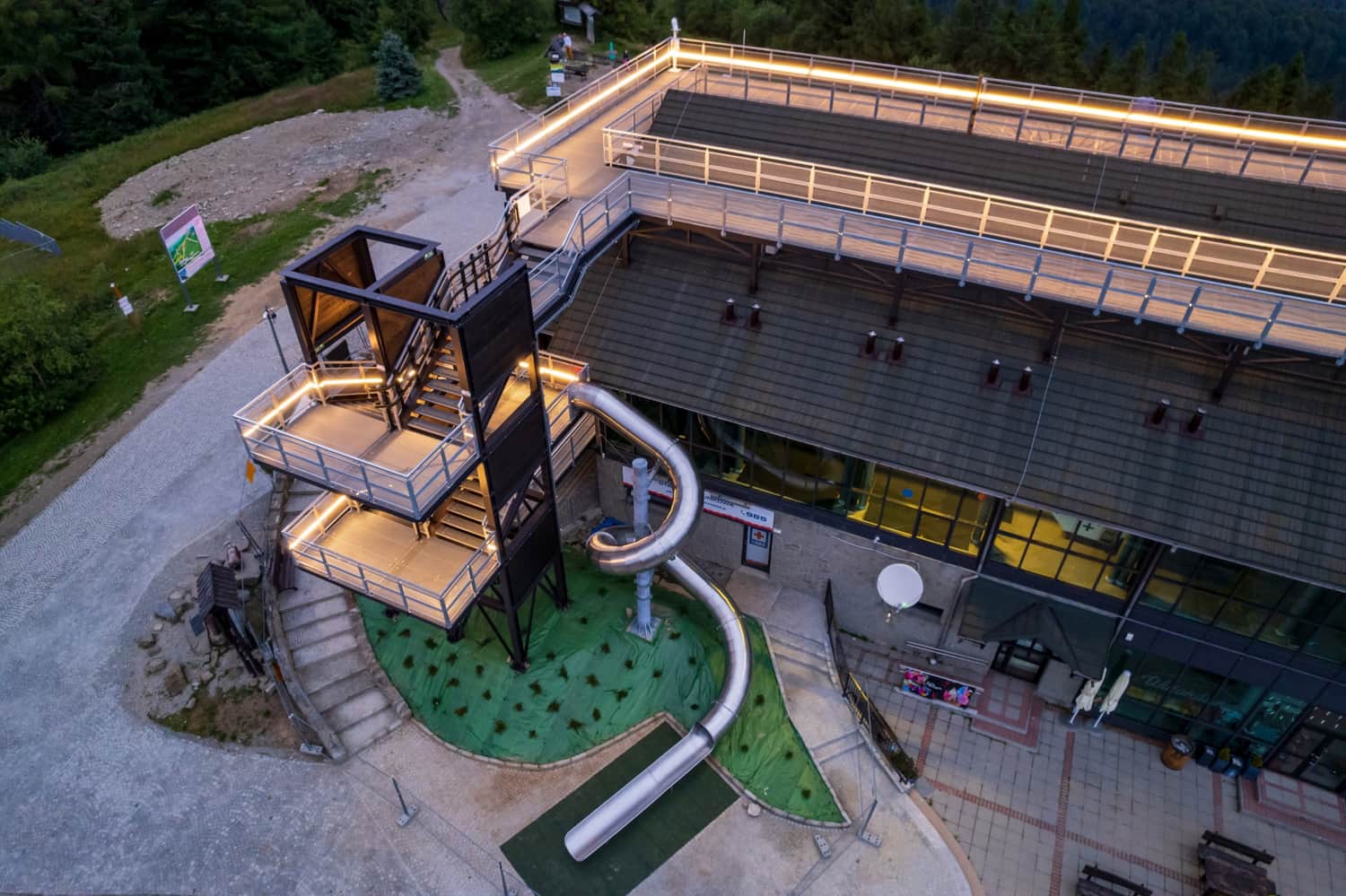
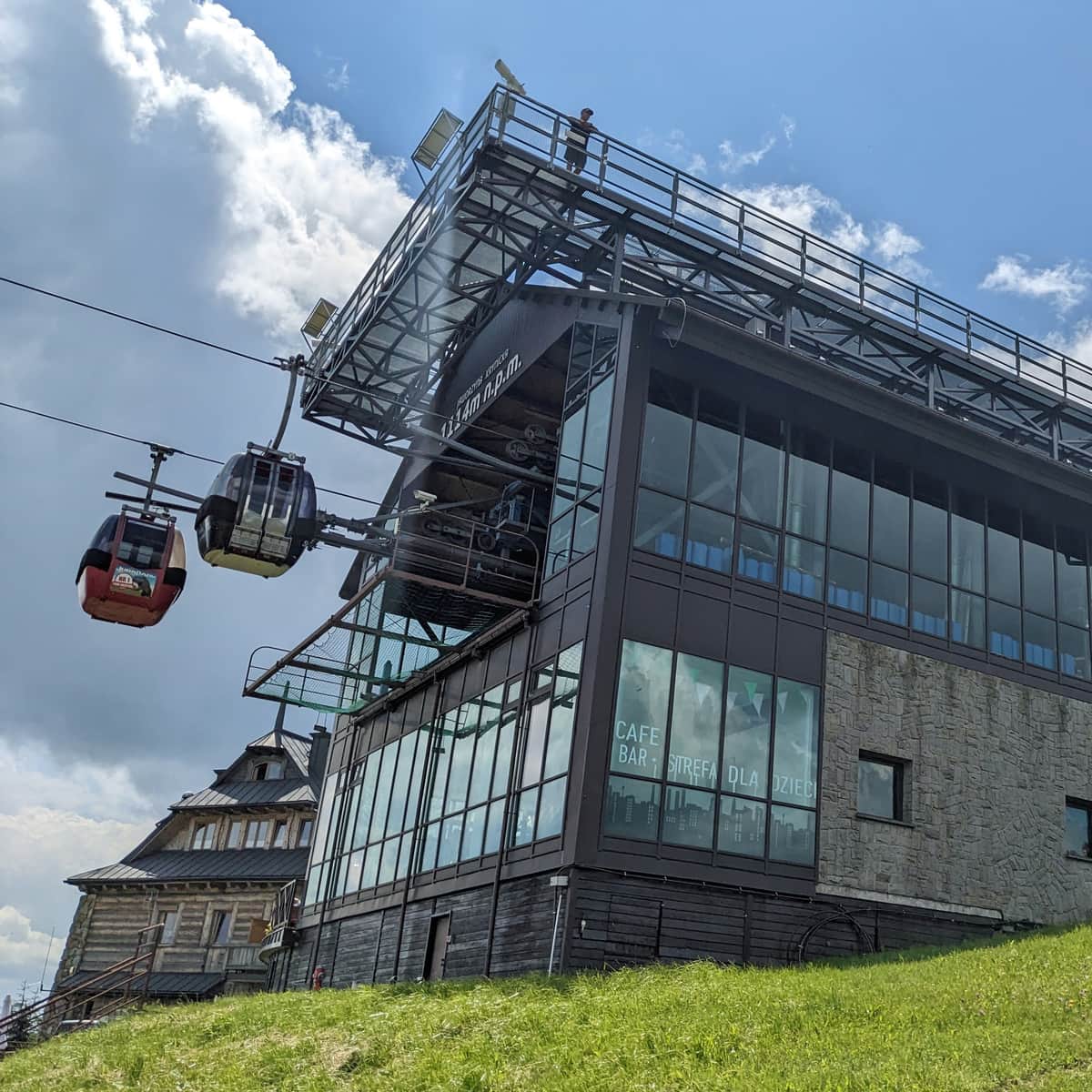
Jaworzyna Krynicka - viewing platform and slide
The most beautiful views of Jaworzyna Krynicka can be seen from the large viewing platform on the top station of the cable car, which is elevated above the treetops. Additionally, children under 15 years old can slide down from it on a slide! Note! There is an additional fee for access to the viewing terrace and slide! Price list >>>
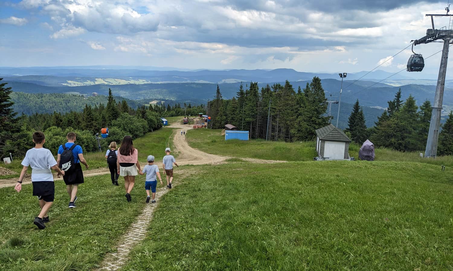
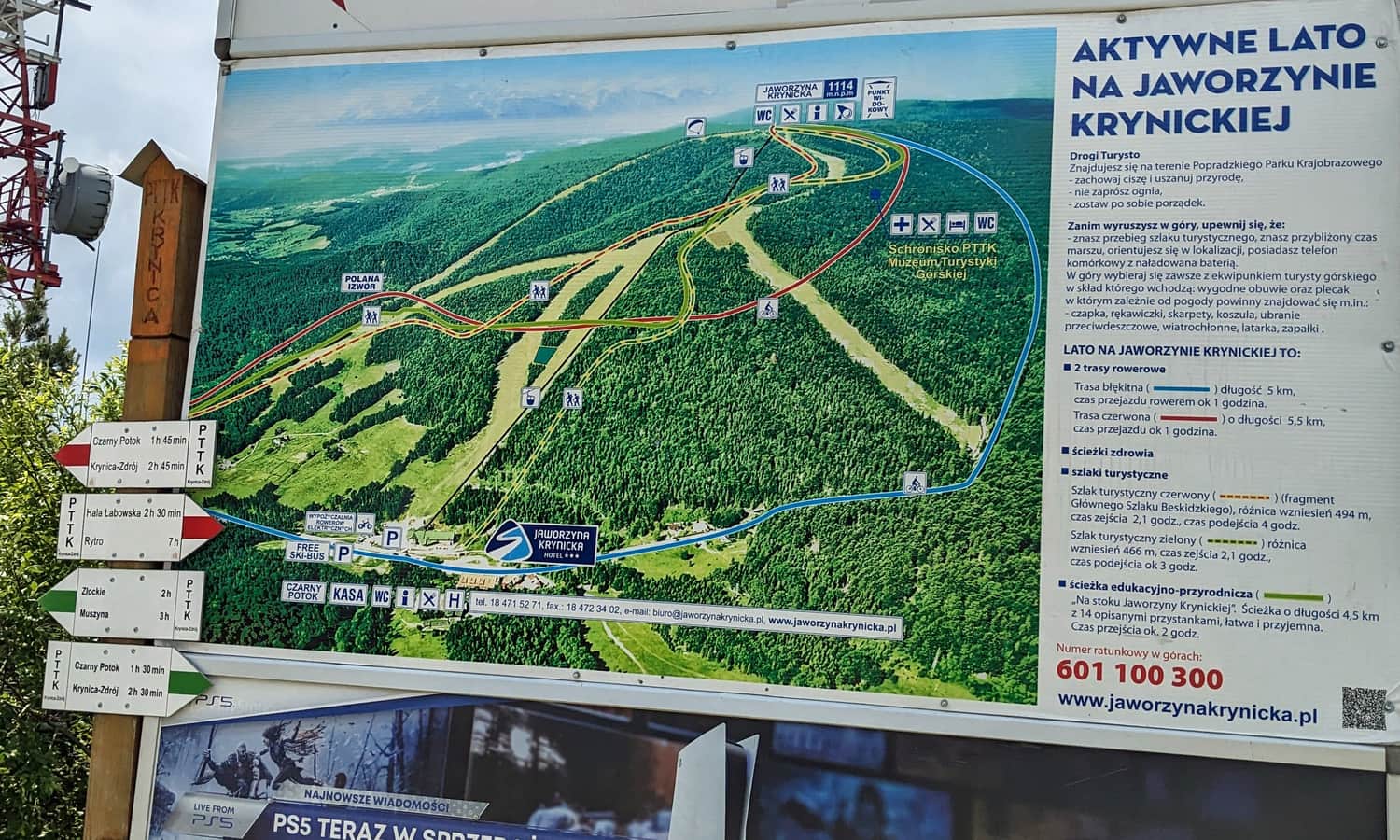
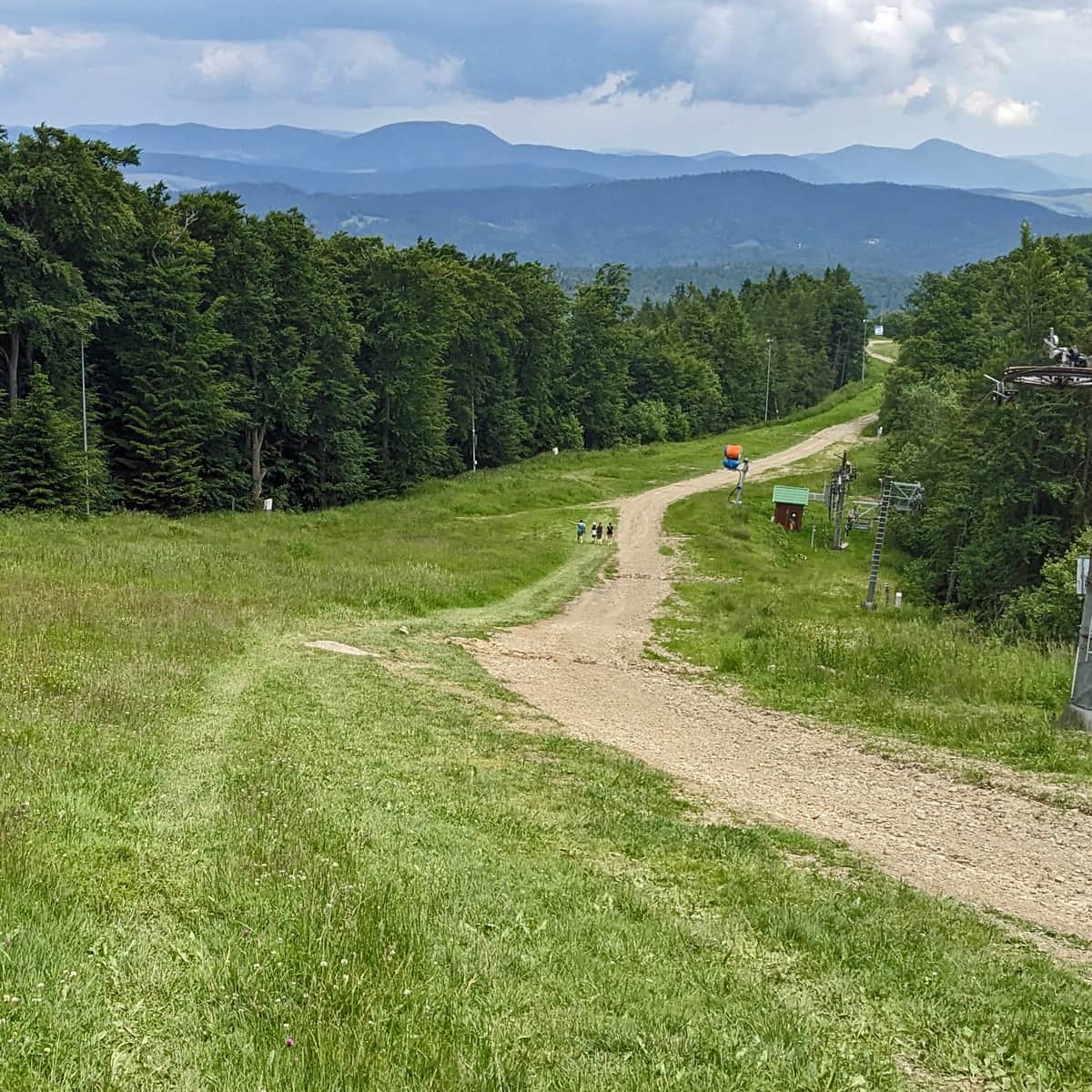
In addition, at the summit, there is a wide range of gastronomic facilities. In winter, it is a kingdom for skiers, and in summer, it attracts hikers and cyclists, with downhill trails prepared for them.
Additional attractions at Jaworzyna Krynicka
During the summer season, many additional attractions are organized at Jaworzyna Krynicka for children, adults, seniors, runners, cyclists, etc. These include guided tours, activities, workshops, yoga and tai chi classes, etc. Details can be found on the website PKL >>>
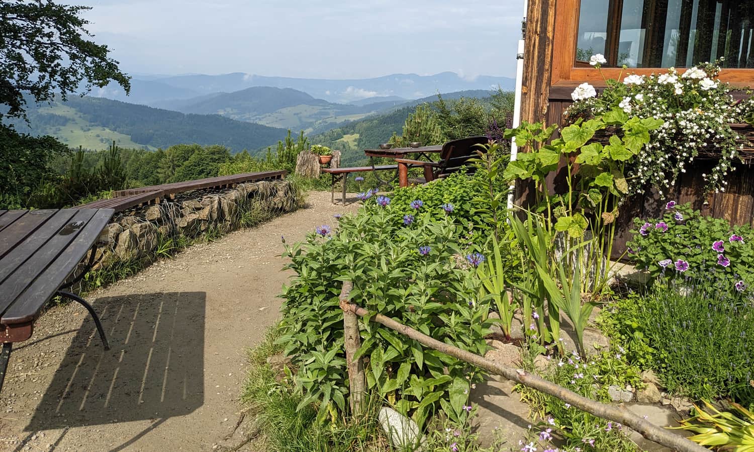
PTTK Mountain Hut on Jaworzyna Krynicka
If you are looking for a bit more tranquility in the mountains, we recommend taking a short walk from the upper station of the cable car to the peaceful PTTK Mountain Hut below Jaworzyna Krynicka. Due to the closure of trails on the northern slopes of Jaworzyna Krynicka, the easiest way to reach the hut from the summit is via the access road (see the map).
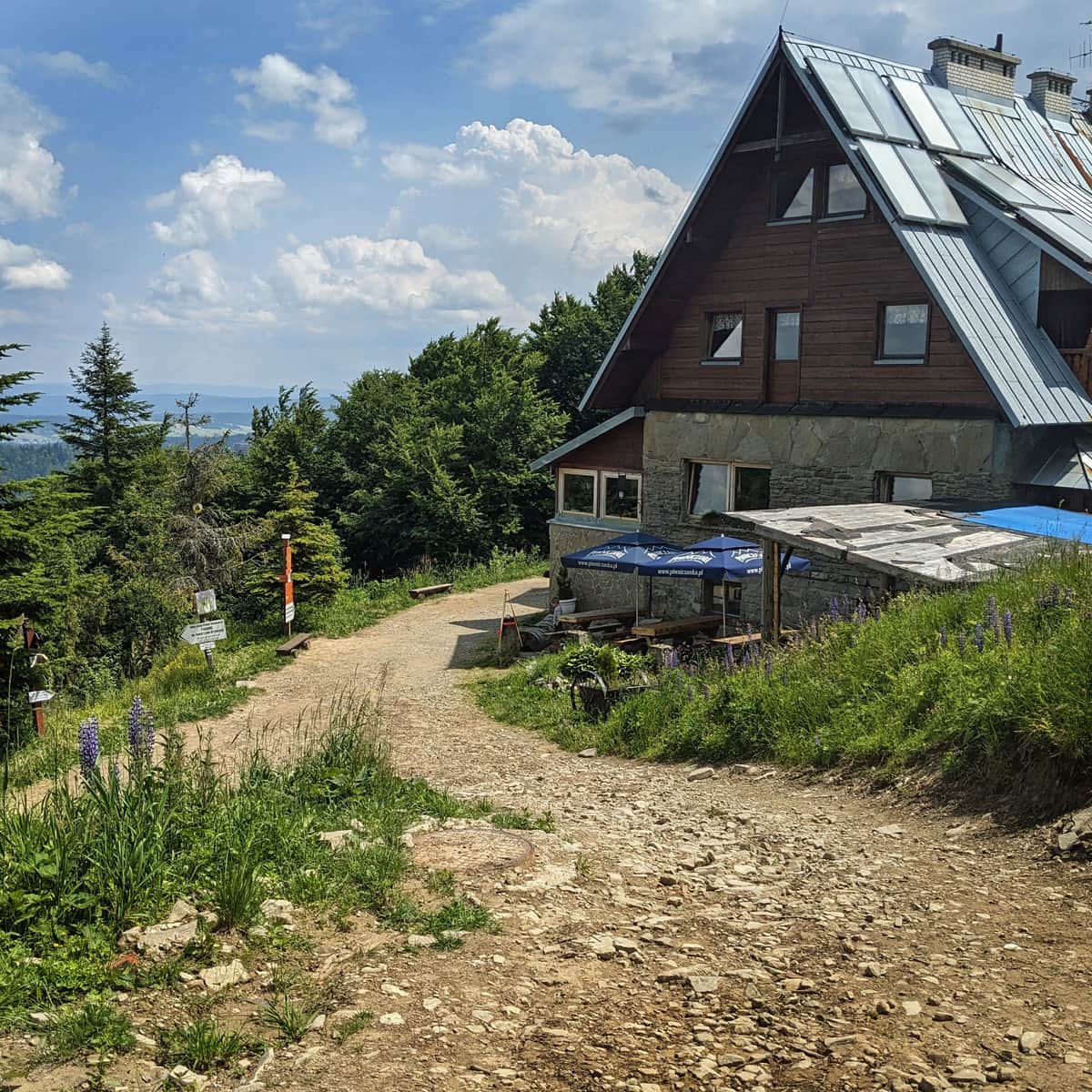
PTTK shelter near Jaworzyna Krynicka
The PTTK Mountain Shelter near Jaworzyna Krynicka is located at an altitude of 1050 meters above sea level. It is a peaceful and atmospheric place where you can take a break from the hustle and bustle of the commercialized summit of Jaworzyna Krynicka. ...
How to get to Jaworzyna Krynicka?
There are many ways to reach the summit of Jaworzyna Krynicka. The easiest way is to take the cable car from Czarny Potok:
Cable car to Jaworzyna Krynicka
Easy
Cable Car to Jaworzyna Krynicka and PTTK Shelter

Hiking trails to Jaworzyna Krynicka
Of course, we will have much greater satisfaction when we reach the summit of Jaworzyna Krynicka on our own! There are several trails leading here from Krynica-Zdrój (green, red, or blue + red trails), as well as from Muszyna (green trail from Muszyna Złockie: 6.5 km, less than 3 hours one way) and Szczawnik (black + red, 7 km, 3 hours).
Shortest trail to Jaworzyna Krynicka
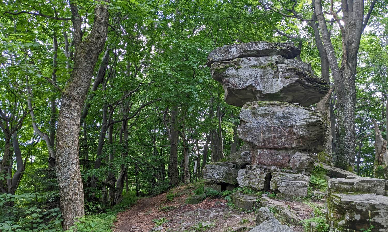
The shortest hiking trail to Jaworzyna Krynicka from Krynica-Zdrój is the green trail. Along the way, we will see the famous rock formation called the Devil's Stone.
Medium
Green Trail to Jaworzyna Krynicka from Czarny Potok

Jaworzyna Krynicka from Wierchomla
We also recommend taking a scenic route to Jaworzyna Krynicka from Wierchomla Mała. First, we take a chairlift (Dwie Doliny station) or hike up the black trail to Bacówka nad Wierchomlą:
Medium
The Black Trail from Wierchomla to Bacówka nad Wierchomlą

...and then we hike along the ridge on the red trail:
Easy
From Jaworzyna Krynicka to the Hut above Wierchomla

The entire route is approximately 8 km long with a total elevation gain of less than 600 m. The one-way hike should take about 3 hours.

Publish Date:
Last Updated: