Green Trail to Jaworzyna Krynicka from Czarny Potok
Nearby: Krynica Zdrójbeach_access Route in the shade
restaurant Restaurant or bar nearby
directions_car Access by car
directions_bus Can be reached by bus
wc Toilet along the route
The shortest hiking trail to the summit of Jaworzyna Krynicka starts from Czarny Potok, near the lower station of the gondola lift. The route is not long, but it involves a total ascent of 500 meters.
Beginning of the Green Trail to Jaworzyna Krynicka
You can enter the green trail from the center of Krynica-Zdrój, but in that case, you will also have to climb through the forested slopes of Góra Krzyżowa (an additional 200 meters of ascent). It will be easier to start from Czarny Potok, where you can get by bus or car (there are many parking lots near the lower station of the gondola lift).
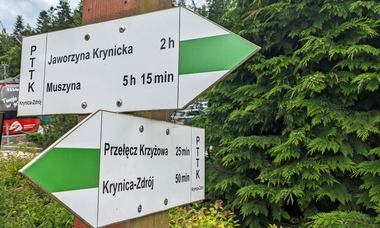
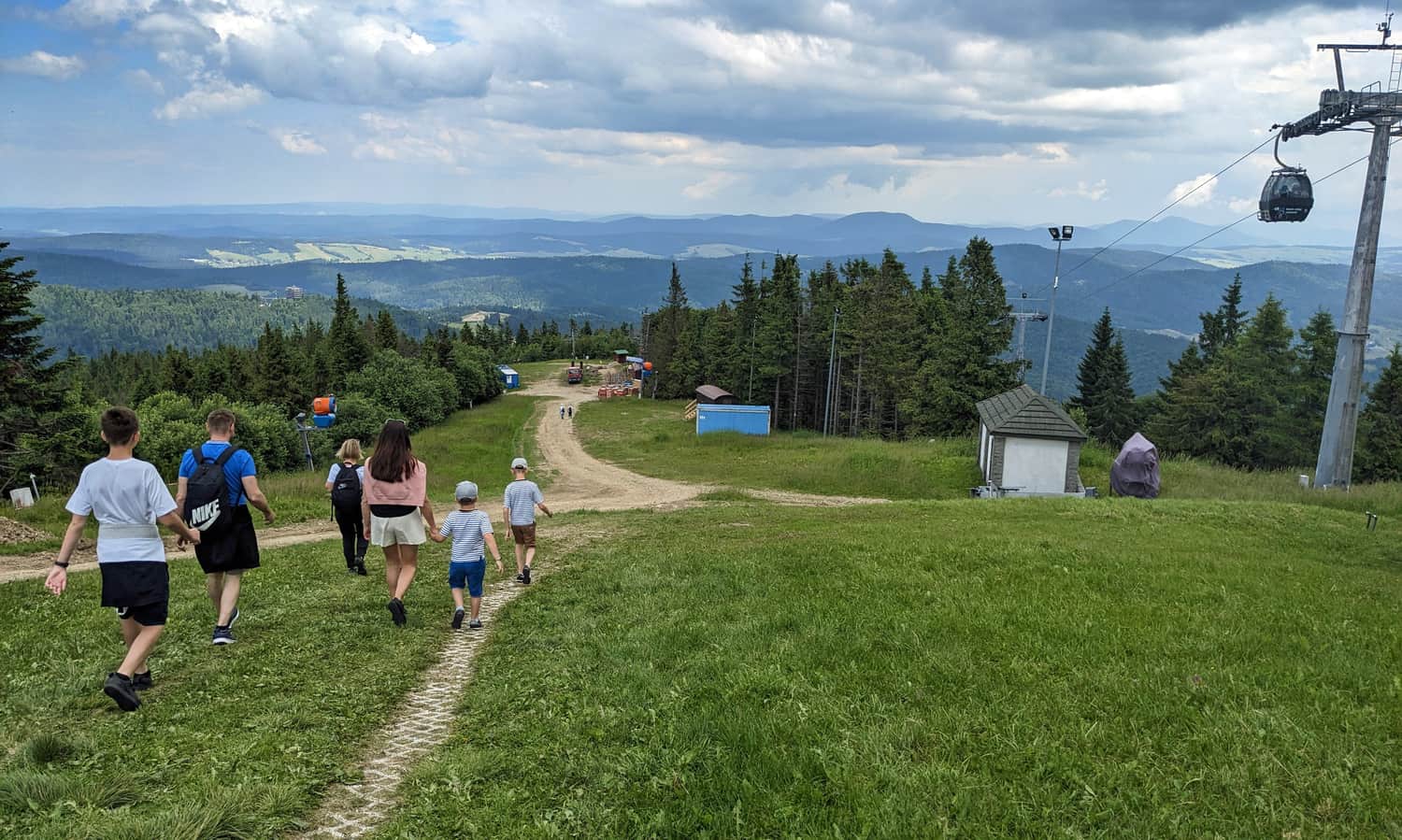
Green Trail to Jaworzyna Krynicka
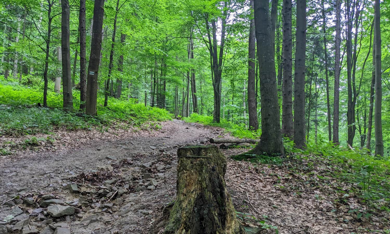
The first section of the trail leads through the forest. The path is wide and comfortable, but it steadily climbs uphill.
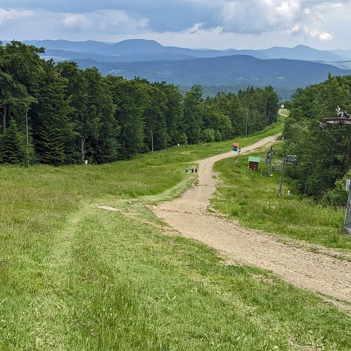
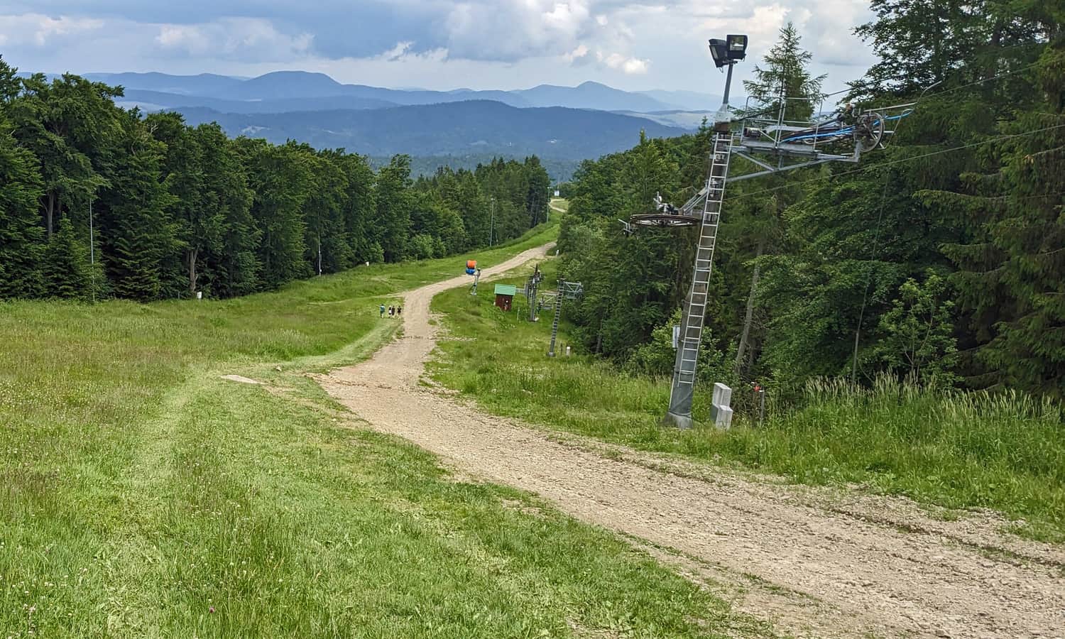
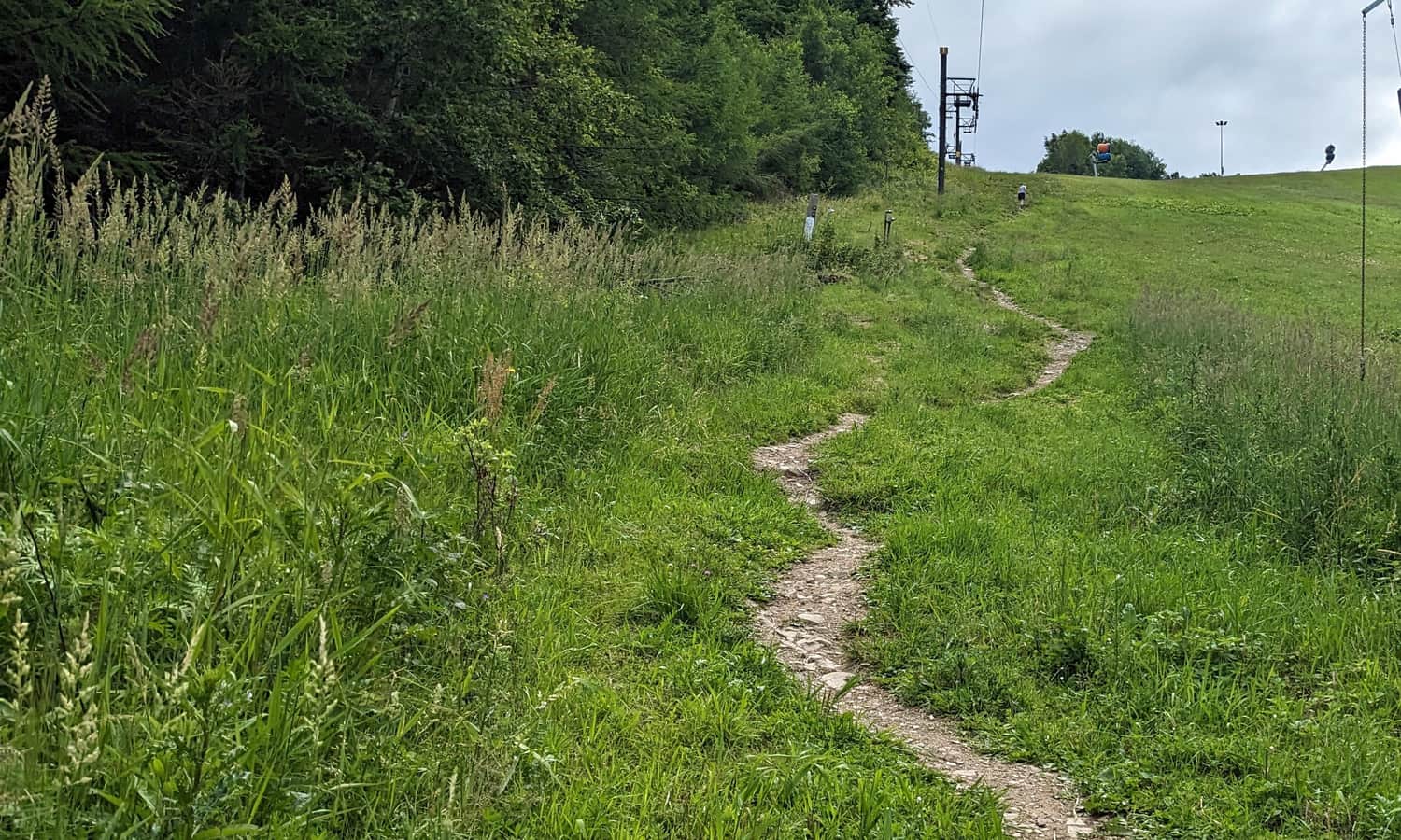
The most challenging part will be climbing the steep side of the ski slope.
When we reach the artificial water reservoir used for snowmaking on the ski slopes, we can take a breath - although it is only halfway, most of the ascent is already behind us.
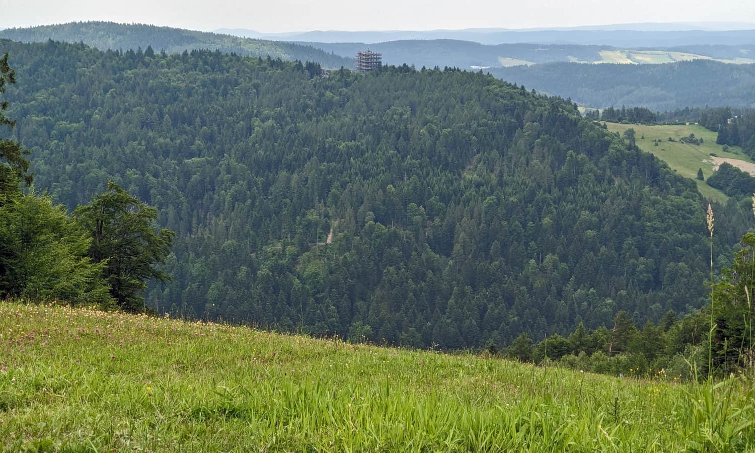
Along the way, we will have views of the surrounding area, including a glimpse of the "treetop path" in Słotwiny:
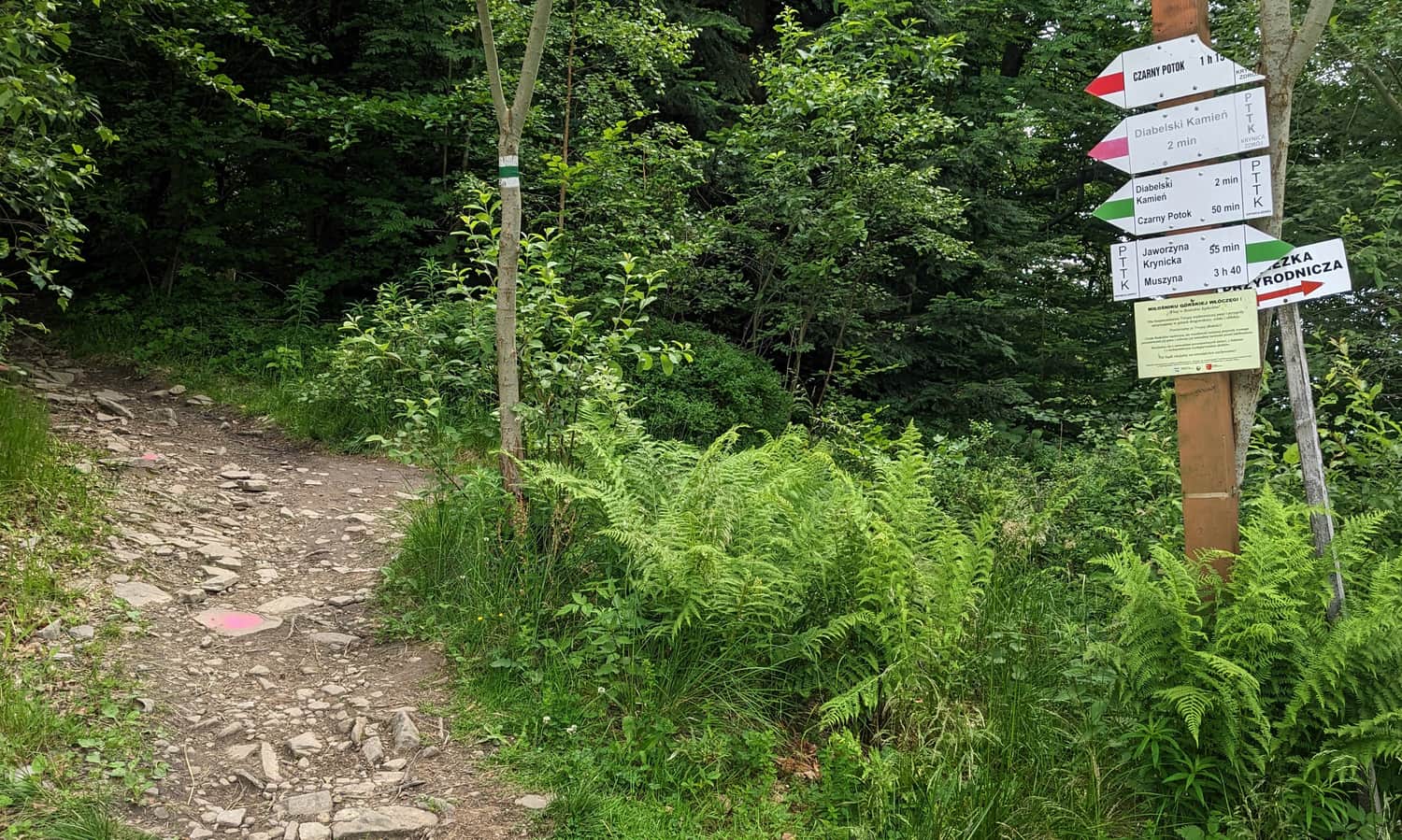
From here, we can already see the destination of our hike: the summit and the upper station of the cable car. Although it may seem that the easiest way would be to simply follow the slope, let's look for trail markers and enter the forest behind them - it is really worth it!
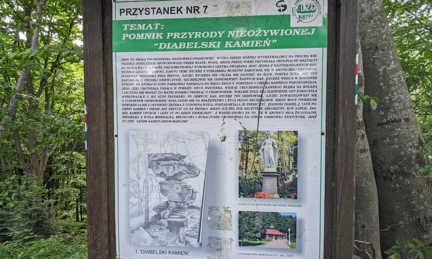
Devil's Stone beneath Jaworzyna Krynicka
One of the attractions along the green trail, where it is worth stopping for a while, is the mysterious rock formation called Devil's Stone. It is located in the forest, just above the main ski slope. Nearby, there is also the Bandit Cave, which is not open for visitors.
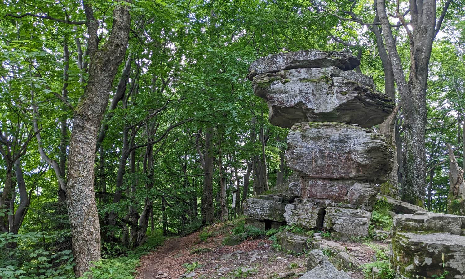
Legend of the Devil's Stone on Jaworzyna Krynicka
According to the legend, the devil abandoned the rock, intending to destroy the life-giving springs in Krynica. Fortunately, he did not have time to do so before dawn: a rooster crowed, and the frightened devil dropped the stone.
A more elaborate version of the legend, including a love story (!), as well as geological curiosities, can be found on information boards near the stone.
Jaworzyna Krynicka: Summit or Shelter?
After leaving the forest, we can decide where to go first: the green signs turn right towards the peaceful PTTK shelter beneath Jaworzyna Krynicka, while the red signs lead straight to the summit.
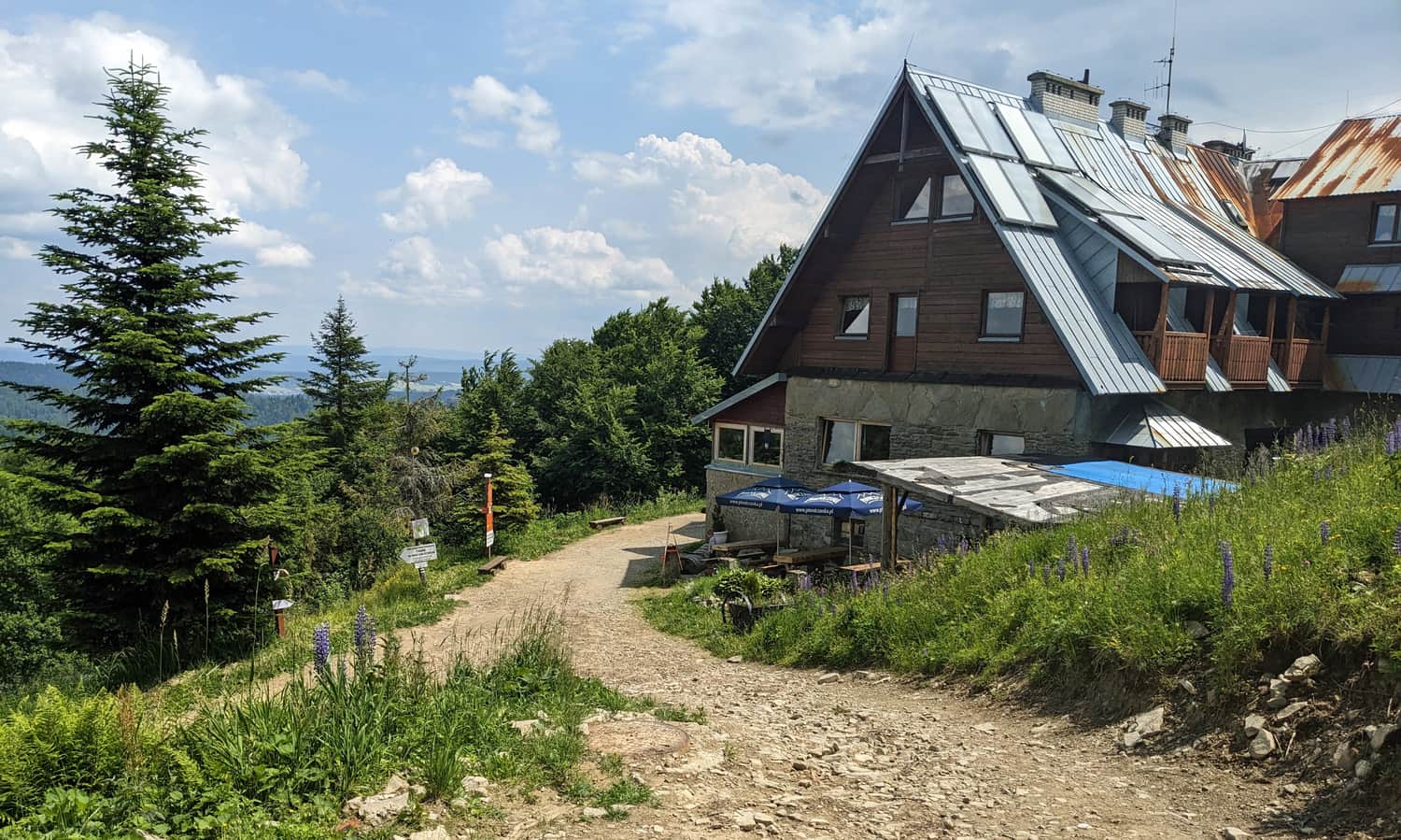
PTTK Shelter on Jaworzyna Krynicka
If we choose to visit the shelter first, we can rest there, have a meal, and enjoy the view to the east. Due to the construction of new slopes on the northern slopes of Jaworzyna Krynicka, the easiest way to reach the summit is via the access road (without a trail, approximately 15 minutes).
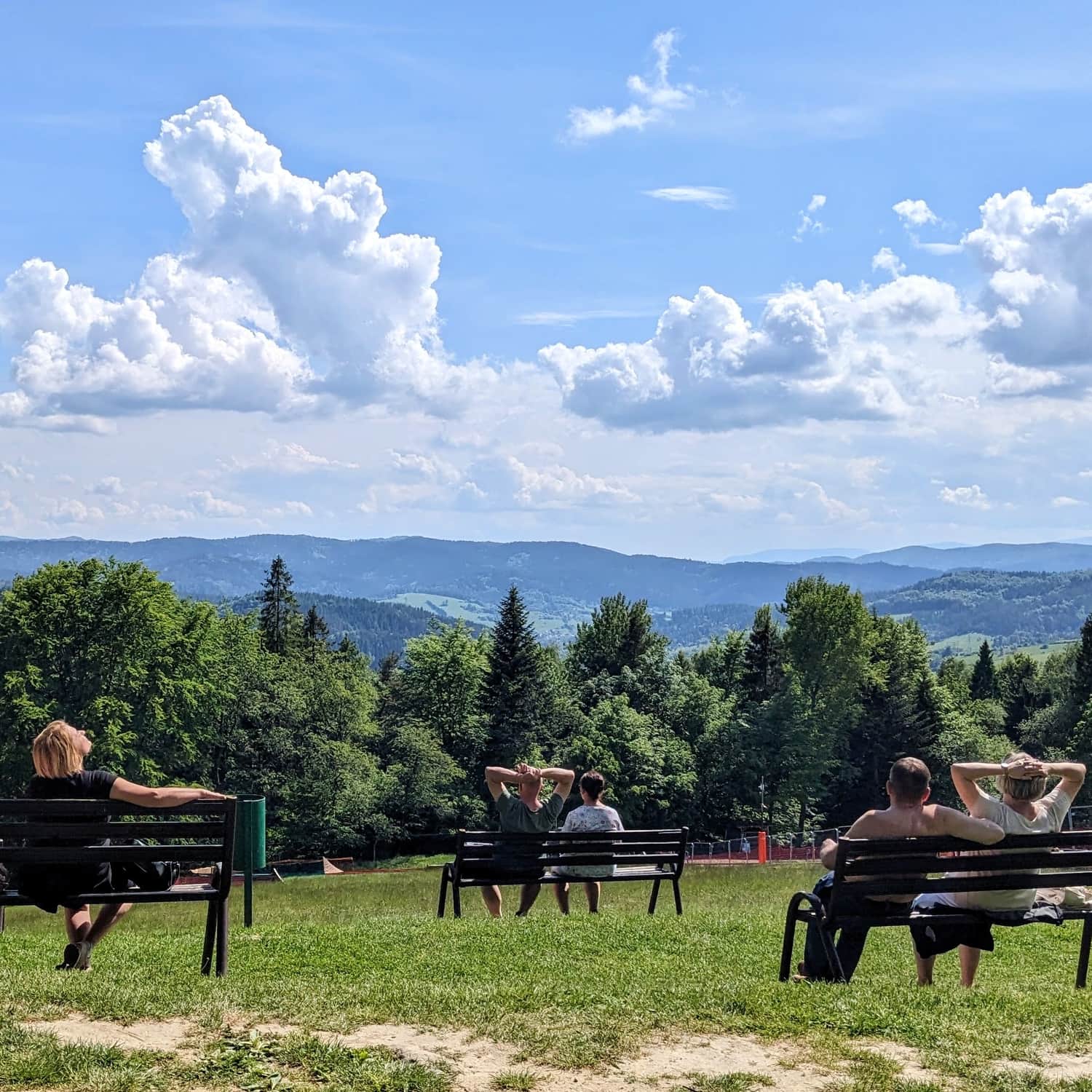
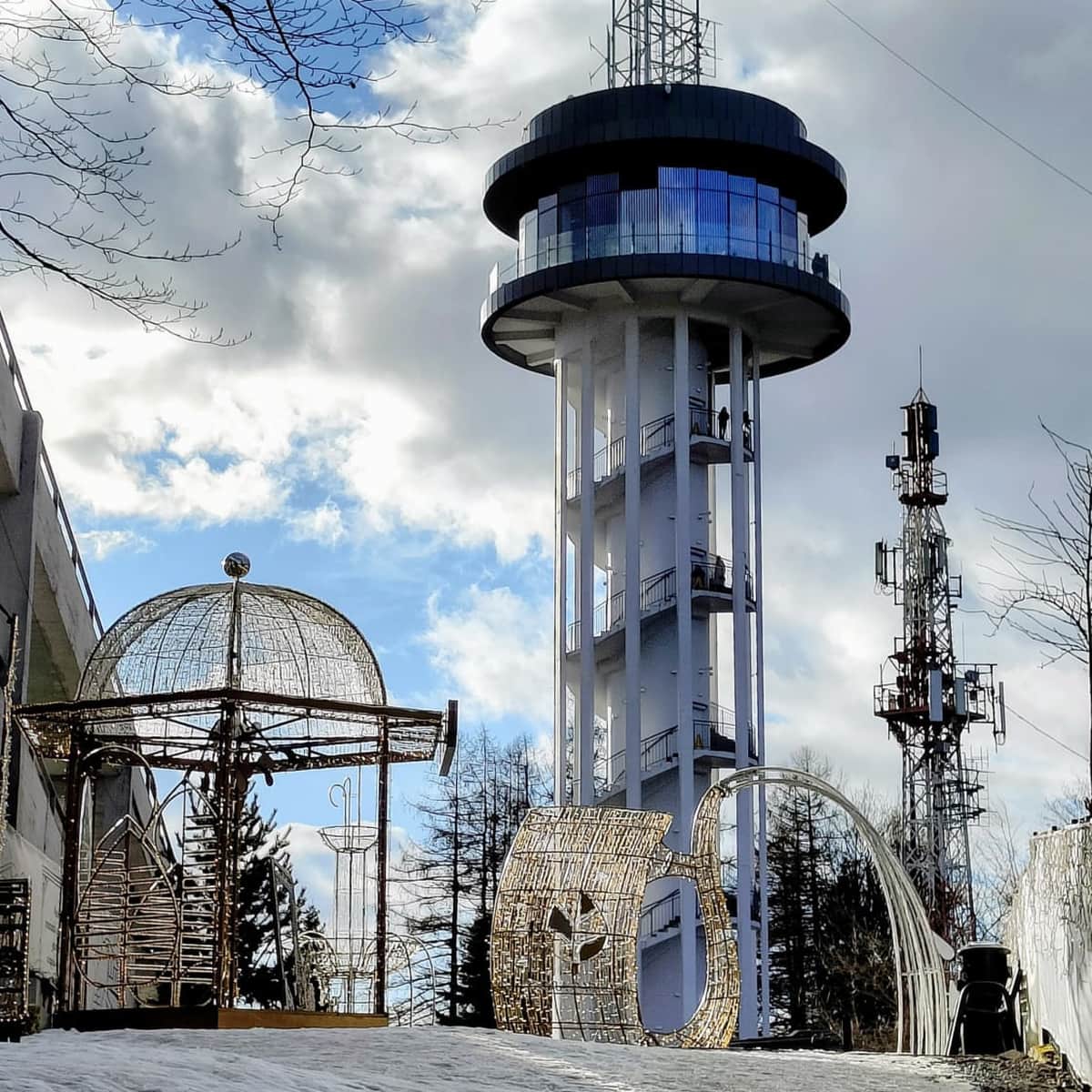
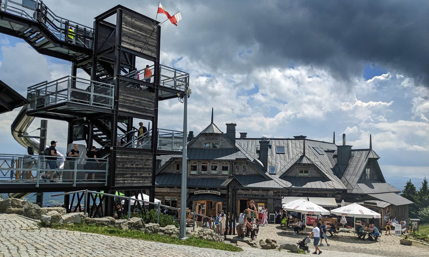
Jaworzyna Krynicka - Summit at 1114 meters above sea level
From the summit of Jaworzyna Krynicka, there is a beautiful panorama in all four directions (unfortunately, the northern part is partially obstructed by construction fences...).
As there is an upper station of the cable car and gastronomic points here, it can get quite lively and crowded. An additional attraction is the extensive viewing terrace above the station building - please note that there is an entrance fee!
If you prefer to relax in a more secluded place, we recommend taking the access road down to the PTTK shelter beneath Jaworzyna Krynicka (approximately 10 minutes from the summit).
For more information about Jaworzyna Krynicka, the summit, views, the shelter, and trails in the area, you can read here:

Jaworzyna Krynicka - trails, mountain hut, cable car, and views
Jaworzyna Krynicka (1114 meters above sea level) is the highest peak in the eastern part of the Sądecki Beskids, overlooking Krynica-Zdrój, and is known as the Jaworzyna Krynicka Range. Here, you can find a cable car, beautiful views, a mountain hut, and even a slide! ...

Publish Date:
Last Updated: