Wysoka Peak - the shortest trail through the Homole Gorge
Nearby: Nowy Targ
warning Difficulties for parents with a toddler in a baby carrier
directions_car Access by car
directions_bus Can be reached by bus
warning No dogs allowed
The green trail from Jaworek through the Homole Gorge is the shortest, most interesting, and most popular route to the highest peak of the Pieniny Mountains - Wysoka (1050 m above sea level).
- Trail start: the village of Jaworki, about 6 km from Szczawnica
- Parking is available right at the entrance to the Homole Gorge, but it is worth taking a bus to Jaworek (they are very frequent) and hiking to Szczawnica along the Małe Pieniny ridge
- Steep and rocky ascent to the summit
- Difficult point on the trail: a very steep path with a large incline after Polana pod Wysoką
- No dogs allowed in the Homole Gorge
- Possibility of making a loop by descending to Jaworek on a different trail: through Durbaszka or Biała Woda
Homole Gorge and Stone Books
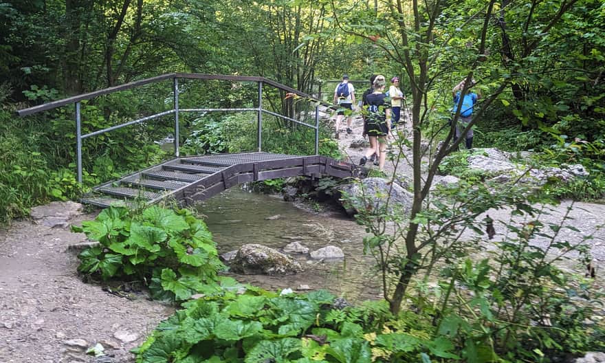
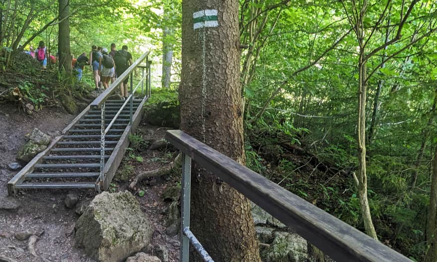
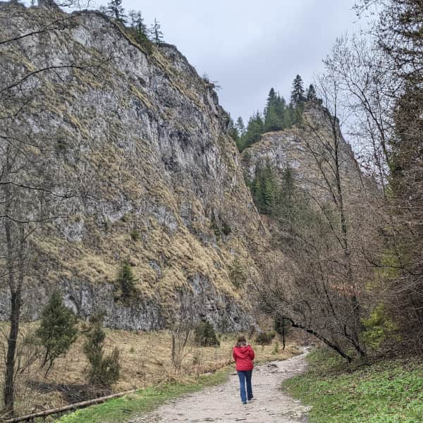
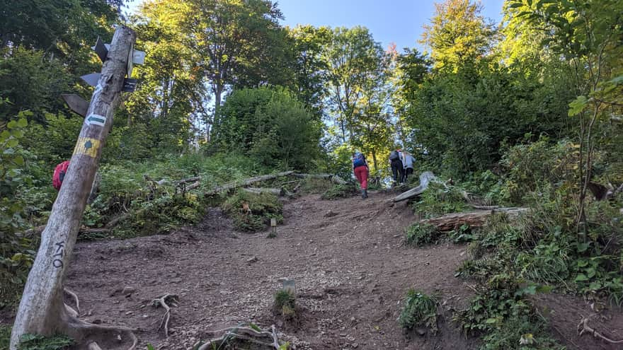
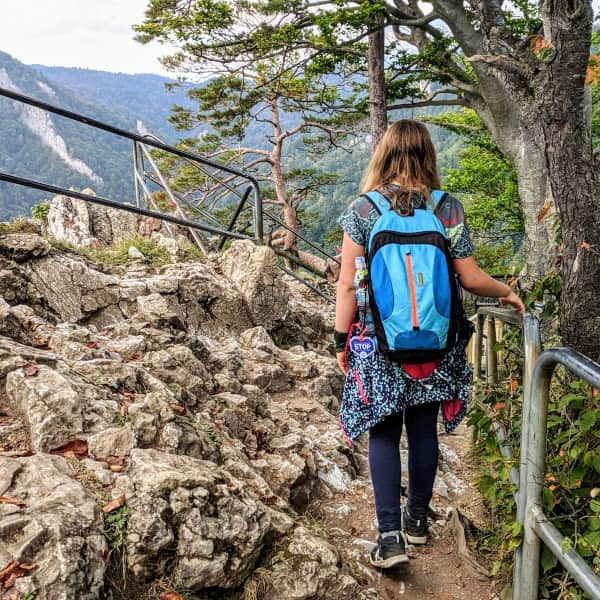
Initially, the trail leads us through the bottom of the Homole Gorge - a rocky gorge with steep slopes, which is one of the main attractions of the Pieniny Mountains. The path winds through the gorge, crossing over the stream on metal bridges. At the end of the gorge, we have to climb uphill on metal stairs to reach Polana Dubantowska and the "Stone Books".
You can read more about the Homole Gorge trail, including the mysterious "Stone Books," here:
Medium
Homole Gorge
Jameriska Glade and Polana pod Wysoką
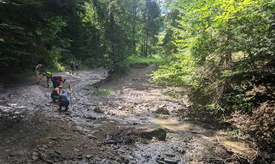
After passing through the Homole Gorge, the green trail takes us through the forest to Jameriska Glade. Attention! This section is always muddy... Be careful not to lose your shoes here!
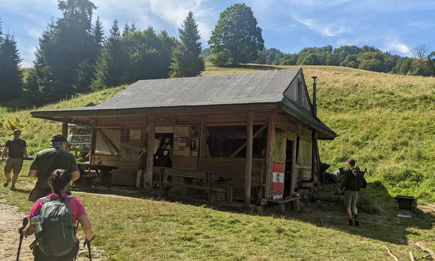
During the summer season (July - August), you can visit the tent base of the Student Circle of Beskid Guides from Łódź along the way:
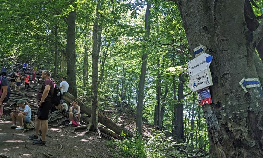
The last glade before reaching the summit is Polana pod Wysoką - beautiful and scenic, but it is here that the most difficult ascent awaits us.
The slope here is steep and with a significant incline, making it difficult to climb. It is also challenging to secure and hold onto a child's hand or carry a backpack because it is hard to maintain balance and not slide down. It becomes even more slippery and muddy after rain...
...in addition, it can get really crowded here during the season and on weekends. Some people are descending on the narrow path while others are ascending.
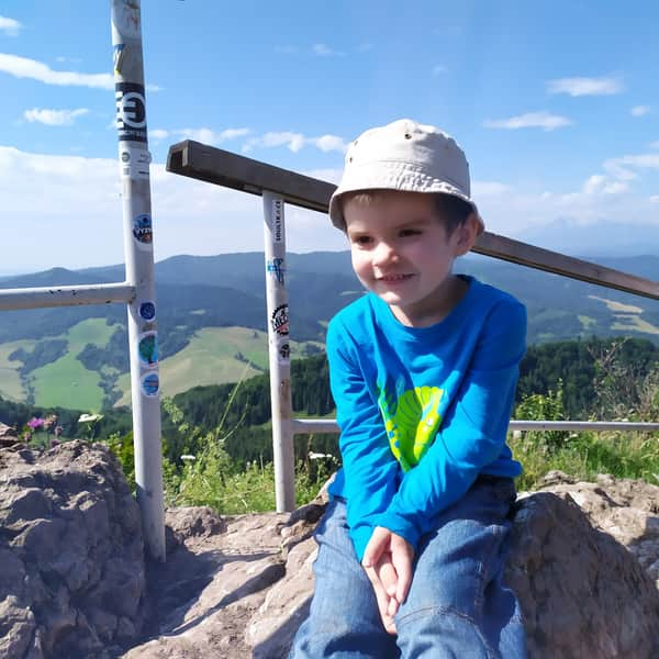
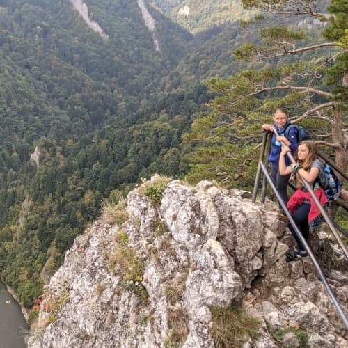
Wysoka, 1050 m above sea level
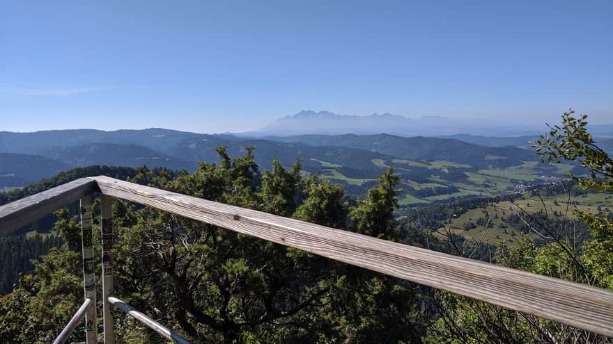
Just before reaching the summit of Wysoka, there is a rocky, approximately twenty-minute ascent. The rocks here are very slippery, but there is a railing on the side. When there is heavy traffic on the trail, we may have to wait in line to enter the small panoramic platform.
It won't be easy to overcome this section. But if you succeed... congratulations! You have climbed to the highest peak of the Pieniny Mountains! Interestingly, the highest peak of these mountains is located in the Małe Pieniny range.
On the small viewing platform, we can enjoy beautiful panoramas of the Tatra and Pieniny Mountains and get a commemorative stamp.
You can read more about Wysoka and other trails to the summit (including those that are not as steep and crowded) in this article:
Wysoka Peak in the Pieniny Mountains - all trails from the Polish side
Wysoka (1050 meters above sea level) is the highest peak of the entire Pieniny Mountains, located (for fun, it seems!) in the Lesser Pieniny! ...
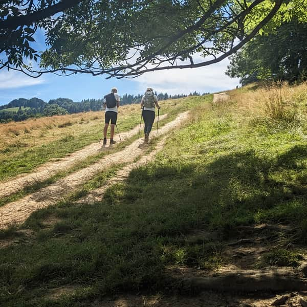
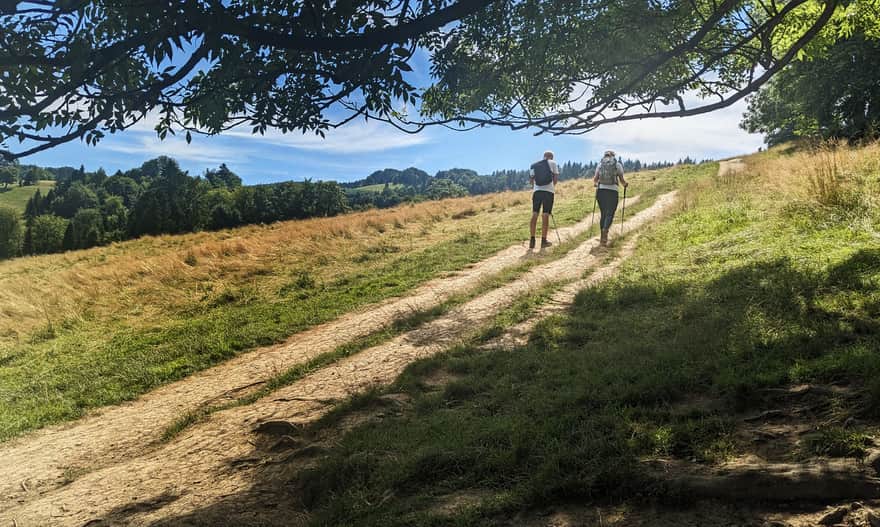
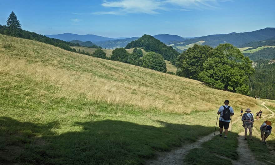
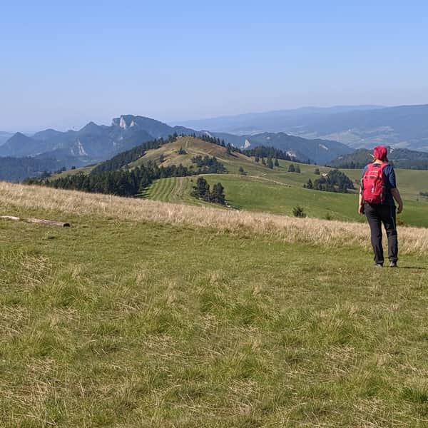
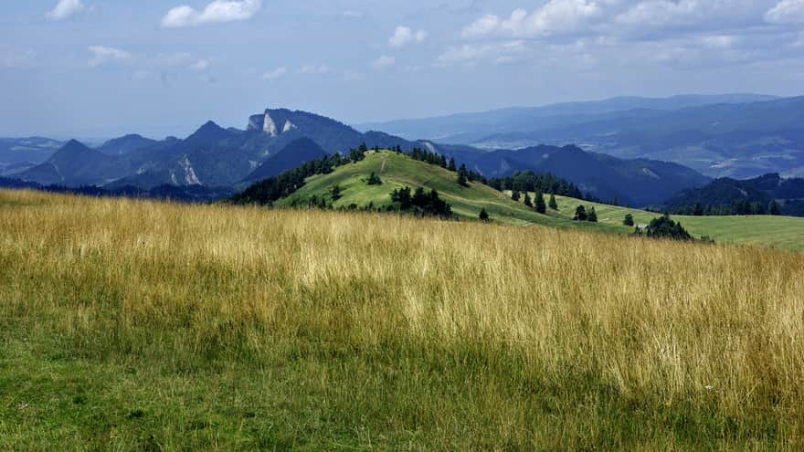
Descending along the Małe Pieniny Ridge
After reaching Wysoka, it is worth descending to Szczawnica along the Małe Pieniny ridge. This is a very scenic trail that follows the exposed ridge of the mountains. While descending towards Szczawnica, we have a view of Trzy Korony, and on the other side, there is a panorama of the Tatras.
Medium
Along the Ridge of the Small Pieniny Mountains: Wysoka - Szczawnica
Return from Wysoka to Jaworek
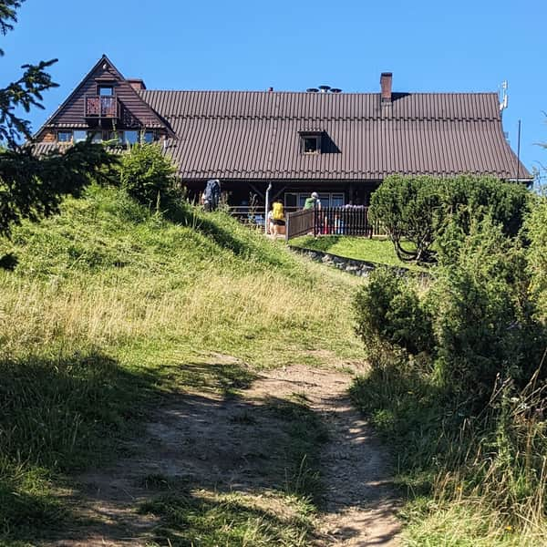
If you want to return to Jaworek without descending the steep slopes of the Homole Gorge, we recommend taking the blue trail through Borsuczyny to the shelter under Durbaszka, and then descending to Jaworek on a wide and comfortable access road. This route will take you less than 2 hours, not including the rest at the shelter.
You can also take the blue trail in the opposite direction - to Przełęcz Rozdziela and descend to Jaworek through the picturesque Biała Woda Reserve (this route will take about 2.5 hours).
PS. The trail through the Homole Gorge to Wysoka has been included in our article "Pieniny - Discover Their Most Beautiful Trails":
Pieniny Mountains - Discover Their Most Beautiful Trails!
Pieniny are mountains with rocky peaks, often called the 'Little Tatras.' However, the trails in the Pieniny Mountains are much easier, making them more suitable for family hikes. ...


Publish Date: 2022-06-02
Last Updated: 2023-08-31
More in the Region Pieniny (Pieniny)
Total Length 126 km