Loop around the Czech Table Mountains from Teplice nad Metuji
Nearby: Teplice Nad MetujiCountry: Czechy
| Distance | 14.4km |
|---|---|
| Time | 5h 6min |
| Ascents | 603m |
| Descents | 603m |
beach_access Route in the shade
wb_sunny Route in the sun
sports_tennis Attractions for children
directions_car Access by car
train Access by train possible
Czech Table Mountains is a magical rocky land located near the Polish-Czech border. Here, you will find kilometers of interesting trails and comfortable paths. One of the recommended starting points in the Czech Table Mountains is the town of Teplice nad Metuji, from where you can take a walk in the Teplice Rocks reserve.
Teplice nad Metuji - the beginning of the trail
We start the trip at the free parking lot near the post office in the town of Teplice nad Metuji. We follow the blue trail leading along residential houses and continue until we reach the intersection with the yellow trail, where we turn right.
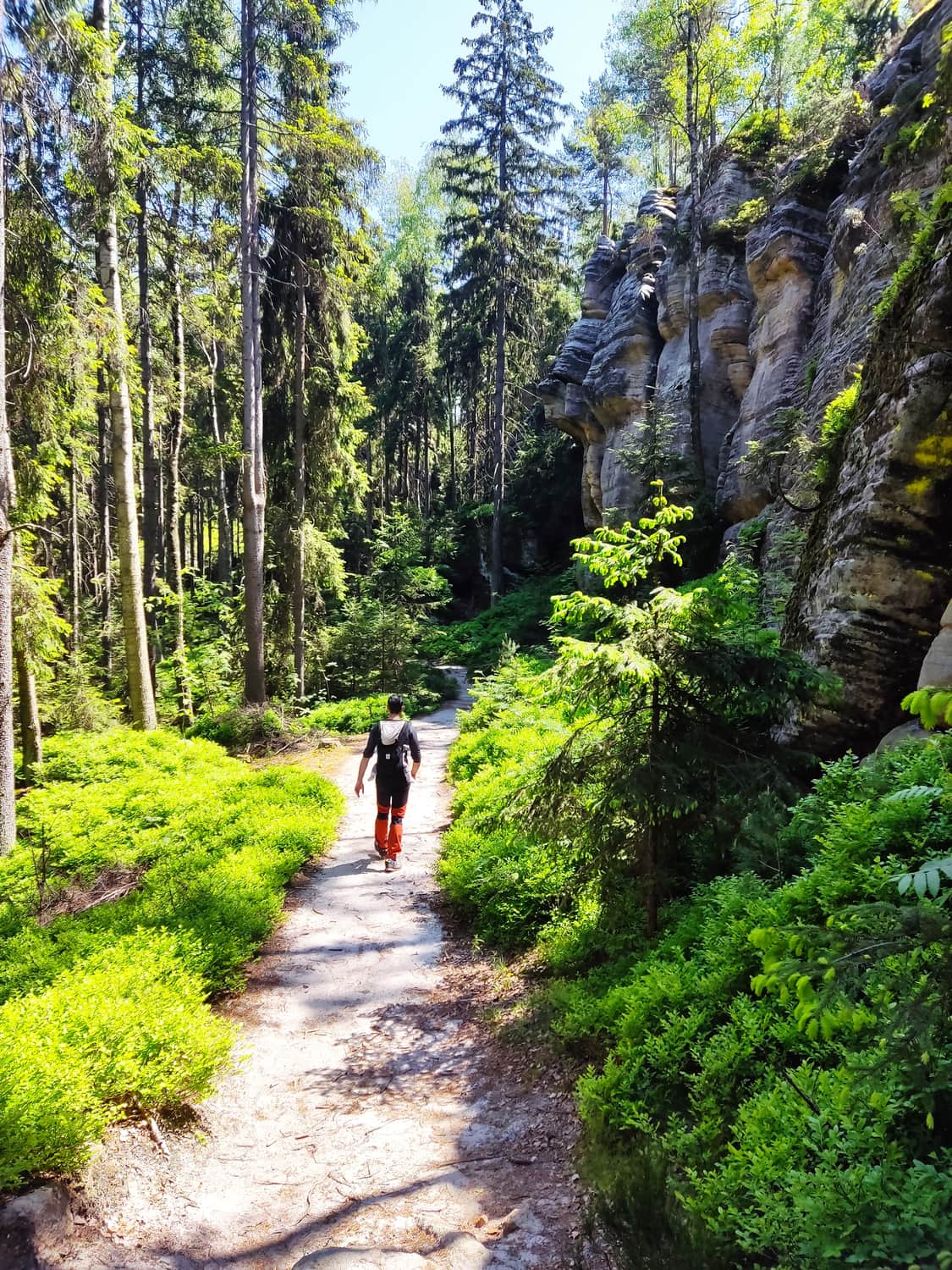
Following the yellow trail, we leave the buildings and after a short uphill climb, we reach a meadow, and then head towards the forest. The path is a typical forest road, wide and comfortable, gently ascending.
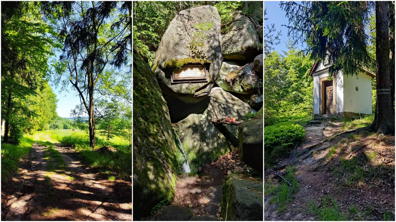
After a few minutes' walk through the forest, we reach the first attraction, which is the St. Hubert's spring. It is easy to miss, so we need to be vigilant. When we see a sign on a tree indicating the spring, we should turn right onto a narrow forest path after about 50 meters. Then, we will see a small rock formation from which water springs. We drank the water and had no gastric problems. Moreover, two cups are left by the locals at the spring.
After quenching our thirst, we return to the trail and continue our hike. Along the way, we pass a tiny chapel dedicated to Mary. The chapel is open, and you can take a look inside.
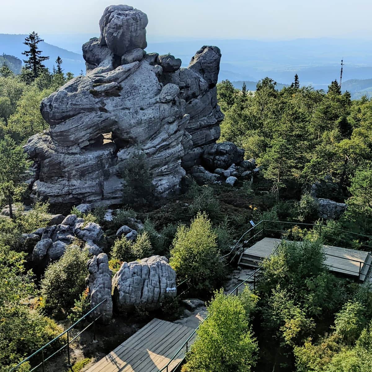
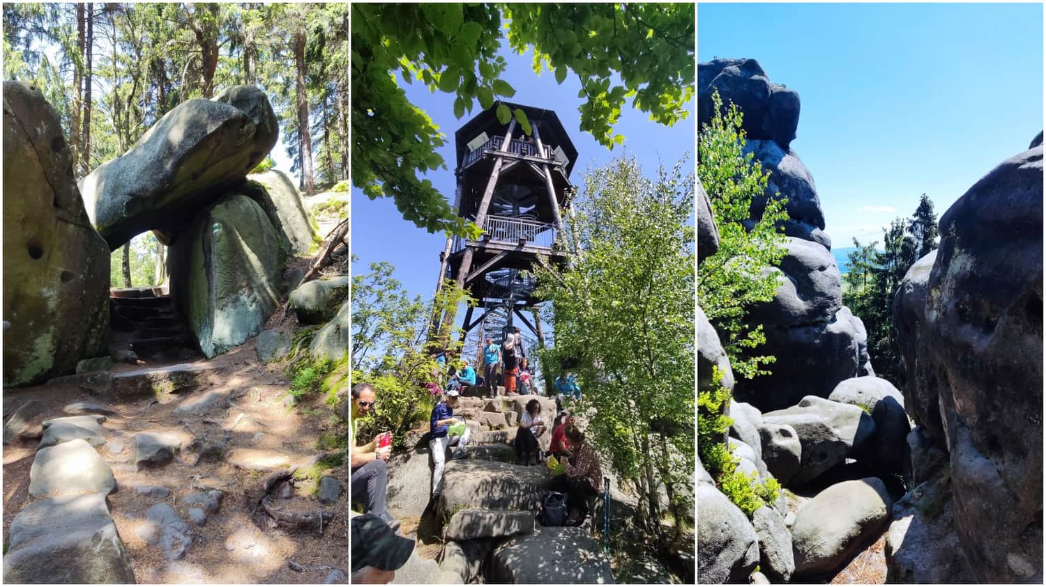
Zámek Skály (Bischofstein)
We continue along the yellow trail until we reach the next attraction, which is Zámek Skály.
These are publicly accessible ruins of a castle, also known as Bischofstein. The castle walls intertwine with natural rock formations, which contain carved rooms and stairs.
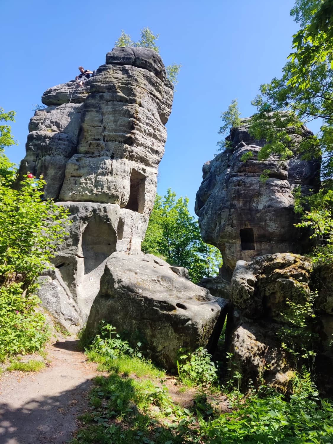
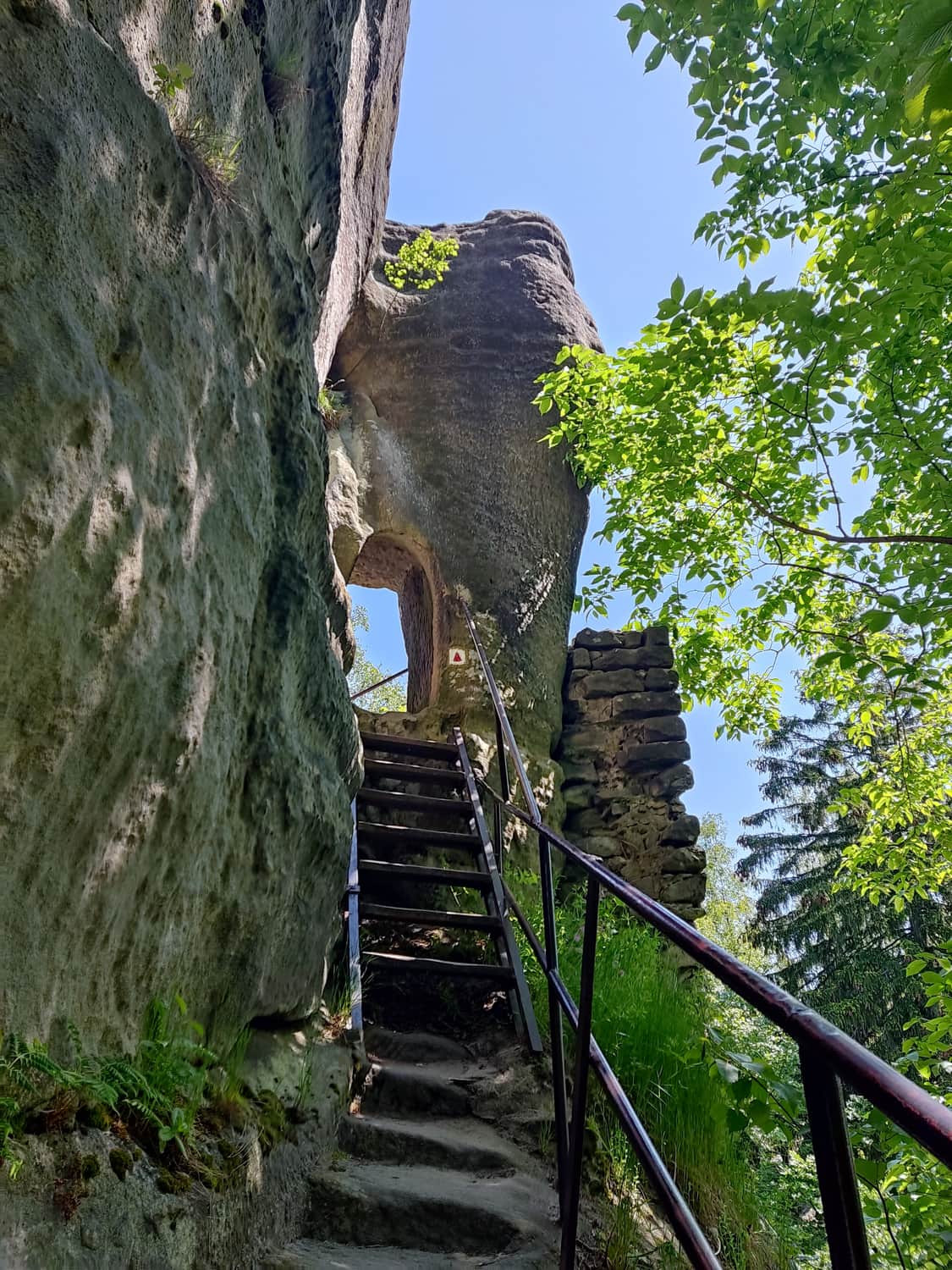
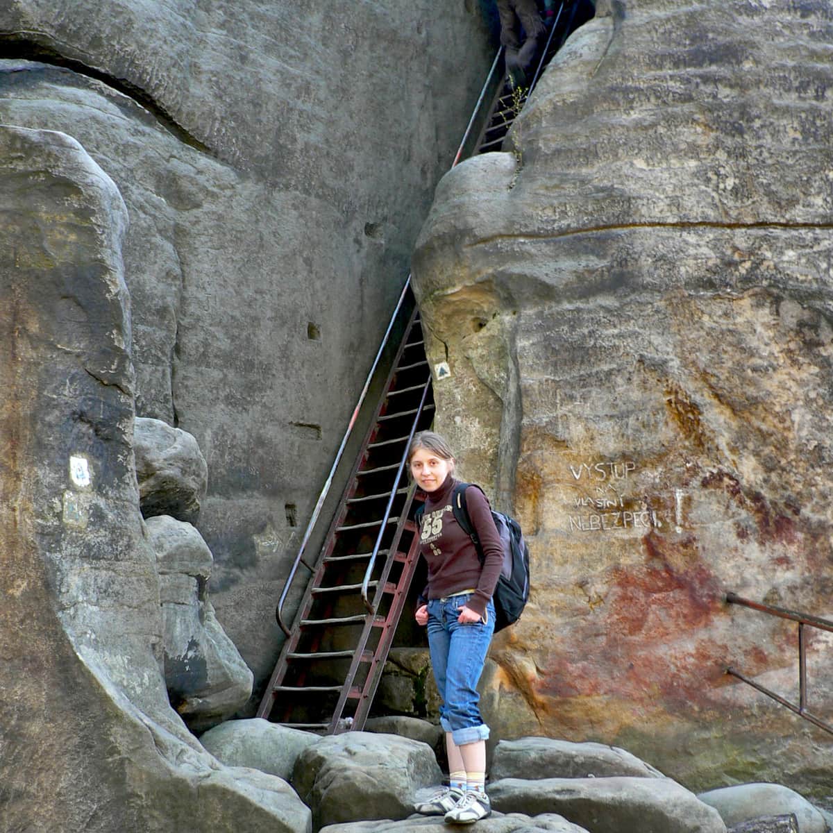
We climb one of the stone towers, where a viewpoint is located. From there, we can see, among other things, the panorama of the Polish Table Mountains.
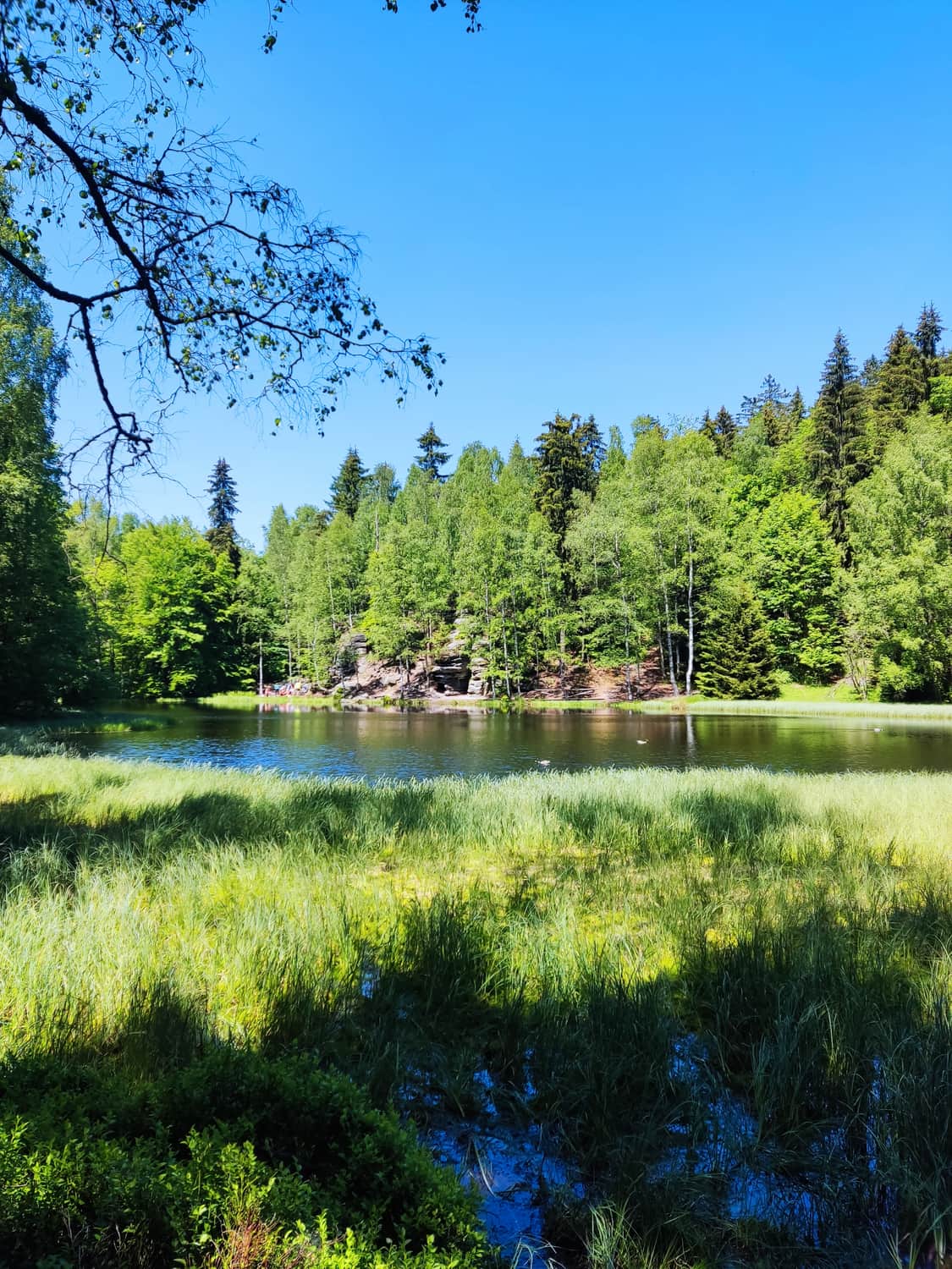
Czarne Jeziorko
Descending from the castle, it is worth taking a walk along the picturesque Black Pond, where a few benches are placed, perfect for a short break.
Čáp (Stork) Peak - observation tower
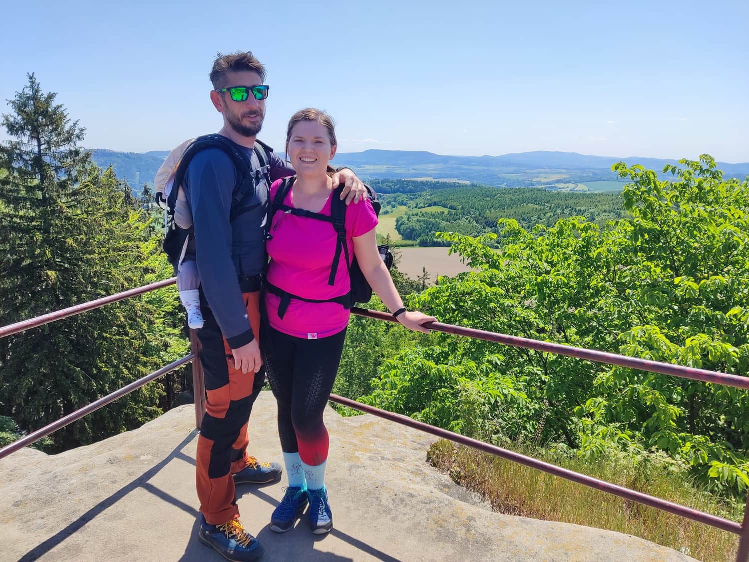
After a short rest, we continue towards the next attraction. This time, it is an observation tower on the top of Čáp. To reach it, we need to follow the green trail for about half an hour. However, it is worth stopping by one of the many self-service shops in the Czech Republic. Near the Pasieruv Statek guesthouse, there is a small fridge with drinks and snacks, as well as a box for money. After drinking a cold Czech cola (for 15Kc) and returning the bottle, we continue on the trail. The path to the summit is short and leads up stone steps. After a short climb, we reach the top, which is often crowded. On the summit, there is a small observation tower and interesting rock formations.
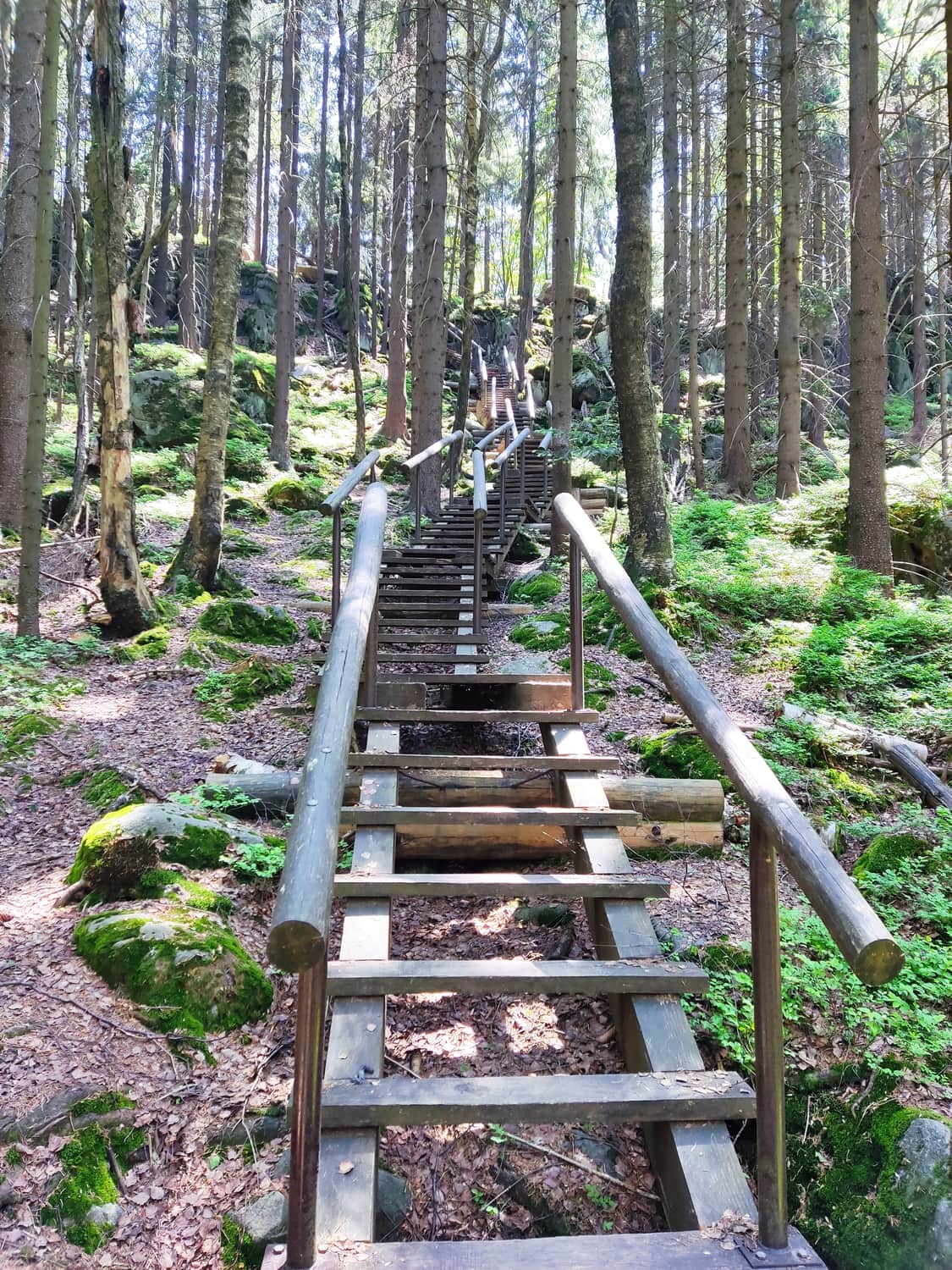
Descent from the summit and forest road along the Teplice Valley
The descent from the summit consists of a long series of wooden stairs.
The part of the trail that goes along the Teplice Valley is a peaceful road through the forest, about 1.5 km long.
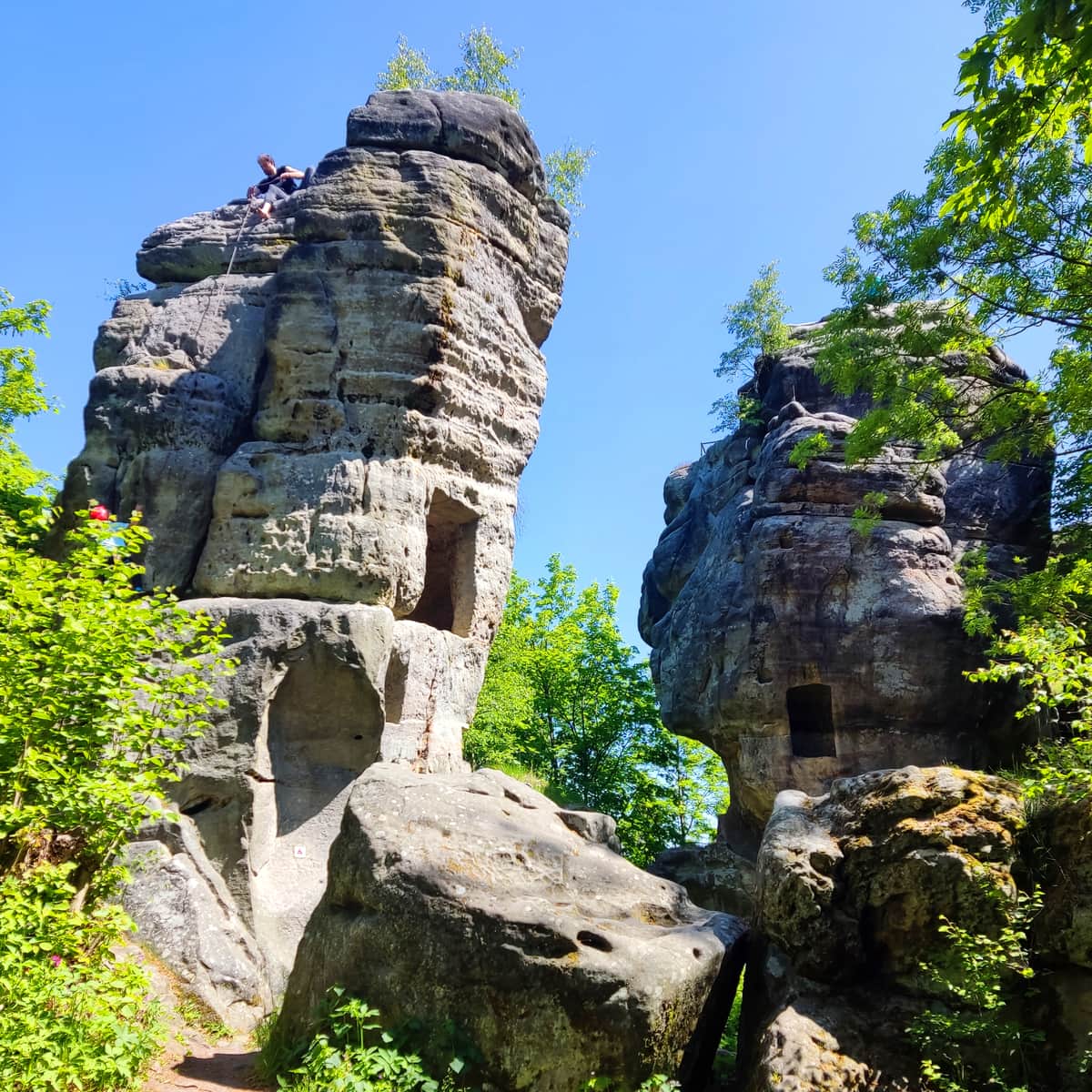
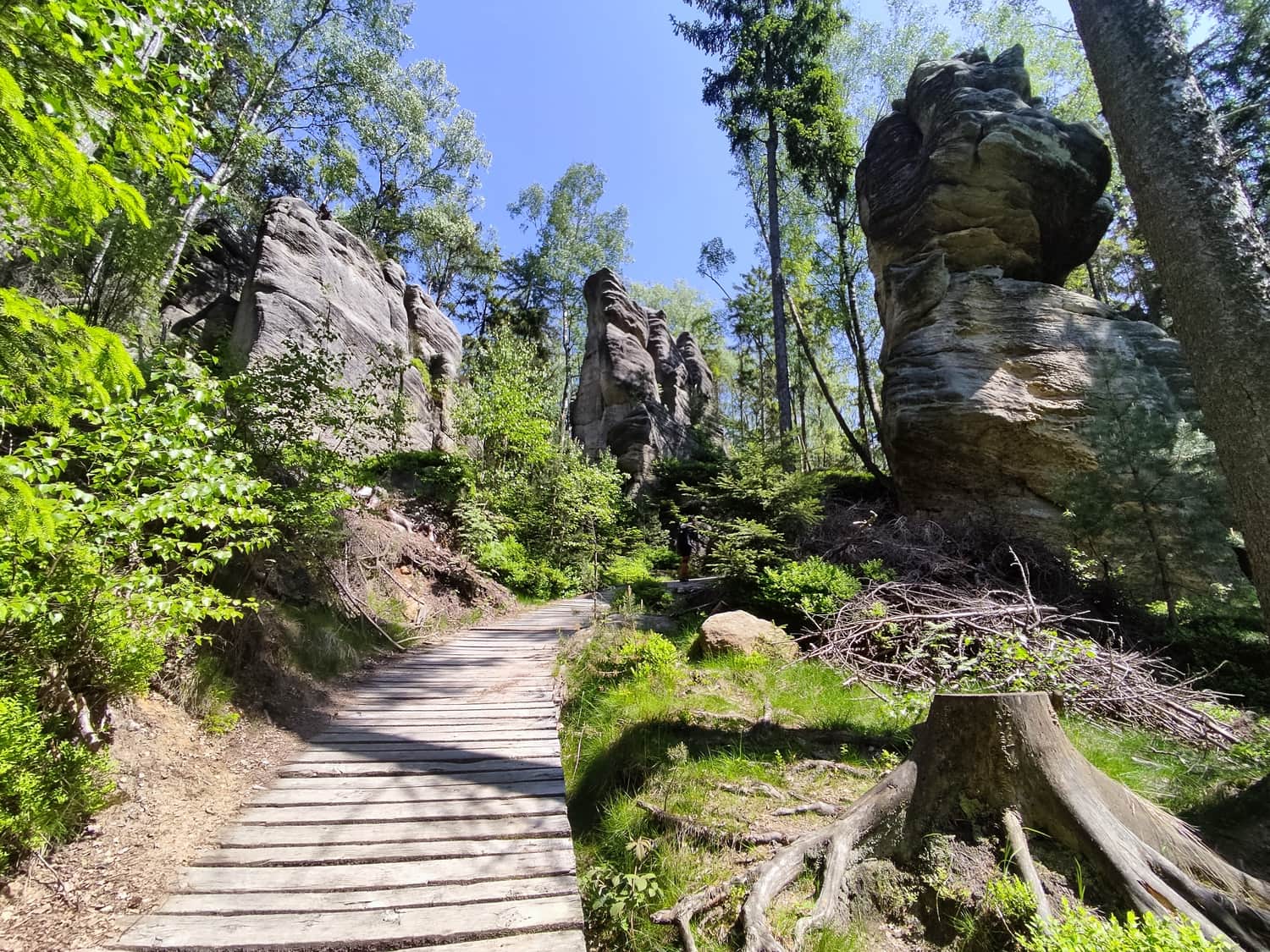
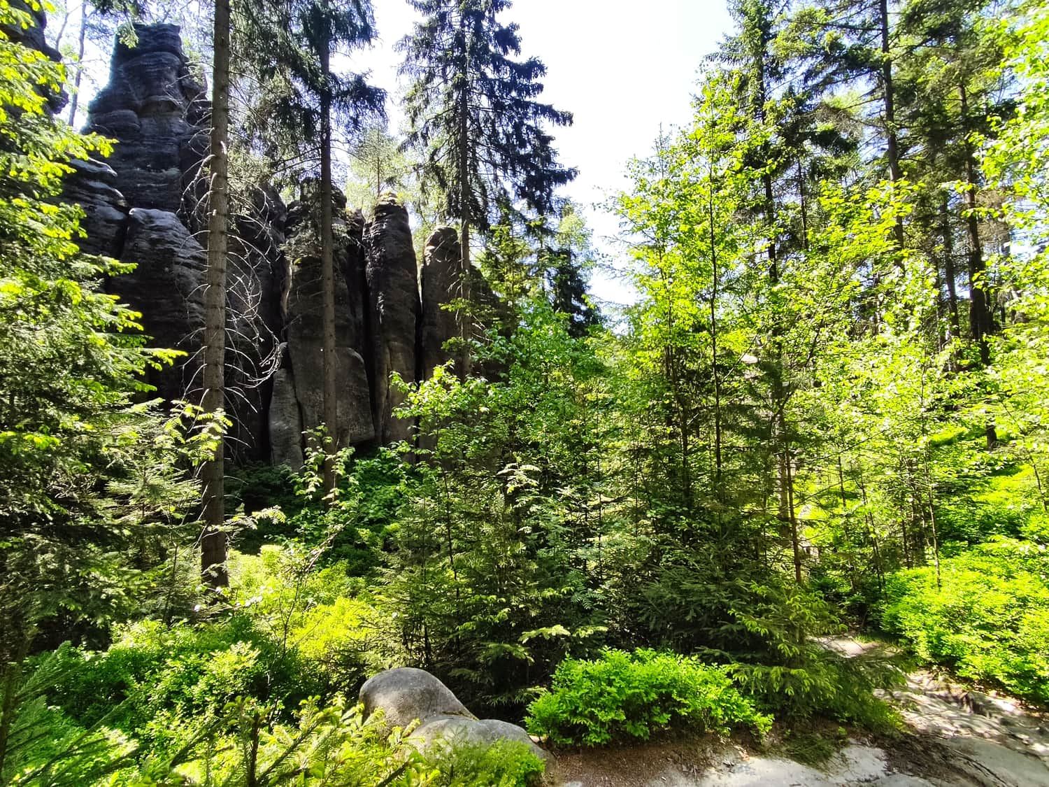
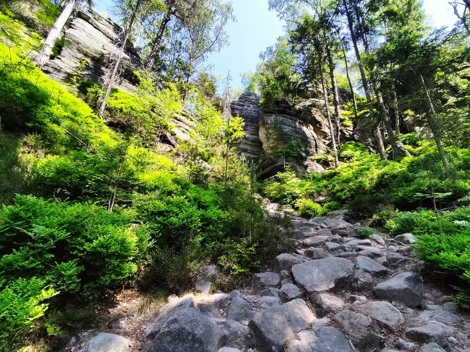
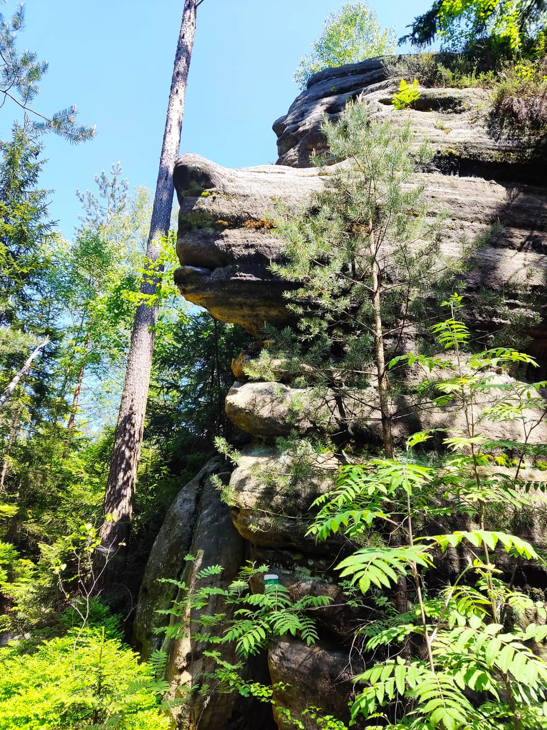
Upon reaching the intersection with the yellow trail, the most beautiful section of the entire trail begins. We continue our hike on the green trail, but we notice a distinct change in the surroundings. More and more interesting rock formations emerge from behind the trees.
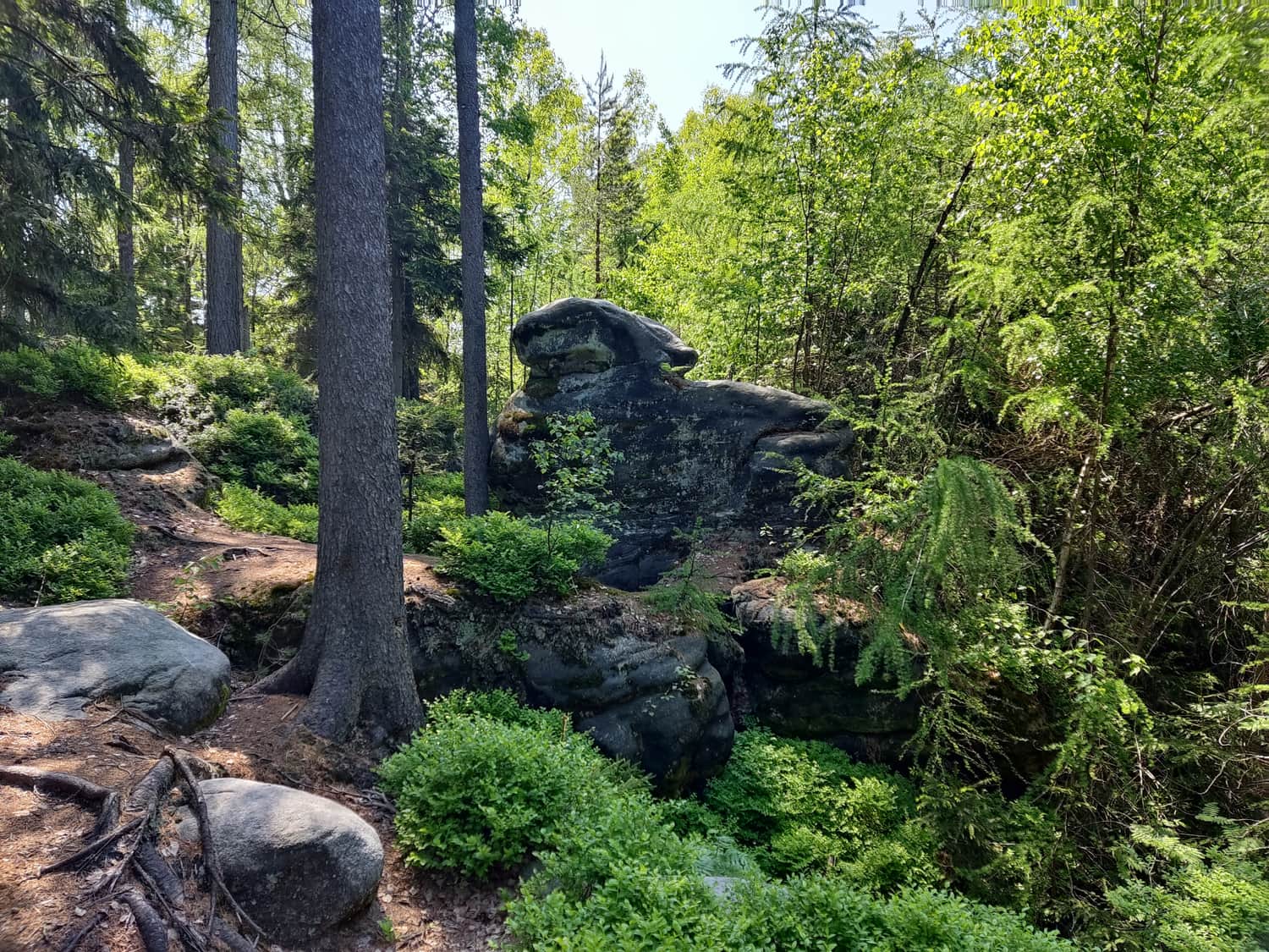
Along the way, we pass by the last viewpoint today, which is named after the Three Musketeers. We also see various rock mushrooms, a stone rabbit, rocky gorges, a stone dog, and many other incredible formations, whose interpretation depends only on our imagination!
Lokomotiva (Locomotive) Peak
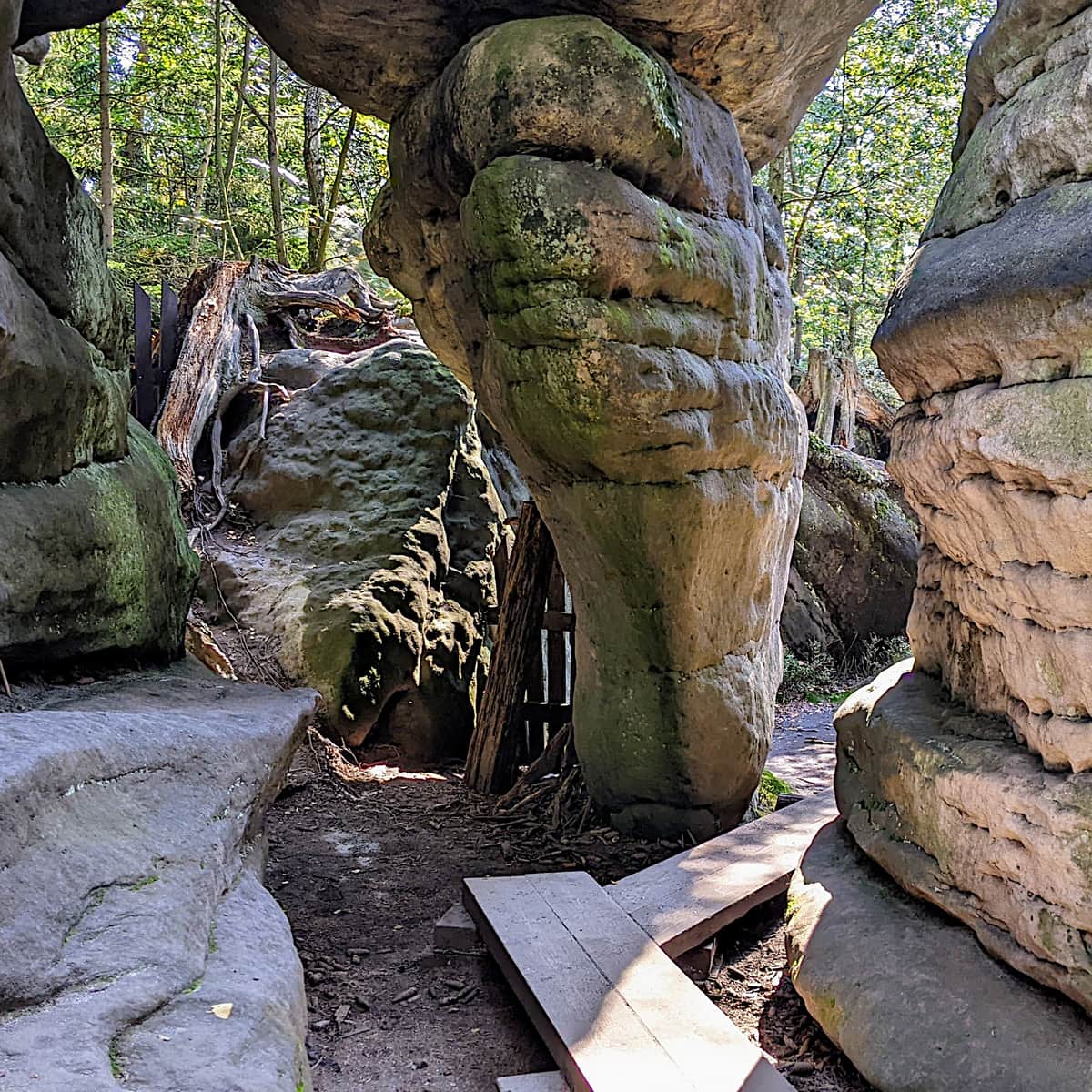
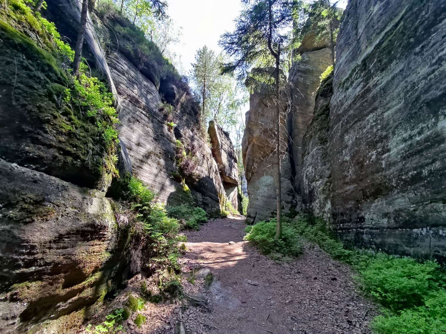
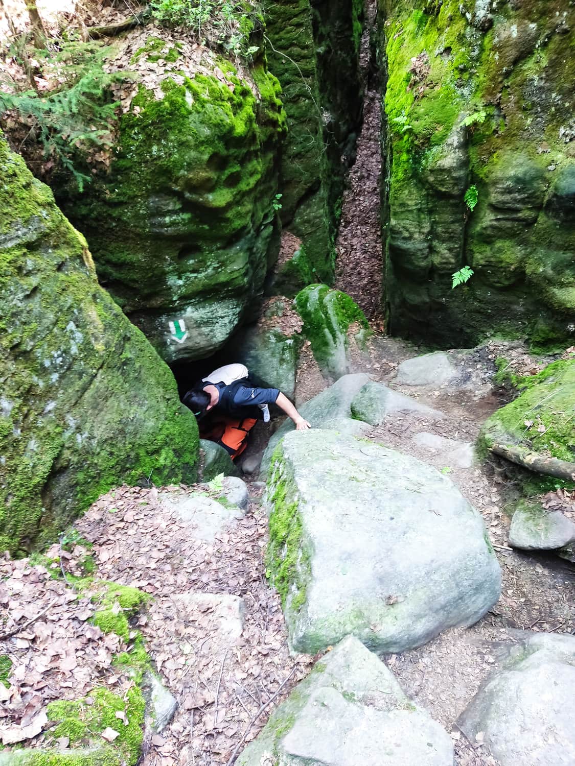
Before reaching Lokomotiva Peak, the trail leads us through several narrow passages.
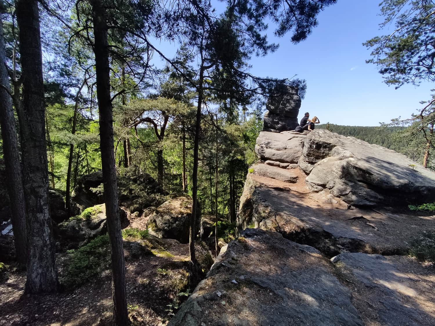
Finally, we reach the last viewpoint, where we can once again admire the neighboring rock cities from above. We only have to descend further on the green trail back to the parking lot where we left our car.
Summary
Completing this 15 km trail took us about 5.5 hours, including a break for a meal and numerous photo stops. All attractions along the trail are free, and the trail is not as popular as the nearby rock cities.
I can wholeheartedly recommend this trail for a family trip full of experiences, where no one will get bored!
PS. Here is another, shorter and easier trail in Teplice towards the "Adršpasske skaly" reserve.
Medium
Rock City in the Czech Republic - Teplice Rocks

Publish Date: