From Zawoja to Mosorny Groń
Town: Zawoja Nearby: Sucha Beskidzka| Distance | 4.1km |
|---|---|
| Time | 2h 14min |
| Ascents | 486m |
| Descents | 27m |
Elevation Profile:
beach_access Route in the shade
restaurant Restaurant or bar nearby
directions_car Access by car
directions_bus Can be reached by bus
wc Toilet along the route
The blue trail from Zawoja Mosorne will take us to a beautiful waterfall on Mosorny Potok and further to the summit of Mosorny Groń (1047 meters above sea level) with an upper station of a year-round cable car, a restaurant, and an observation tower.
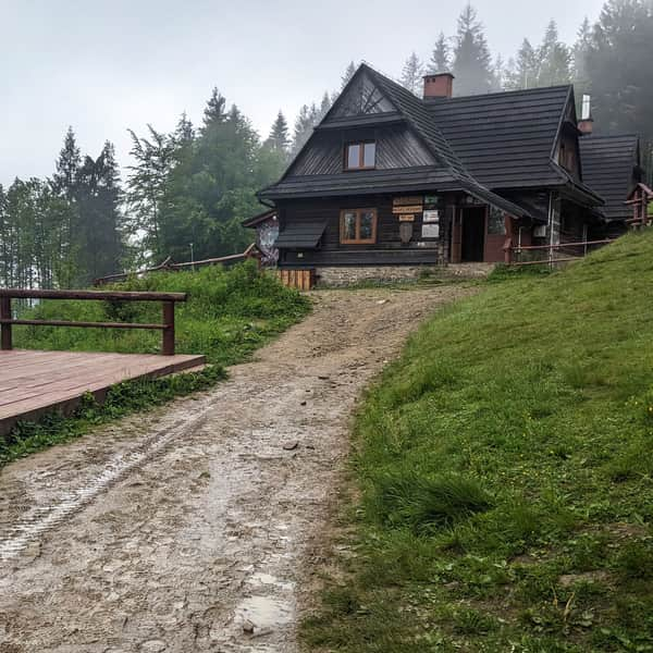
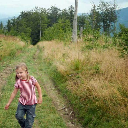
The Beginning of the Blue Trail to Mosorny Groń
Right at the entrance of the blue trail from the asphalt road into the forest, there is a parking area for a few cars. The path along the stream climbs up, then slightly descends, and after about 20 minutes, it reaches the descent to the waterfall.
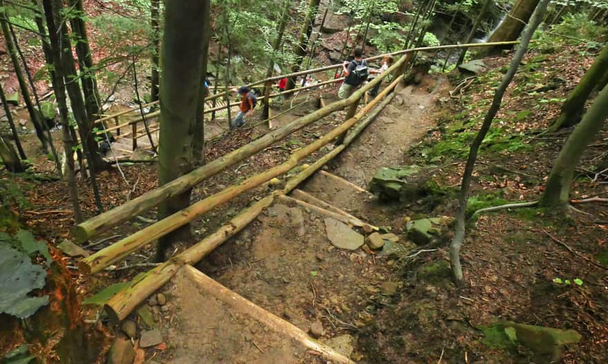
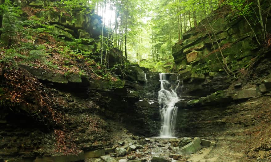
Waterfall on Mosorny Potok
The short, steep path with a wooden railing may be challenging for little legs - some steps are very high. However, it is definitely worth overcoming it - the waterfall is stunning!
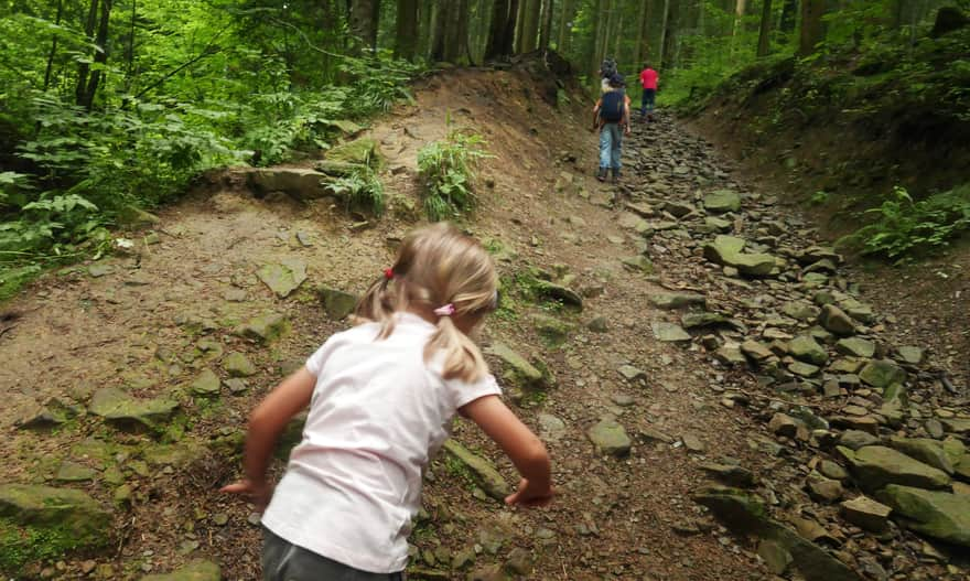
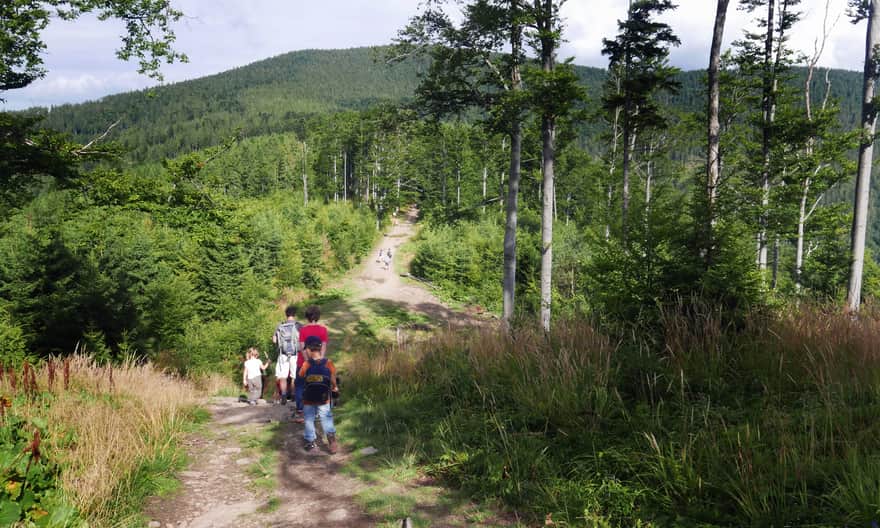
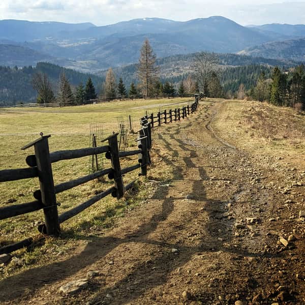
Ascending to the Summit of Mosorny Groń
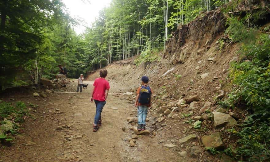
The blue trail continues through the forest uphill. Some sections are quite steep and tiring. A short flat section provides a moment of rest, but soon another ascent awaits - narrower, more rocky, and sunnier... but if we turn around, we will see beautiful views!
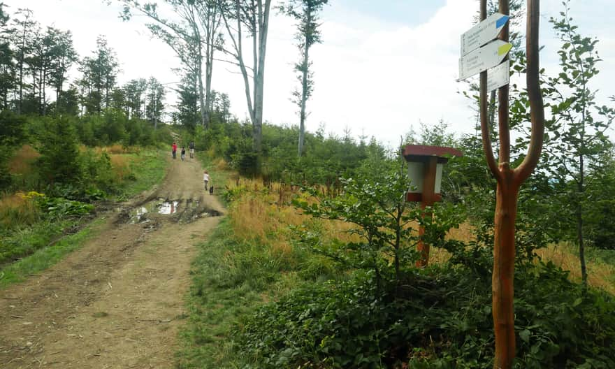
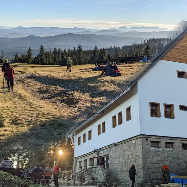
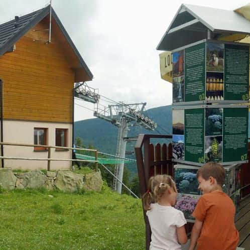
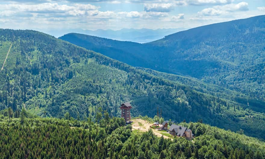
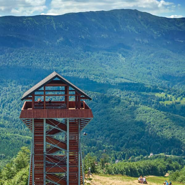
Mosorny Groń - Attractions at the Summit
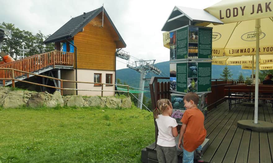
From the pass, it's only a 5-minute walk to Mosorny Groń, where you'll find the upper station of a cable car and a restaurant (serving lunch, sweets, ice cream, and drinks). And above all - a beautiful view of Babia Góra! From the observation tower, you can even see the Tatra Mountains.
An additional attraction is the riddles placed on the benches of the cable car (e.g., what is mosor?). The answers can be found on the boards on the restaurant terrace.
More about Mosorny Groń:
Mosorny Groń - observation tower, trails, attractions
Mosorny Groń (1047 meters above sea level) is a peak in the Polic Range, at the foot of Babia Góra. The new observation tower offers beautiful panoramas of the surrounding ranges: Babia Góra, Polic Range, Jałowiec Range. On a clear day, you can even see the Tatra Mountains! ...
Return from Mosorny Groń
You can return the same way or take the cable car down to Zawoja - Policzne. If you consider going up or down Mosorny Groń using the yellow trail, please be aware that it intersects with numerous cycling routes (3 MTB trails), which can sometimes be dangerous for pedestrians. From our observations, cyclists - acrobats constituted the majority of cable car passengers: they rode up to Mosorny Groń and then sped down towards the yellow trail...
You can also continue along the ridge trail towards Cyla Hala Śmietanowa (1 hour, 2 km one way), Policy (about 2 hours, 4.5 km one way), or even the shelter at Hala Krupowa (2.5 hours, almost 7 km one way).
PS. This route has been included in our article "Around Babia Góra. Trails around Zawoja". Would you like to learn about the others?
Around Babia Góra. Trails in the vicinity of Zawoja
Where to go for a mountain hike from Zawoja? Not just to Babia Góra! The surrounding mountain ridges offer kilometers of beautiful scenic trails accessible to everyone! ...


Publish Date: 2019-08-16
Last Updated: 2023-06-24
More in the Region Beskid Żywiecki (Żywiec Beskids)
Total Length 213 km