Bukowe Berdo - trail from Muczne
Nearby: Ustrzyki Dolne| Distance | 5.6km |
|---|---|
| Time | 2h 56min |
| Ascents | 617m |
| Descents | 40m |
beach_access Route in the shade
directions_car Access by car
warning No dogs allowed
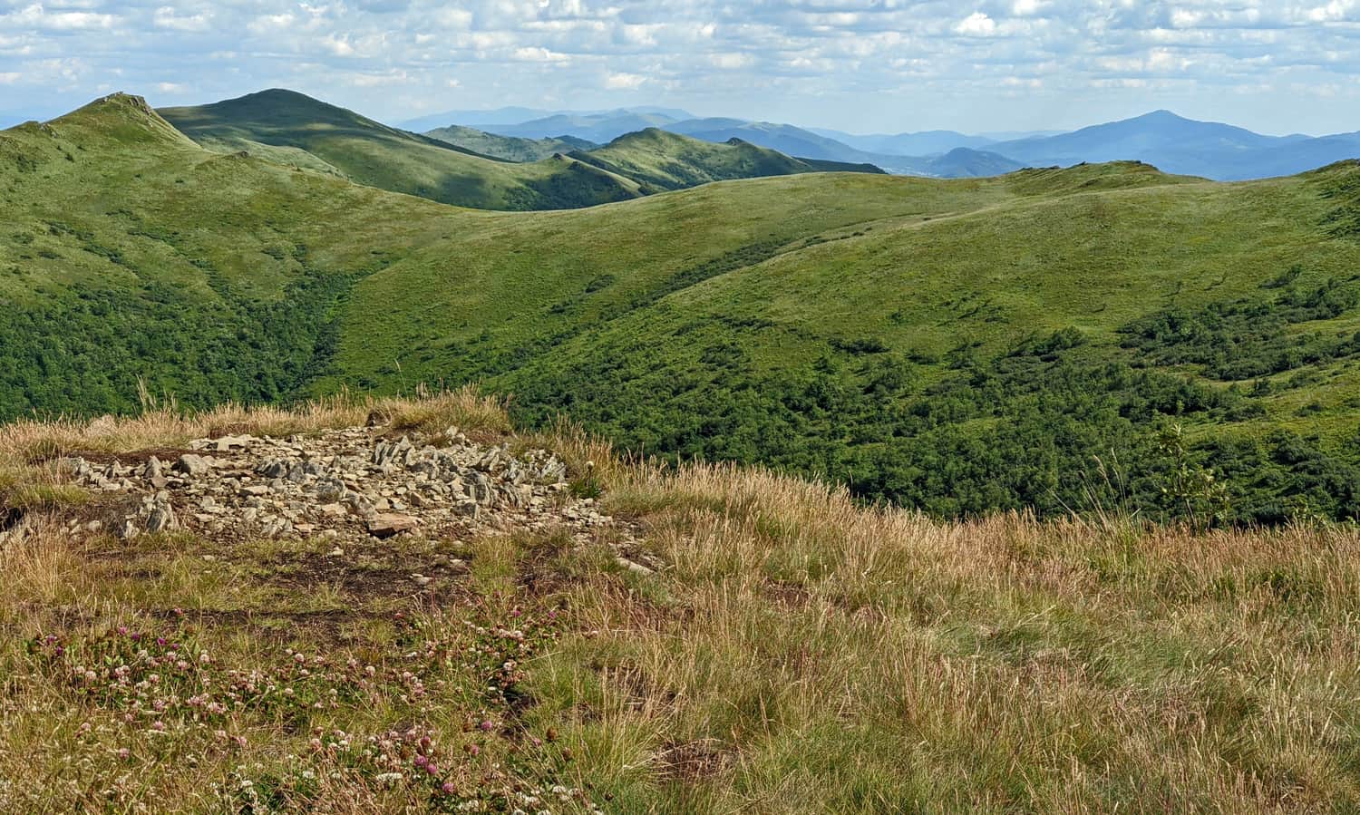
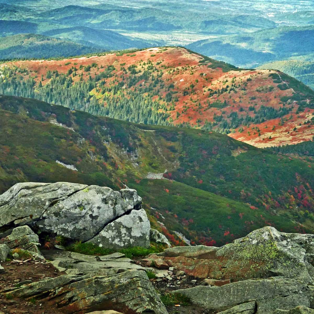
Bukowe Berdo is a beautiful and scenic mountain massif in the Bieszczady Mountains, with three peaks: 1201 meters above sea level, 1238 meters above sea level, and 1313 meters above sea level. It is much wilder and less crowded compared to the surrounding ridges. The panoramic views from the Bukowe Berdo ridge stretch from the San Valley, through the Halicz, Krzemień, Tarnica, Mała and Wielka Rawka, to the Caryńska and Wetlińska mountain meadows.
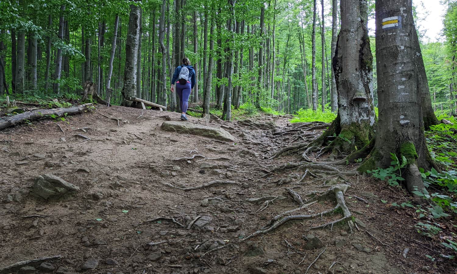
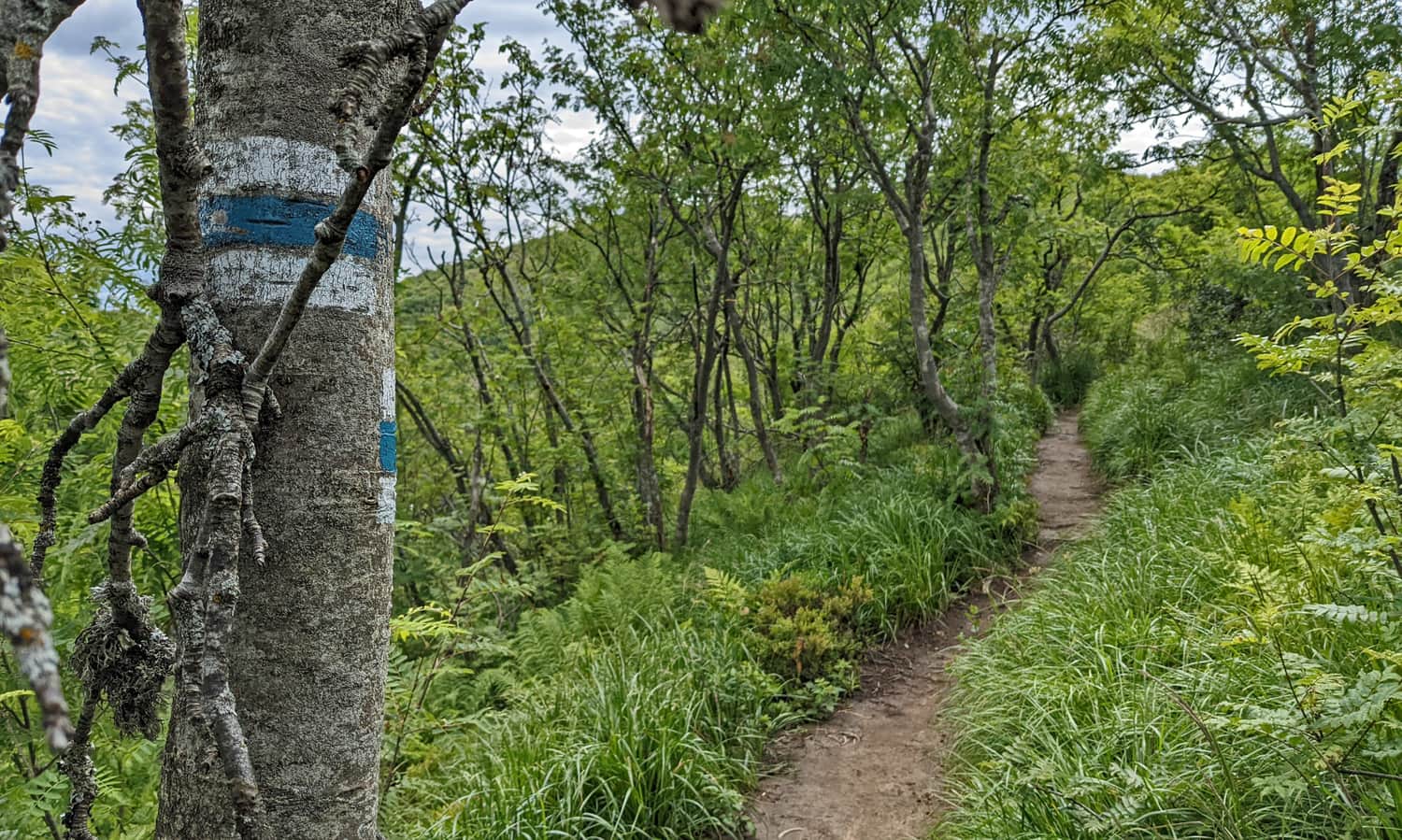
Yellow trail from Muczne to Bukowe Berdo
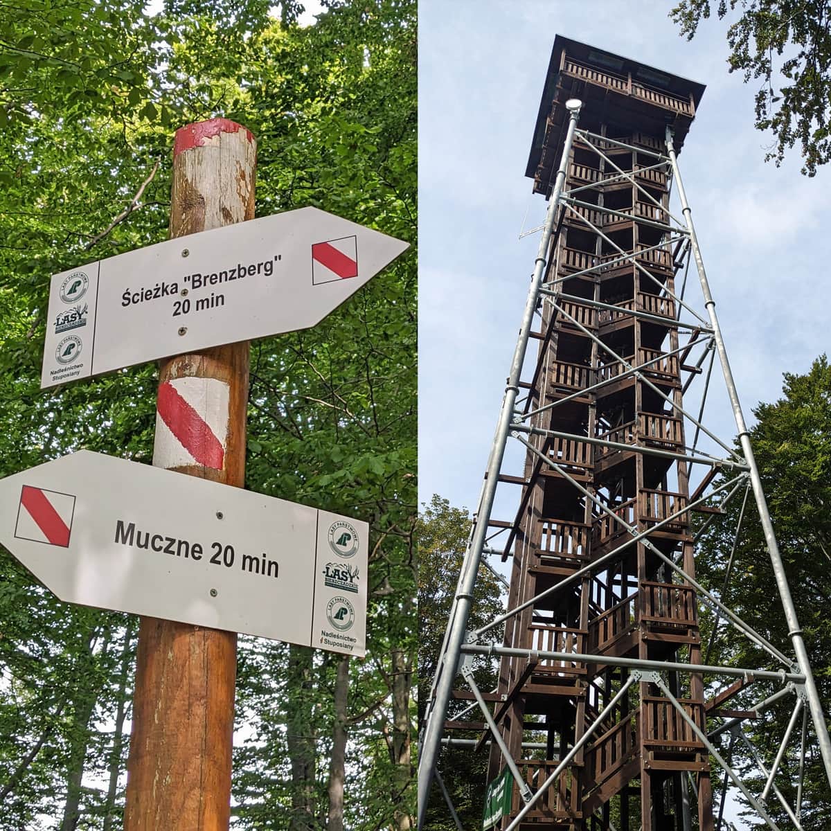
The shortest trail to Bukowe Berdo starts from Muczne. You can leave your car on the street or in a large free parking lot before entering the village.
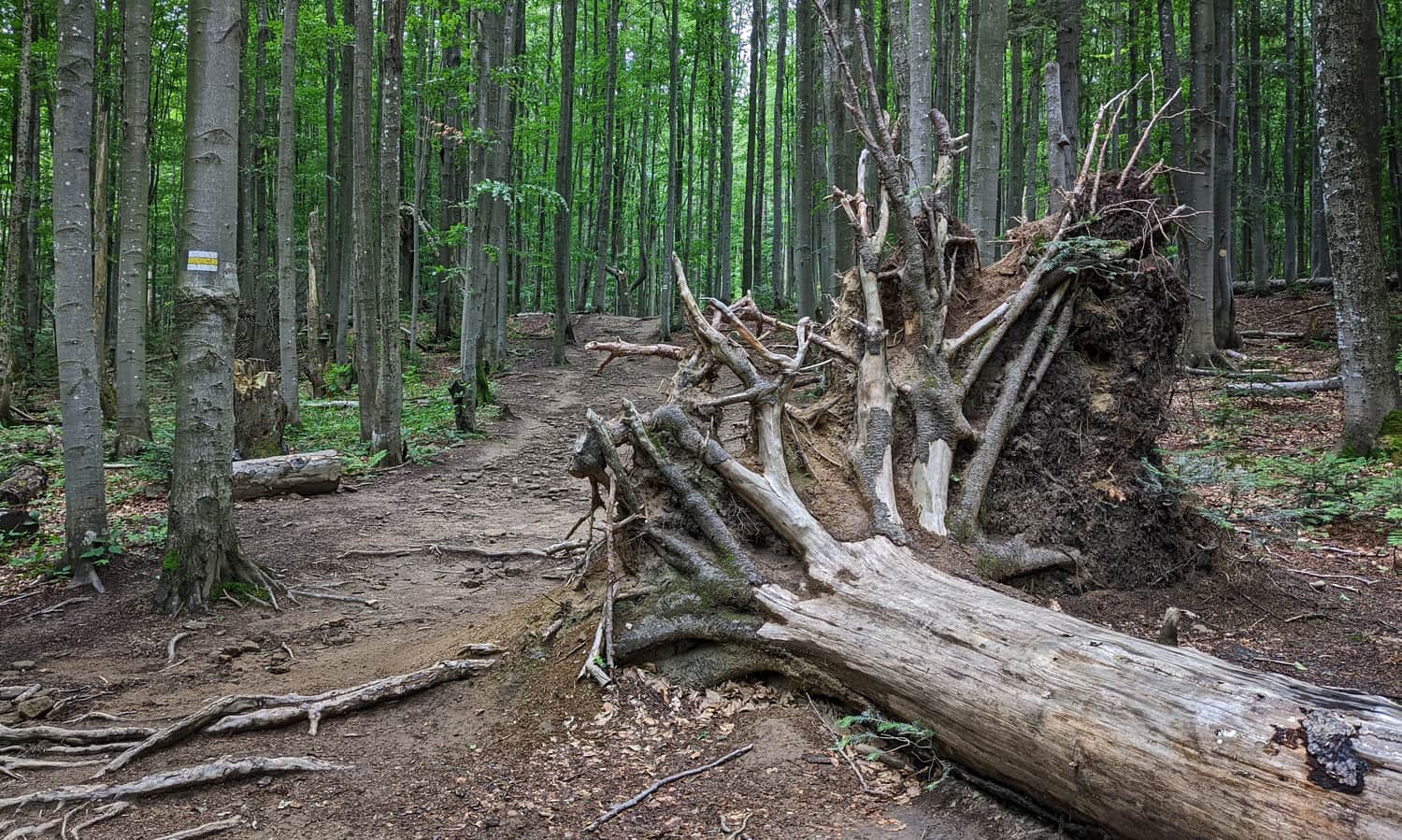
From the asphalt road, we soon enter a meadow (marked with souvenirs and tickets from BPN), and from there into the forest. The initial straight forest road will soon start to ascend (quite steep in some places). We have to overcome an elevation gain of 440 meters.
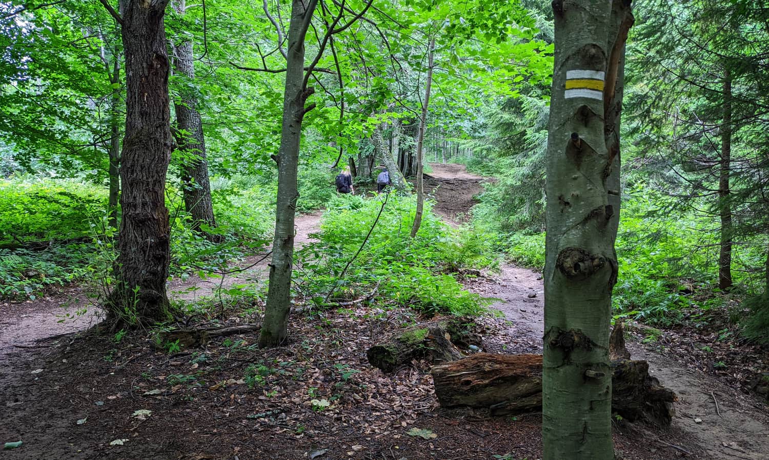
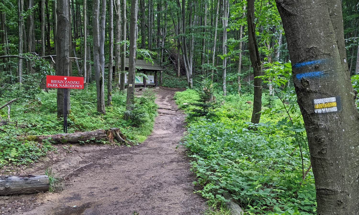
Halfway through, we reach the border of the Bieszczady National Park (information boards, benches). We continue climbing through the "wild" and incredibly picturesque beech forest.
From the forest, we will soon emerge onto a scenic meadow. From above, we will see Muczne and our destination: the Bukowe Berdo ridge.
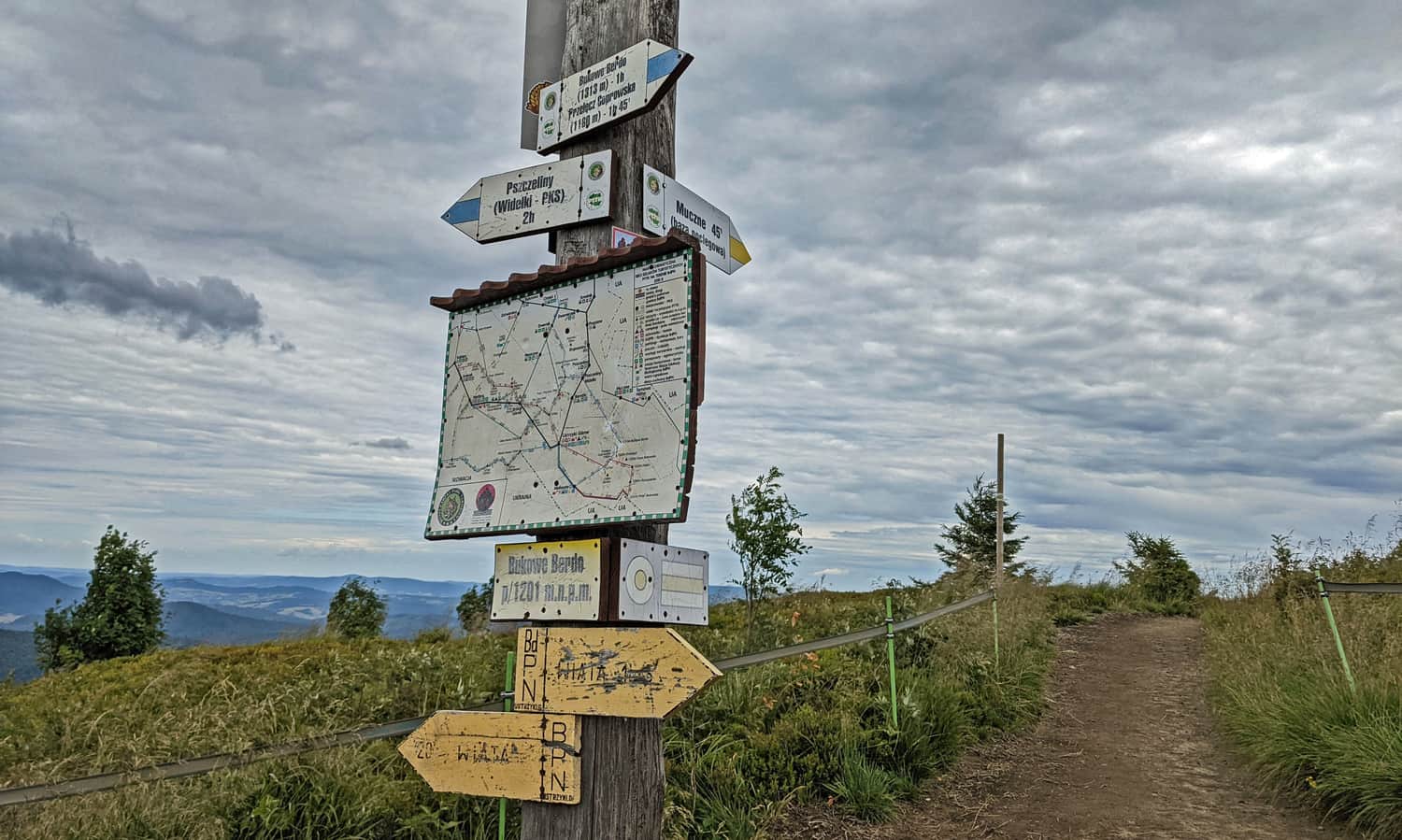
The yellow trail ends on the Bukowe Berdo ridge at an altitude of 1160 meters above sea level (according to the map, but on the sign: 1201 meters above sea level).
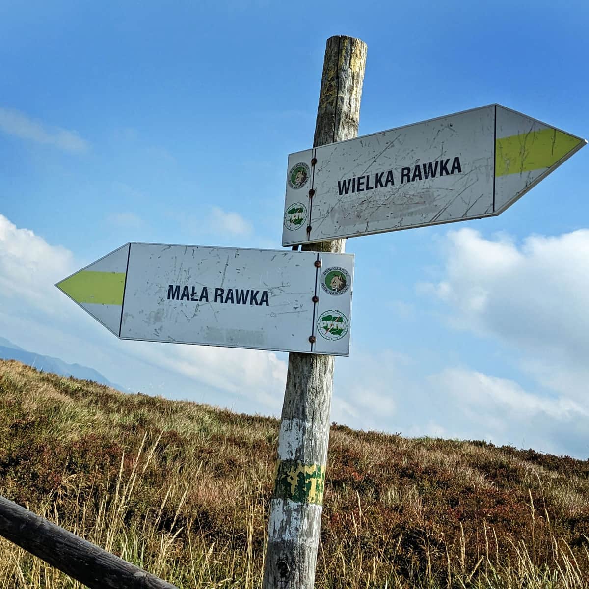
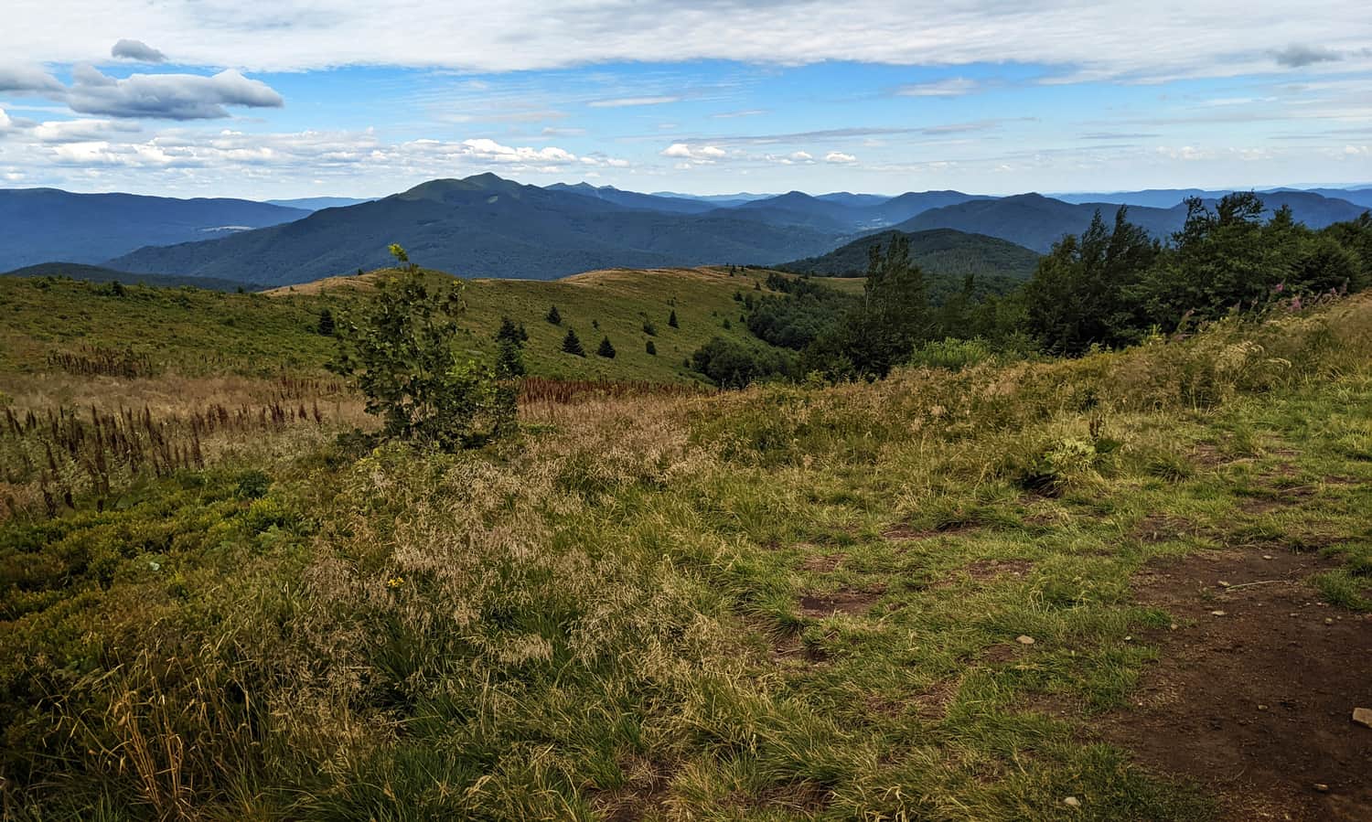
Our first scenic panorama includes the ridges of Wielka and Mała Rawka, Caryńska Mountain Meadow, and the hidden Wetlińska Mountain Meadow behind it.
But that's not all! This is just the beginning of the beautiful, wild Bukowe Berdo ridge. Make sure to continue further on the blue trail to the left!
Bukowe Berdo - blue trail, ridge walk
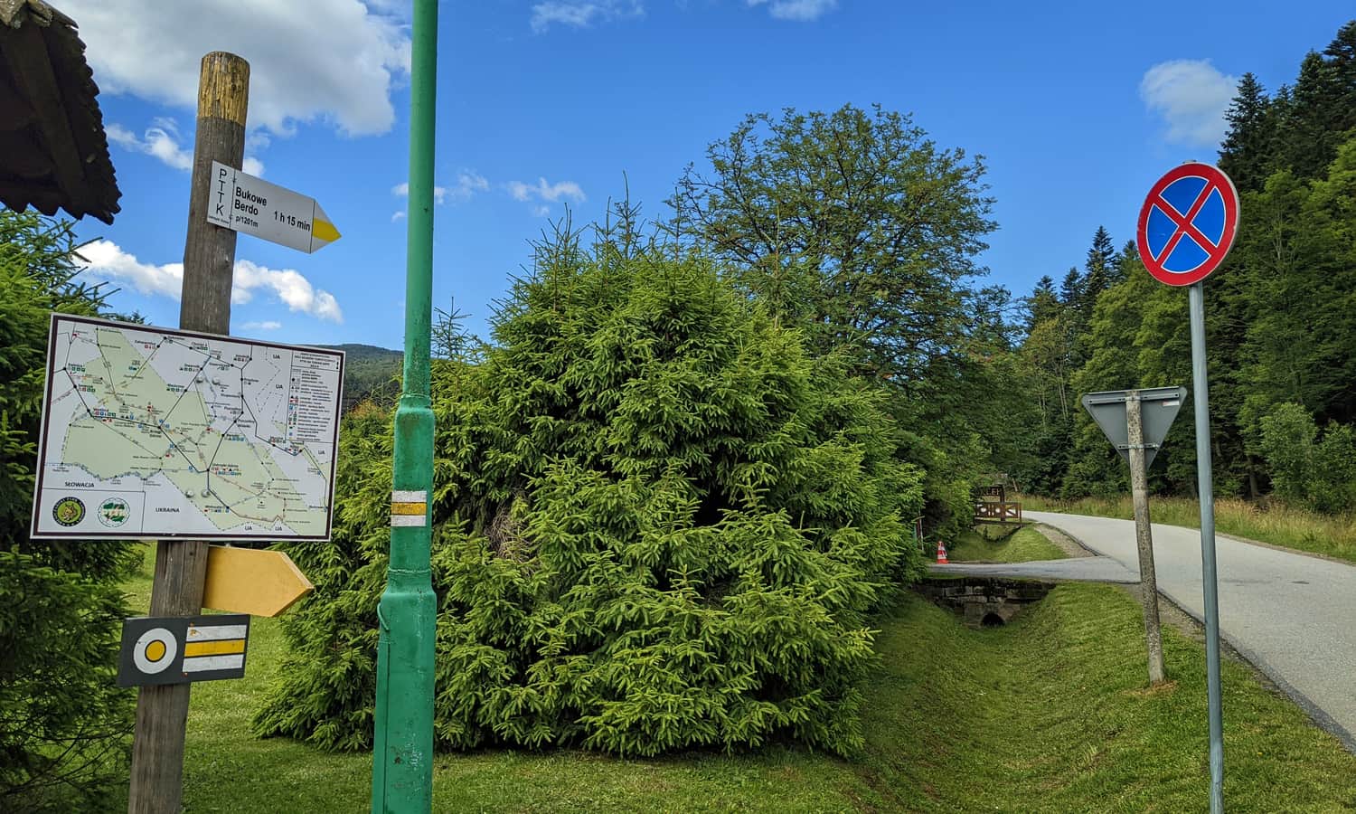
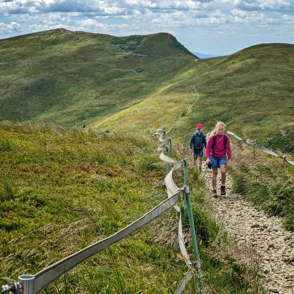
The blue trail (which comes from Widełki/Pszczeliny) leads us successively through the three peaks of Bukowe Berdo: 1201 meters above sea level, 1238 meters above sea level, and finally the highest peak at 1313 meters above sea level. From the end of the yellow trail in Muczne, we have a wonderful, scenic walk (about 2.5 km, 1 hour one way) ahead of us.
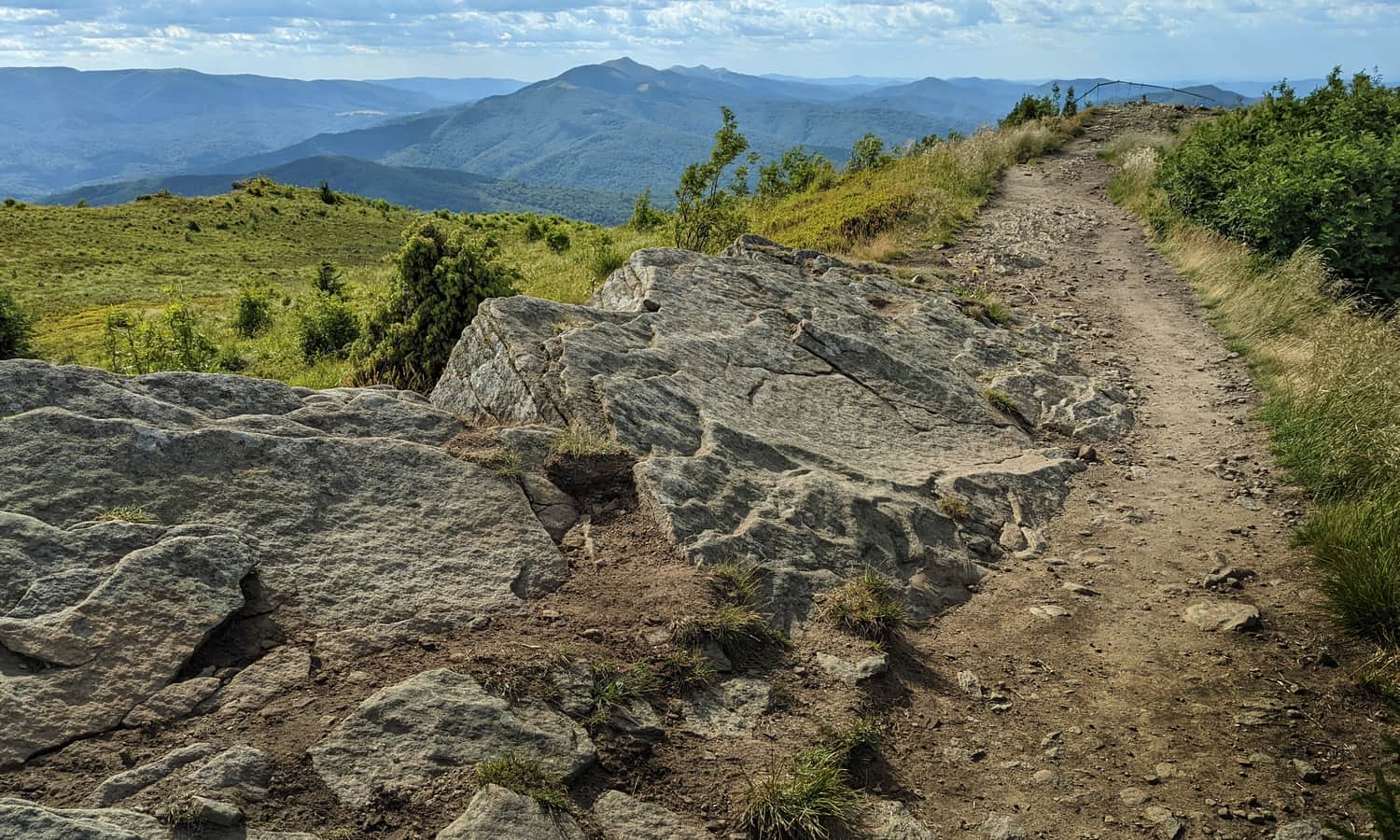
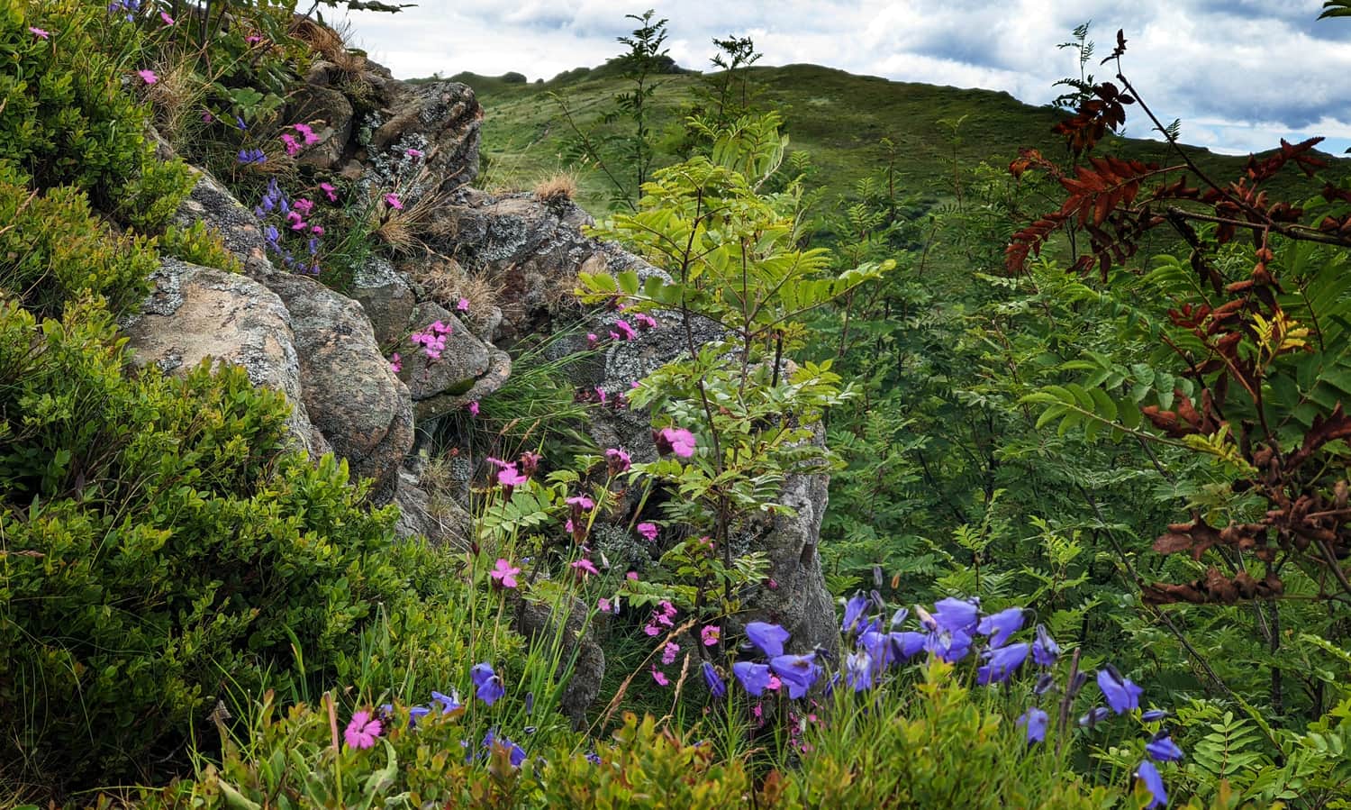
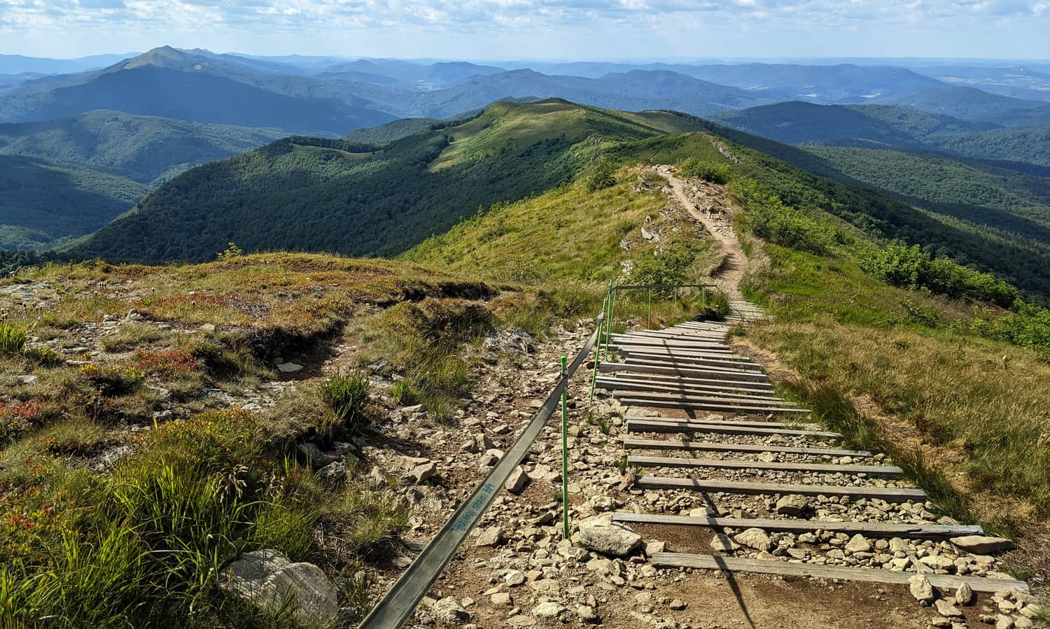
We will walk on comfortable paths, but also climb over rocks. Sometimes downhill, more often uphill. The views will change, the mountain peaks will hide and reveal themselves.
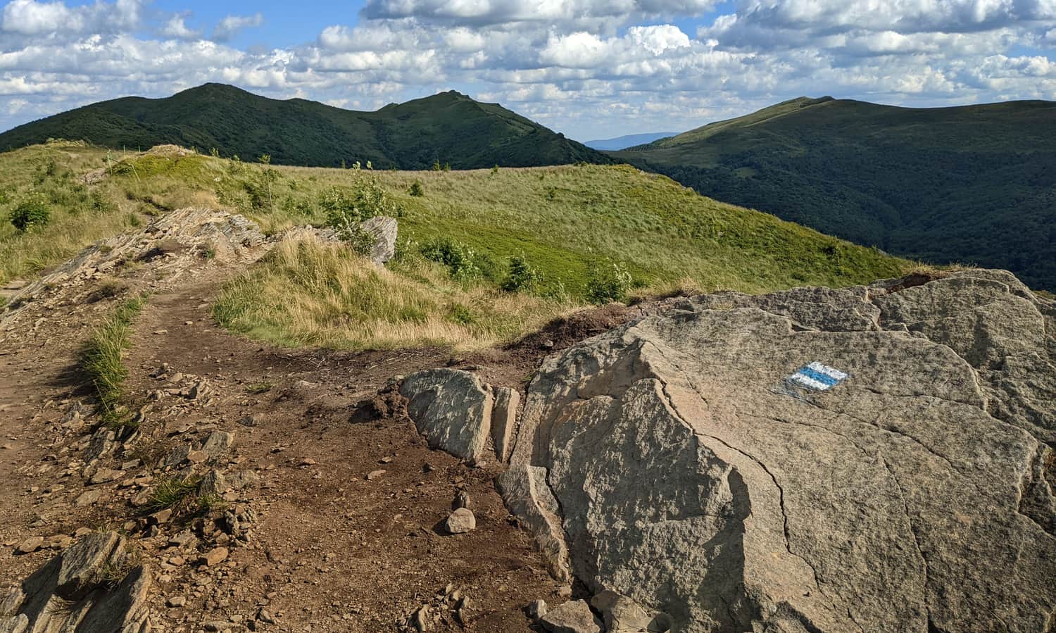
For example, we will only see Tarnica along the way, as Krzemień will cover it at the very top.
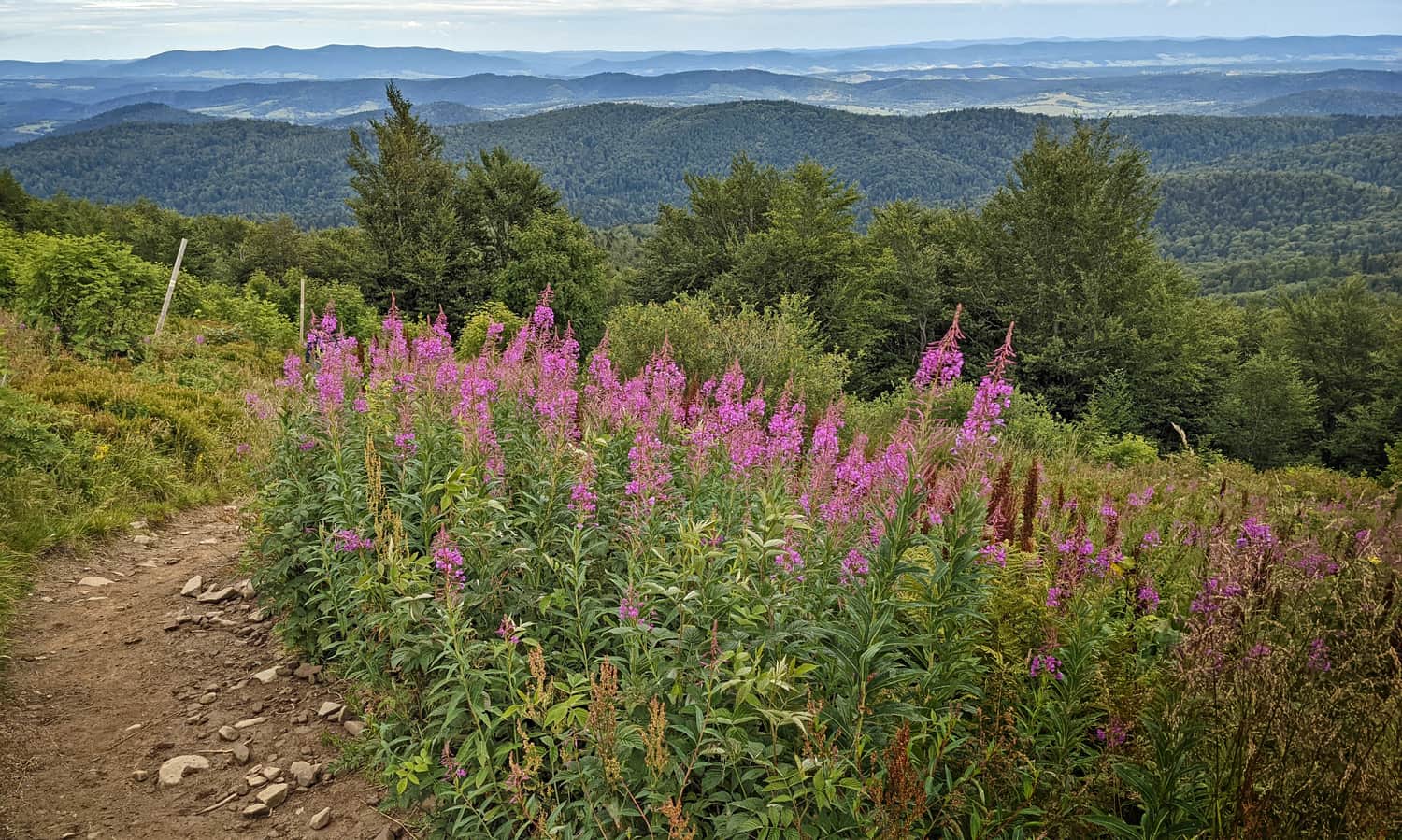
The trail along the Bukowe Berdo ridge mainly passes through open terrain (remember to protect your head on sunny days!), but along the way, we will also encounter a small grove:
No, not beech, but rowan! It must be incredibly beautiful here in autumn!
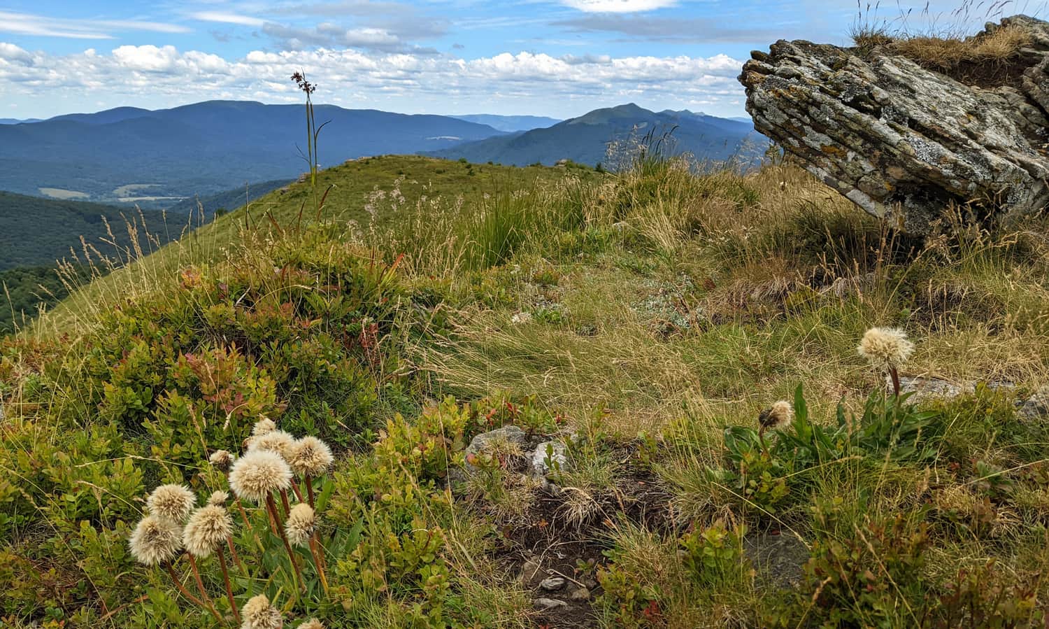
Besides, summer on Bukowe Berdo also has its colors. The wild meadows are vibrant!
Bukowe Berdo - views
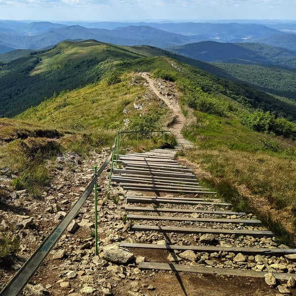
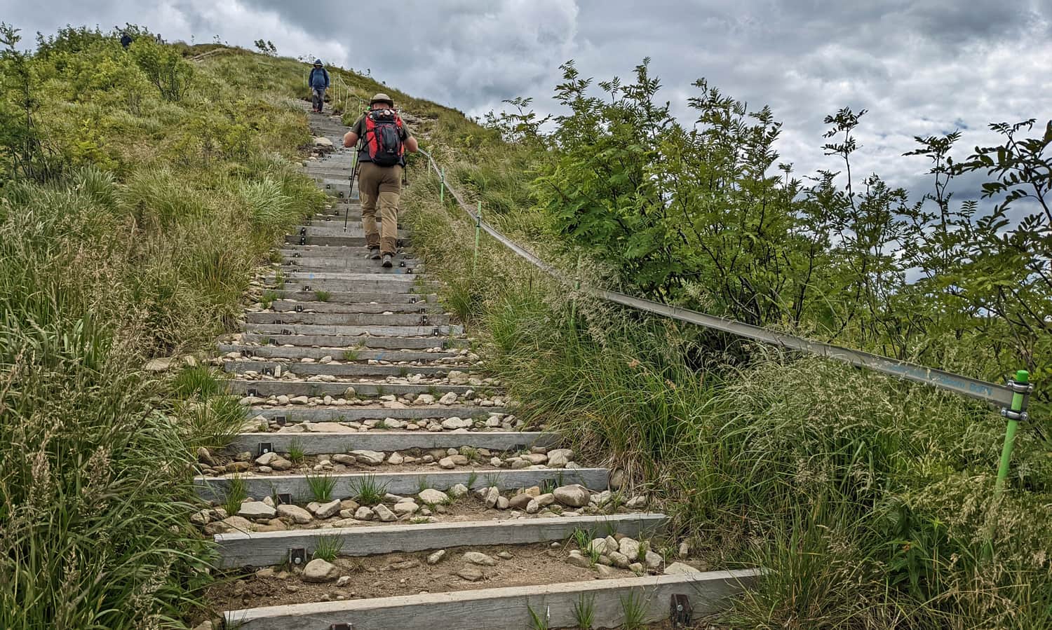
We will have panoramic views throughout the entire route, both to the east (San Valley) and to the west (Szeroki Wierch ridge) and north (Rawki, Caryńska Mountain Meadow). The most beautiful panorama, also to the south, awaits us at the top, the southernmost and highest peak of the ridge. We climb up to it using stairs...
...and at the top, we will find:
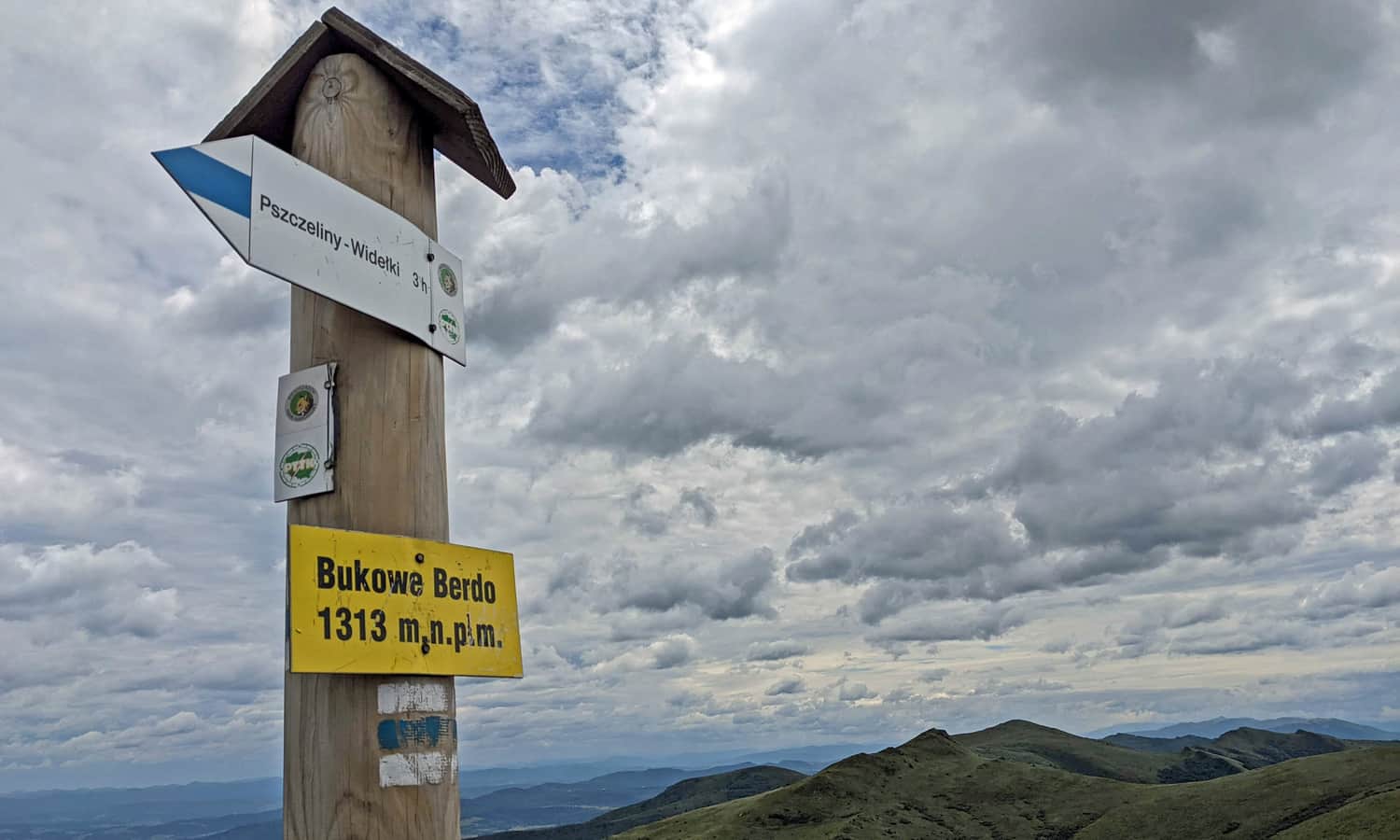
Summit of Bukowe Berdo - 1313 meters above sea level
We reached the highest point of Bukowe Berdo (1313 meters above sea level) on July 13th, the phone showed 13 degrees Celsius...
The breathtaking views all around warmed our hearts so much that we couldn't stop... The mountains were calling!
Bukowe Bredo - return and other trails
We return to Muczne using the same trail (blue + yellow trail), which will take about 1.5 hours. Alternatively, we can descend on the blue trail to Widełki, near the Pszczeliny - Ustrzki Górne road (2.5 hours).
Or... if you have enough time and the weather permits, continue further through Krzemień: to Tarnica or Kopa Bukowska and Halicz.
Medium
Trail to Tarnica through Bukowe Berdo and Krzemień

Muczne - attractions in the area
...and once you have conquered Bukowe Berdo (and maybe even Tarnica) and returned to Muczne, check out other places and routes worth visiting in the area:
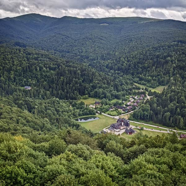
Muczne and its Surroundings: Attractions for Children and More
Muczne is a tiny village located at the end of Poland, surrounded by forests and mountains. It offers its visitors peace and contact with nature, as well as many attractions. ...
PS. This trail has been included in our article "Beautiful scenic trails in the Beskids". Would you like to learn about the others?
Beautiful Scenic Trails in the Beskids
Beskidy is not just forests! It's also scenic meadows and open ridges, offering breathtaking panoramas of the entire mountain range! ...

Publish Date:
Last Updated:
More in the Region Bieszczady (Bieszczady)