Trails to the border tripoint: Krzemieniec / Kremenaros
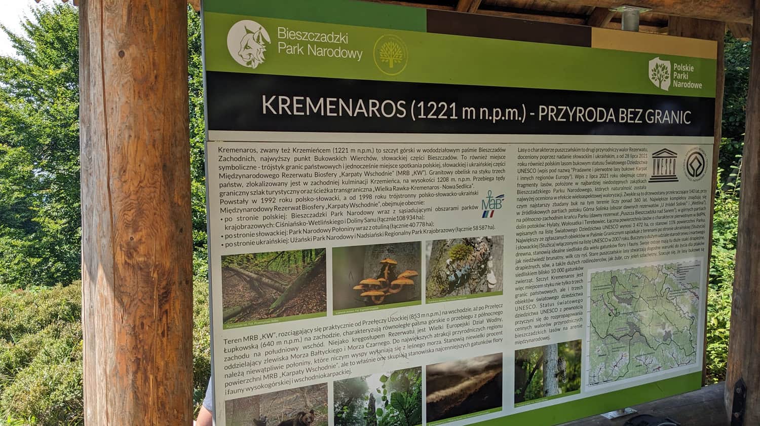
Krzemieniec, 1221 meters above sea level, also known as Kremenaros, is a peak in the Bieszczady Mountains where the borders of three countries meet: Poland, Ukraine, and Slovakia. Known as the Bieszczady border tripoint, it is a popular destination for hiking. Which trail can you take to reach it? What should you know about Krzemieniec and the tripoint itself?
How to reach Krzemieniec / Kremenaros?
Krzemieniec is located in the Border Range, away from the main trails in the Bieszczady Mountains. However, if you want to reach it, there are several routes to choose from.
Shortest trail to Krzemieniec from Ustrzyki Górne and Rzeczyca
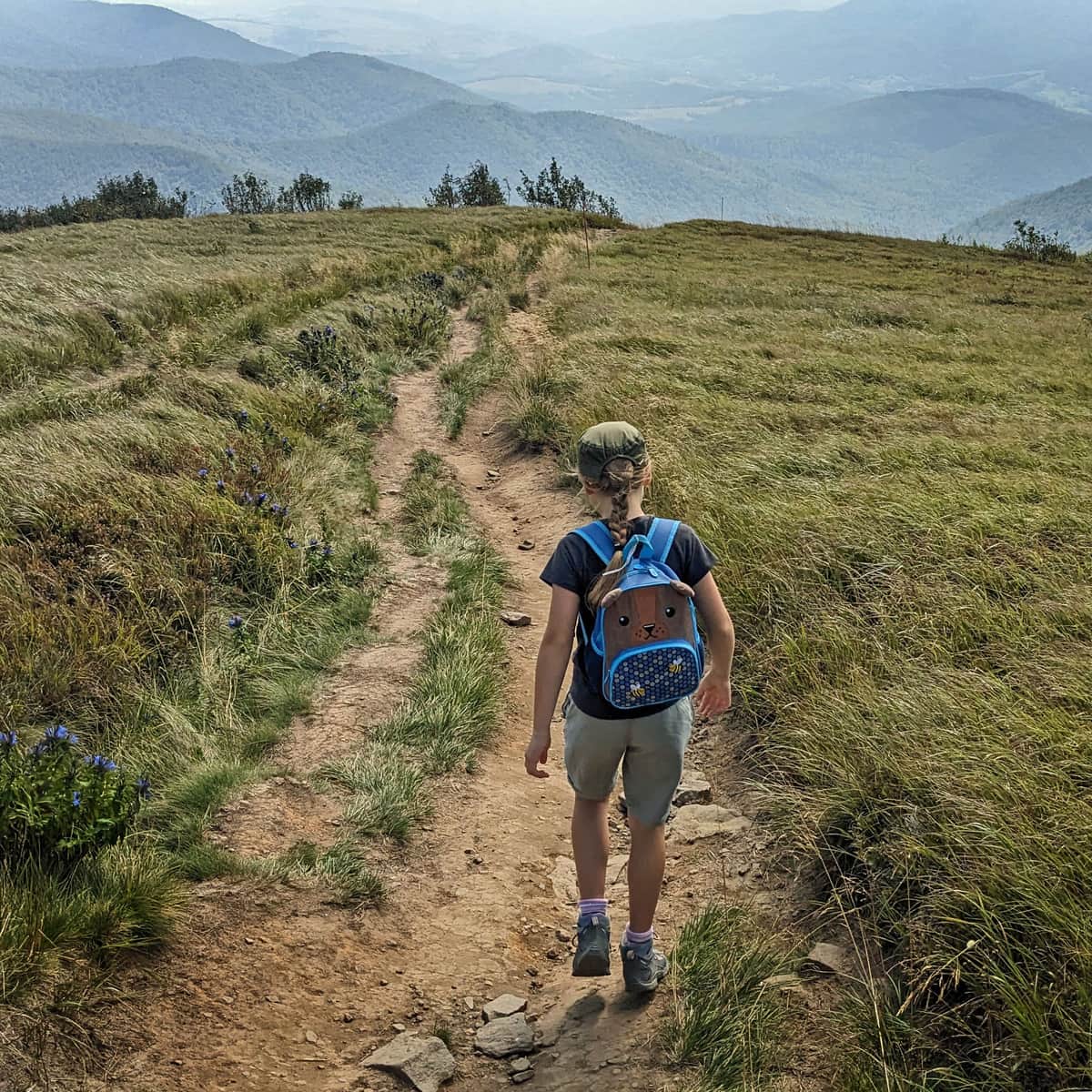
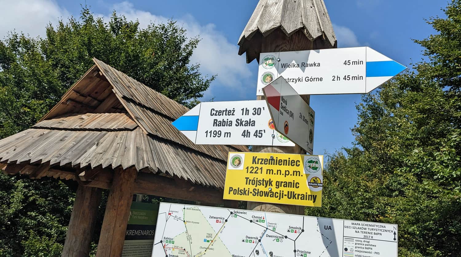
The quickest way to reach the summit of Krzemieniec is by taking the blue trail from Rzeczyca. First, we climb to the southern peak of Wielka Rawka, then continue along the blue trail along the border for about 30 minutes.
In total, this route is 5.8 km long with an elevation gain of 700 m. It should take about 3 hours to reach the destination.
Medium
Blue Trail to Wielka Rawka

Most popular and easiest trail to Krzemieniec through Rawki
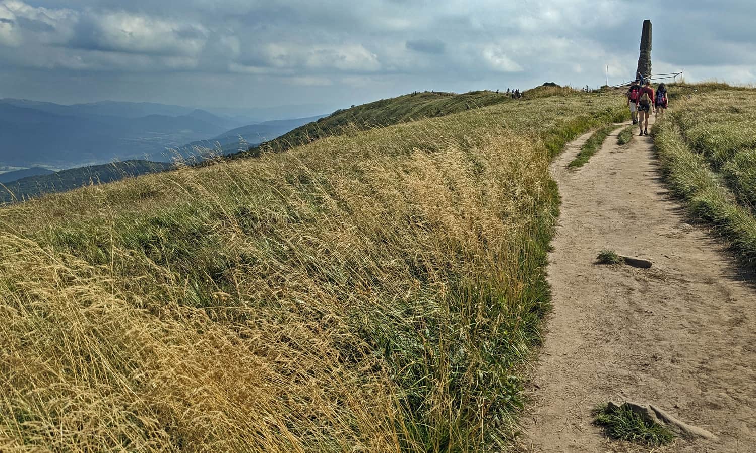
Most tourists conquer the summit of Krzemieniec through Rawki. Although this trail is slightly longer than the blue trail from Rzeczyca (6.3 km), it involves a much smaller elevation difference (570 m). It should take about 3 hours to complete the hike.
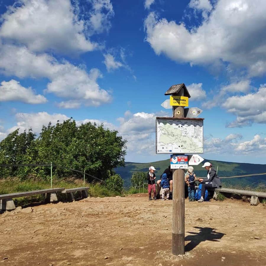
First, we take the green trail from Przełęcz Wyżniańska to Mała Rawka (note: it is a short but sometimes steep route):
Medium
The Green Trail to Mała Rawka from Przełęcz Wyżniańska

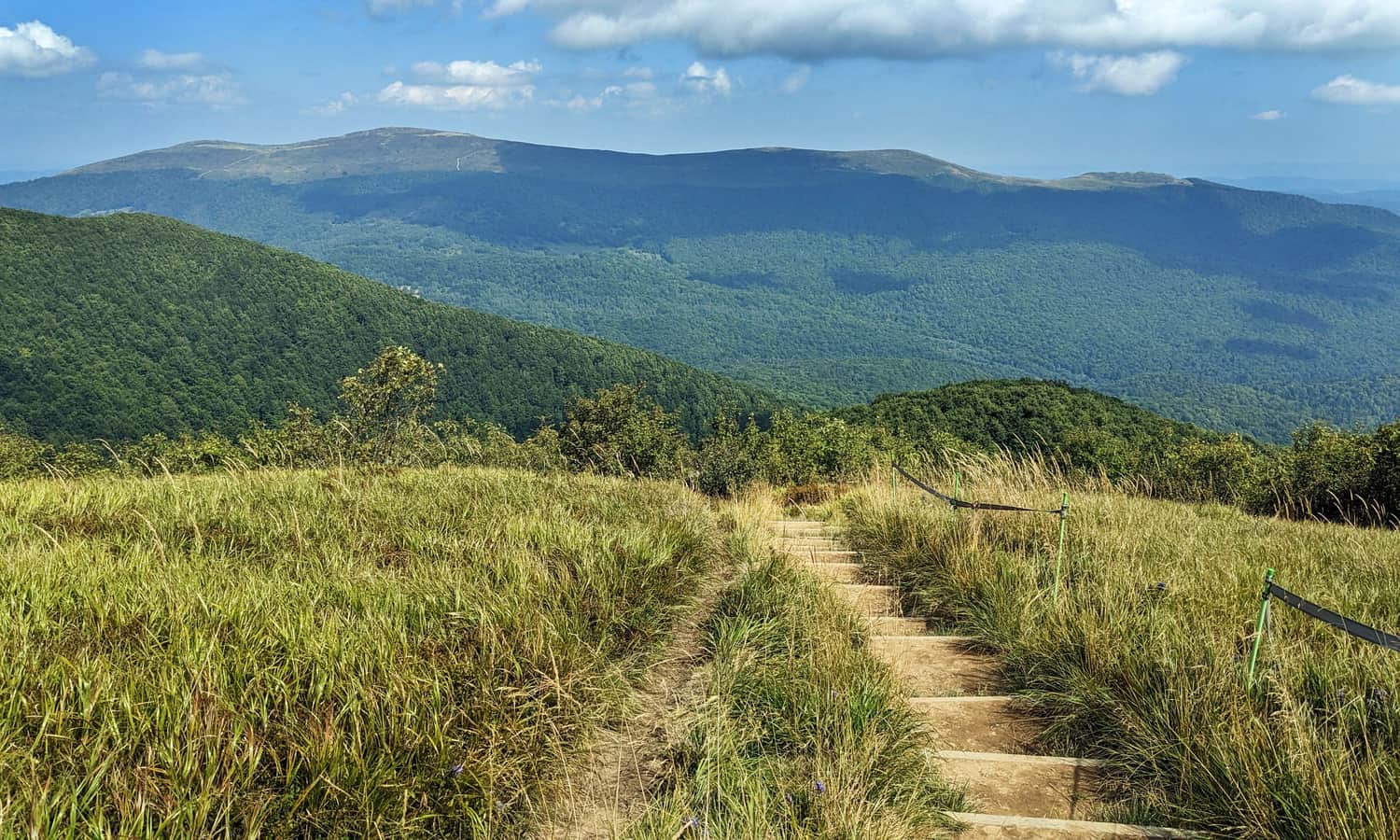
From Mała Rawka, we hike along picturesque and scenic ridges to Wielka Rawka (about 30 minutes), and then another 30 minutes from Rawki to Krzemieniec:
Medium
From Mała and Wielka Rawka to Krzemieniec / Kremenaros

Other trails to Krzemieniec
- From Przełęcz Wyżniańska: yellow trail to Działy, then green to Mała Rawka, yellow through Wielka Rawka, and blue to Kremenaros: 8.5 km, 600 m elevation gain, 3 hours and 10 minutes
- From Wetlina: green trail through Działy, yellow through Wielka Rawka, and blue to Kremenaros: 12.5 km, 870 m elevation gain, 4 hours and 30 minutes
- From Wetlina: green trail to Szczob, from Jawornik yellow through Rabią Skała and border trail (blue and red) to Kremenaros: 18 km, 1260 m elevation gain, 6 hours and 30 minutes
- From Wetlina: yellow trail through Jawornik and Rabią Skała, then border trail (blue and red) to Kremenaros: 19 km, 1300 m elevation gain, 7 hours
Slovak trail to Krzemieniec
You can also hike to Krzemieniec from Slovakia. From Nowa Sedlica, there are two trails: red: 9 km, 990 m elevation gain, about 4 hours one way, and green through Czerteż: 10.5 km, 950 m elevation gain, about 4 hours one way.
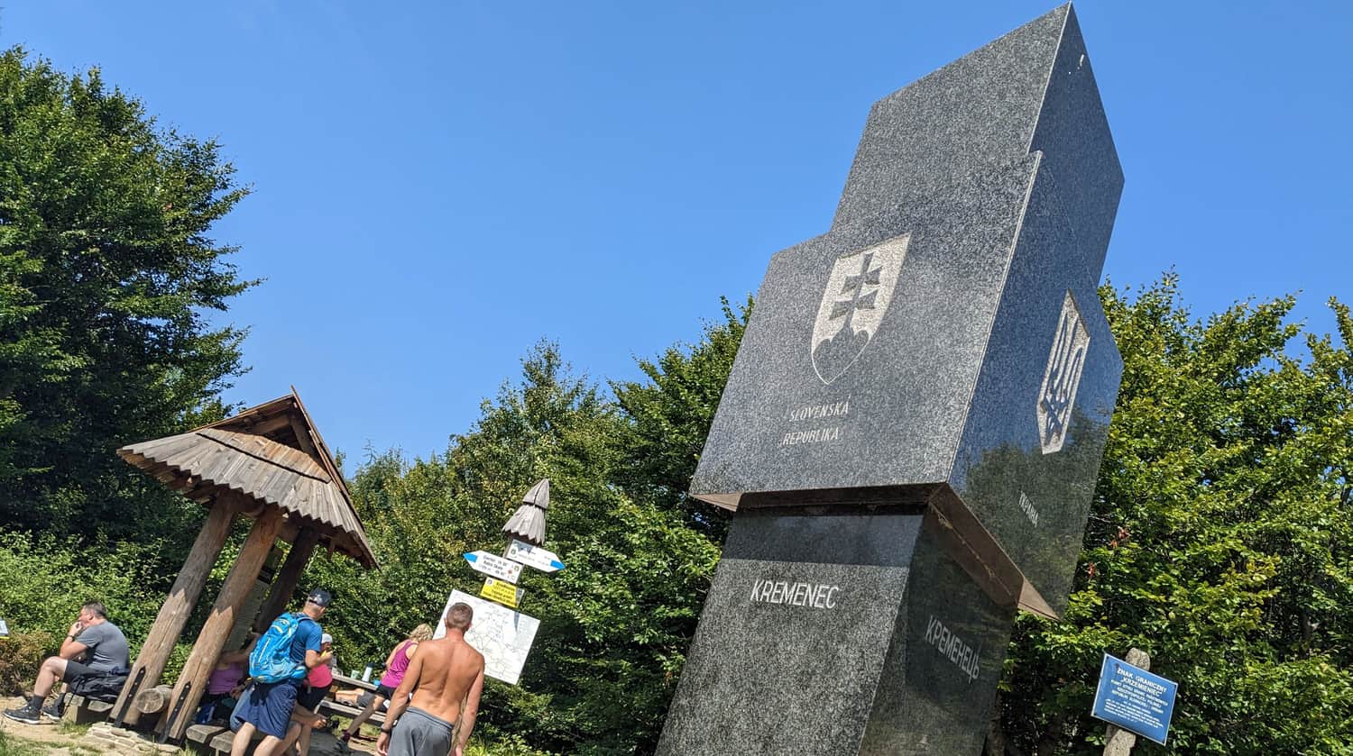
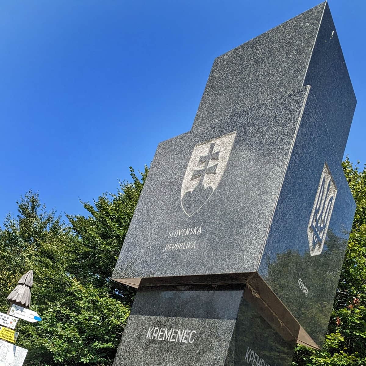
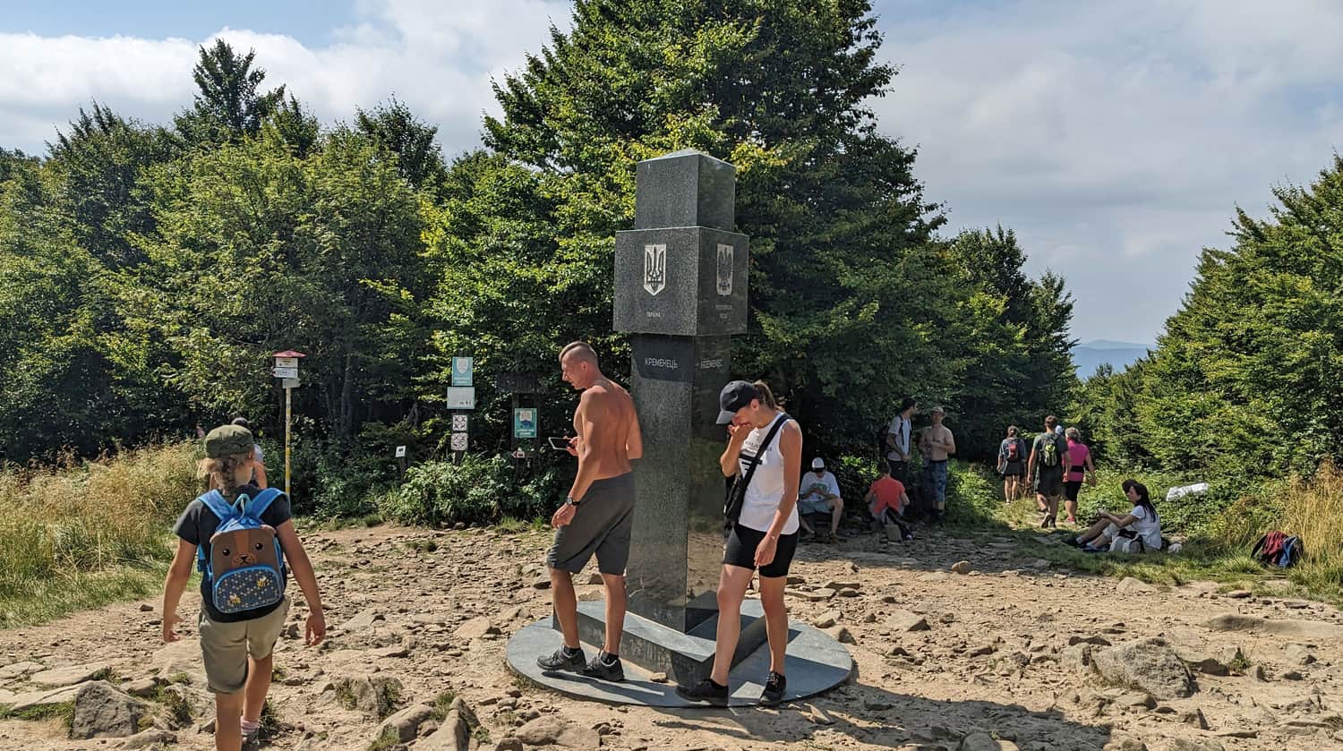
Krzemieniec / Kremenaros; 1221 meters above sea level - facts and trivia
What should you know about Krzemieniec? Why is it so special, not only for Poles?
Krzemieniec or Kremenaros?
The peak where the borders of Poland, Ukraine, and Slovakia meet has two names. Krzemieniec is the modern name you will find on most maps. The Bieszczady National Park and locals often refer to the mountain by its old name, Kremenaros. The name "Kremenaros" comes from Hungarian words meaning "Ruski Kamień" (Ruthenian Stone).
Slovaks on Kremenaros
Have you encountered tourists from Slovakia at the summit of Kremenaros? For Slovaks, it is an important peak, not only because of the tripoint. It is also the highest peak in the Slovak Bieszczady Mountains (known as Bukowskie Wierchy) and the easternmost point of the country.
Tripoint - Has there always been a border here?
During the interwar period, Kremenaros was not a "trijunction" but a regular border peak through which the border between Poland and Czechoslovakia passed (the Ukrainian Soviet Socialist Republic, which was part of the USSR, was still far away).