The Most Beautiful Trail in the Bieszczady Mountains: Through Rozsypaniec and Halicz to Tarnica
Nearby: Ustrzyki Dolne| Distance | 14.5km |
|---|---|
| Time | 5h 46min |
| Ascents | 862m |
| Descents | 274m |
wb_sunny Route in the sun
directions_car Access by car
warning No dogs allowed
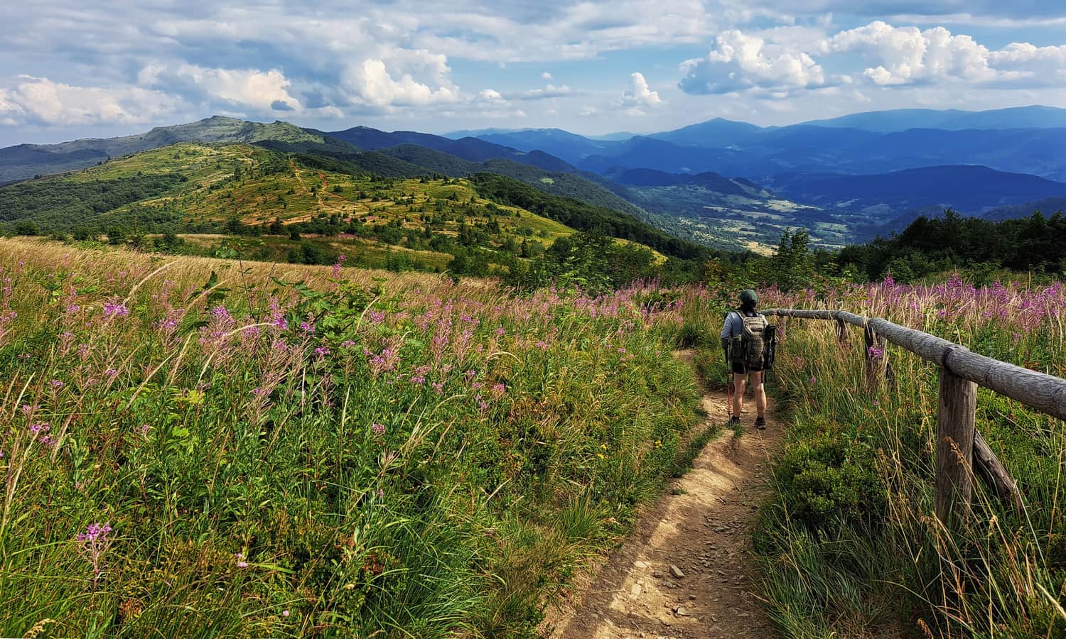
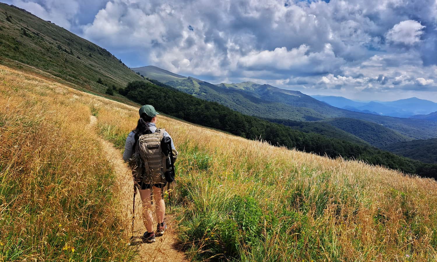
The red trail from Wołosate to Tarnica through Bukowska Pass, Rozsypaniec, Bukowska Meadow, Halicz, Wierszek Jeleni, and Kopa Bukowska is definitely one of the most beautiful and scenic (but also quite demanding) trails in the Bieszczady Mountains.
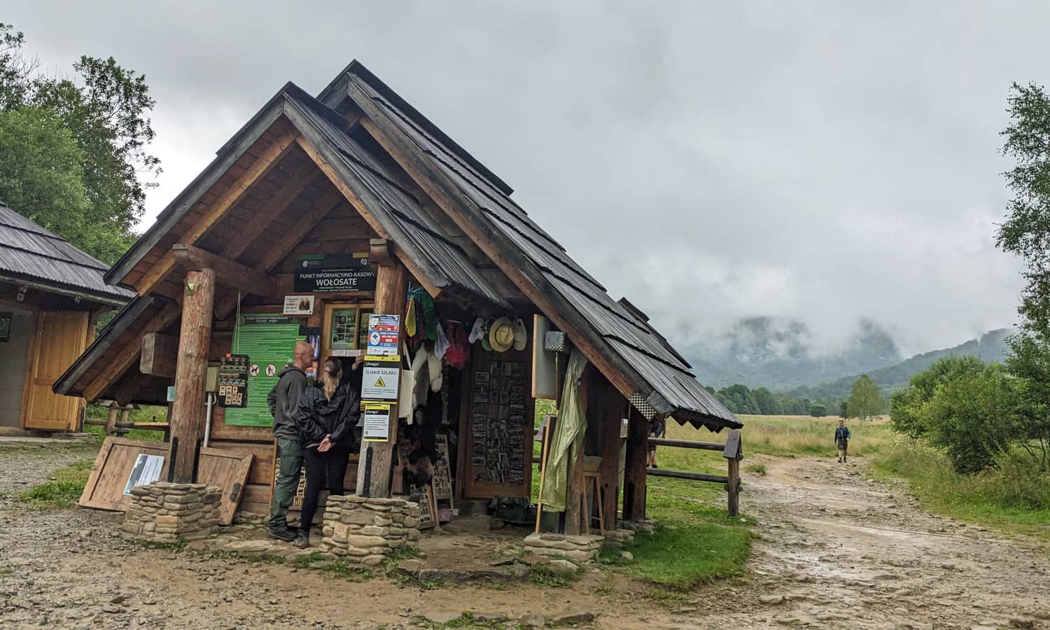
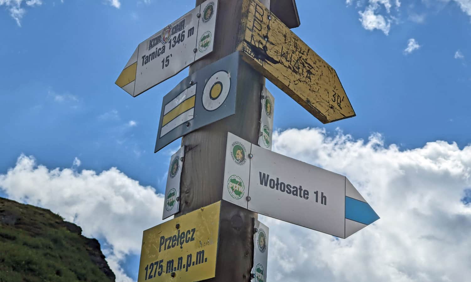
Wołosate - the start of the red trail to Tarnica
In Wołosate, there is a large paid parking lot. Displays in Ustrzyki Górne provide information about available parking spaces. If there are no spaces available or if we arrive in Ustrzyki by bus, we can walk to Wołosate (about 6 km, 1.5 hours) or take a path partially along the road and partially through the peat bogs, the Ustrzyki Górne - Wołosate nature trail (similar distance and time). During the season, we may be lucky to catch a bus to Wołosate.
From Wołosate through Bukowska Pass to Tarnica
In Wołosate, at the beginning of our trail, we will find the ticket office of the Bieszczady National Park with tickets and souvenirs (buying tickets is mandatory!). There are also toilets available.
Wołosate - Bukowska Pass
Contrary to appearances, this is one of the more difficult and tiring sections of our trail. We walk along a wide forest road (closed to car traffic). The catch is that this road is almost 8 km long... Eight kilometers of quite monotonous walking... Initially, we walk along the edge of a meadow, and then only through the forest. Some variety can be found at the stops of the nature trail.
Nature Trail "Rozsypaniec - Krzemień"
The red trail from Wołosate, through Rozsypaniec and Halicz, all the way to the slopes of Krzemień, is accompanied by a nature trail with 28 stops. Each stop, marked with a Haller's anemone, provides various nature information and curiosities. More information can be found in the folder with descriptions of the stops (available for a few złotys at the ticket office). Counting the remaining stops will help us answer the eternal question "are we there yet?".
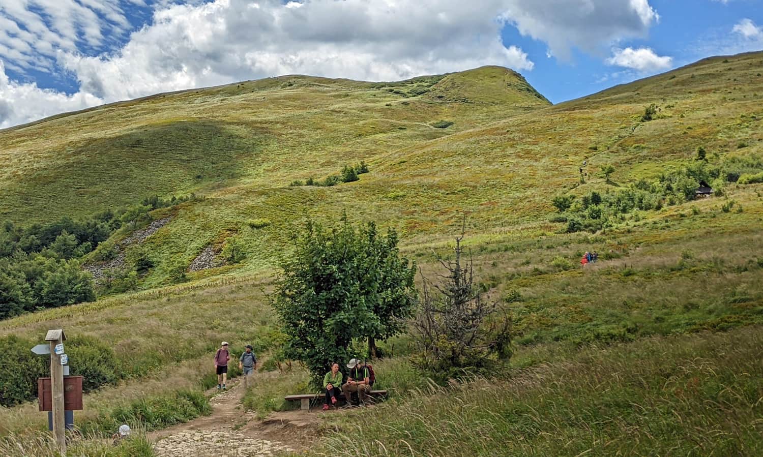
Bukowska Pass, 1127 m above sea level
Phew... The most difficult part is behind us! Ahead of us is the most beautiful part! At Bukowska Pass, the forest road ends, and there is a shelter with benches waiting for us, but most importantly: the trail finally leads us to scenic meadows!
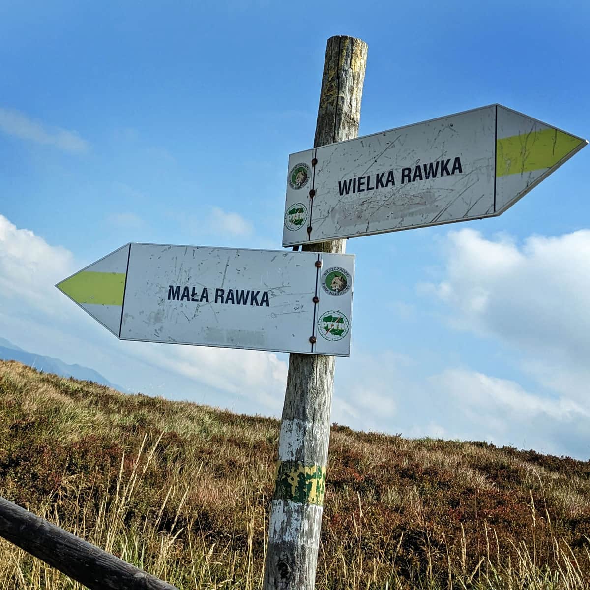
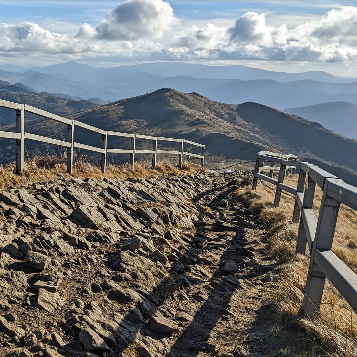
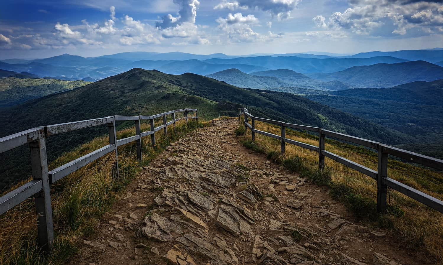
Rozsypaniec, 1280 m above sea level
After about half an hour of ascent through the meadow, we reach the first peak on our trail - Rozsypaniec. It's the first of many opportunities to stop, sit on a bench, and admire the surroundings - there is so much to see!
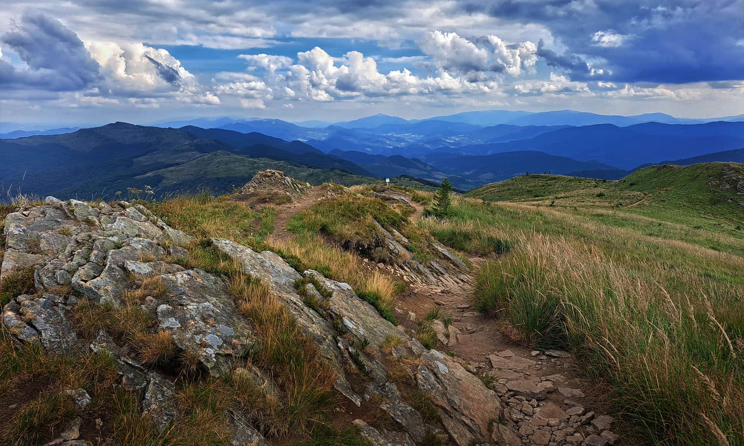
Halicz, 1333 m above sea level
Another half an hour walk along the ridge and climbing the terrain "stairs" will take us to the highest peak on our trail, apart from Tarnica.
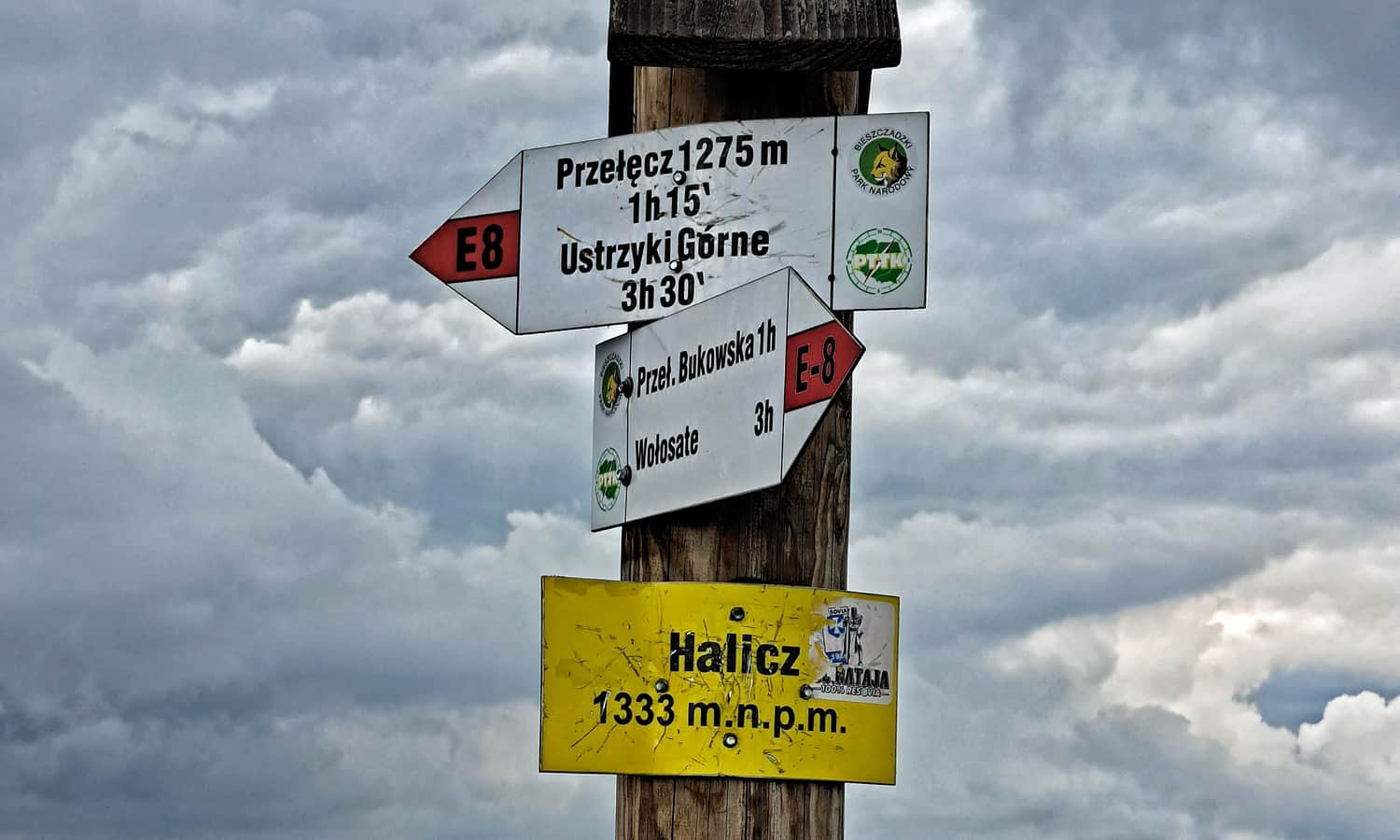
At the top of Halicz, besides a plaque, there are benches and a small metal cross waiting for us. Did you know that it was brought here from Tarnica after a new, large cross was erected?
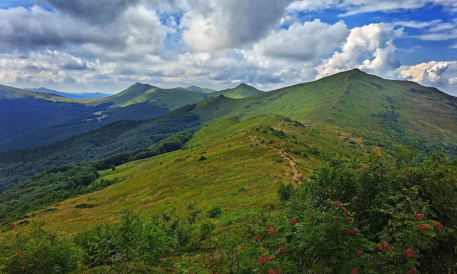
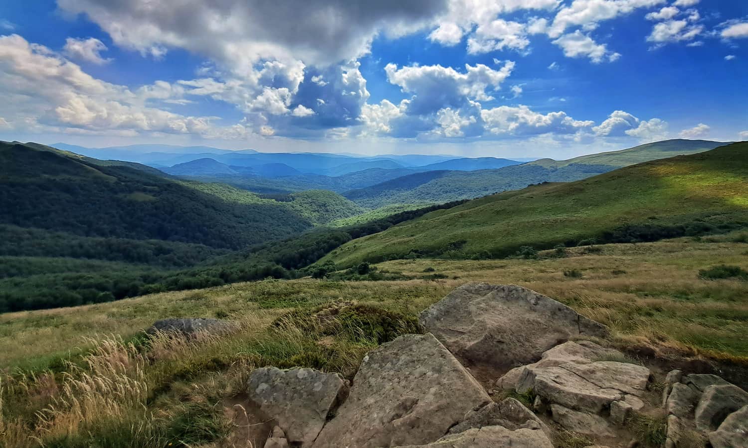
Wierszek Jeleni and Kopa Bukowska
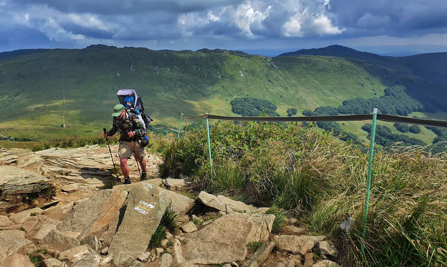
The section from Halicz to Goprowska Pass is a well-deserved moment of rest: for about 1 hour (3.5 km), we descend over 200 m through Wierszek Jeleni and the slopes of Kopa Bukowska to the pass at the foot of the rocky Krzemień. The views continue to accompany us!
Goprowska Pass and Pass under Tarnica
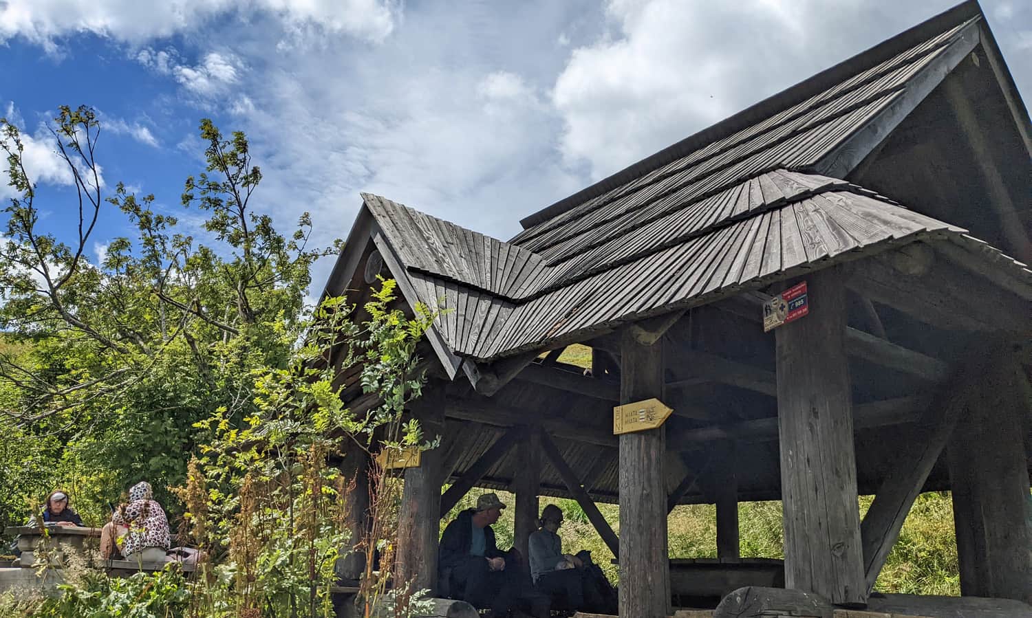
Goprowska Pass (1161 m above sea level) is a deep depression between Krzemień and Kopa Bukowska and Tarnica and Szeroki Wierch. Its name comes from the GOPR (Mountain Volunteer Search and Rescue) station that was located here for many years. At this point, the trail from Bukowe Berdo and Krzemień to Tarnica joins us.
Today, there is a shelter with a roof and a spring above it. Since the next stage of the ascent is about to begin, it is worth taking a moment to rest and regain strength here!
From Goprowska Pass, we climb the "stairs" to Pass under Tarnica (the characteristic "saddle" below the highest peak of the Polish Bieszczady Mountains).
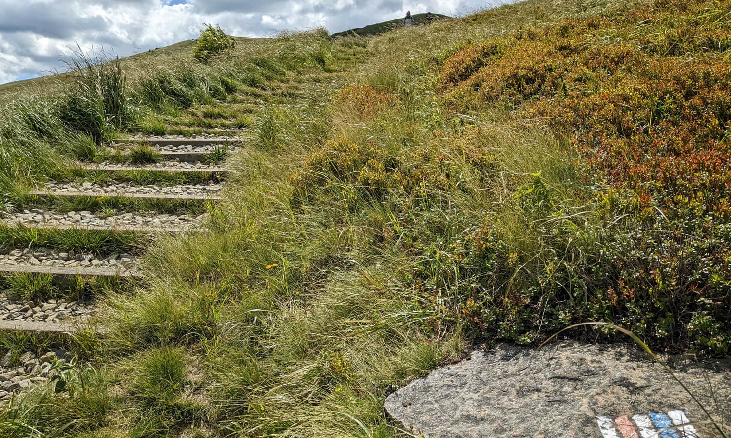
In about half an hour, we climb 125 m higher to Pass under Tarnica, where the remaining trails to Tarnica join us: the blue trail from Wołosate and the red trail from Ustrzyki Górne through Szeroki Wierch.
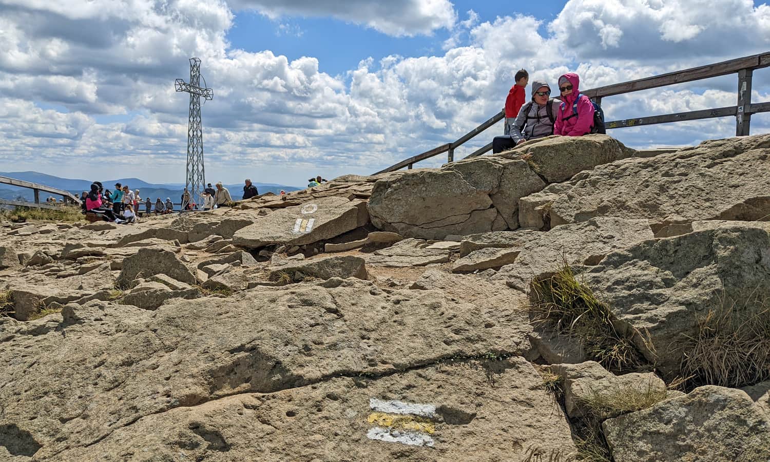
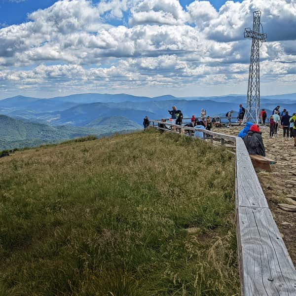
Tarnica, 1346 m above sea level - the highest peak of the Polish Bieszczady Mountains
The yellow trail will lead us from Pass under Tarnica to the summit: it will be steep, with stairs and rocks, and quite crowded during the season, but it will be a short and close journey!
At the top, there is a large cross, benches... and breathtaking views in all directions!
For more information about what we can see from the top of Tarnica, facts and curiosities, and descriptions of all the trails to Tarnica, you can find in this article:
All roads and trails to Tarnica
Tarnica (1346 meters above sea level) is the highest peak of the Polish Bieszczady Mountains. It is famous for its beautiful views... and the queue to take a photo "with the cross." Discover interesting facts about the Tarnica summit and all the roads, trails, and loops to Tarnica! ...
...and back to Wołosate
The return to Wołosate along the same trail will take about 4 hours.
It will be easier and faster to descend using the blue trail. The steep path will lead us to the starting point of the trail in about 1-1.5 hours. This way, we will complete the loop, covering a distance of 19 km and about 6-7 hours of hiking.

Publish Date:
Last Updated:
More in the Region Bieszczady (Bieszczady)