Glichowiec Range: Trupielec and Ostrysz
Nearby: Myślenicebeach_access Route in the shade
directions_car Access by car
directions_bus Can be reached by bus
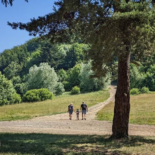
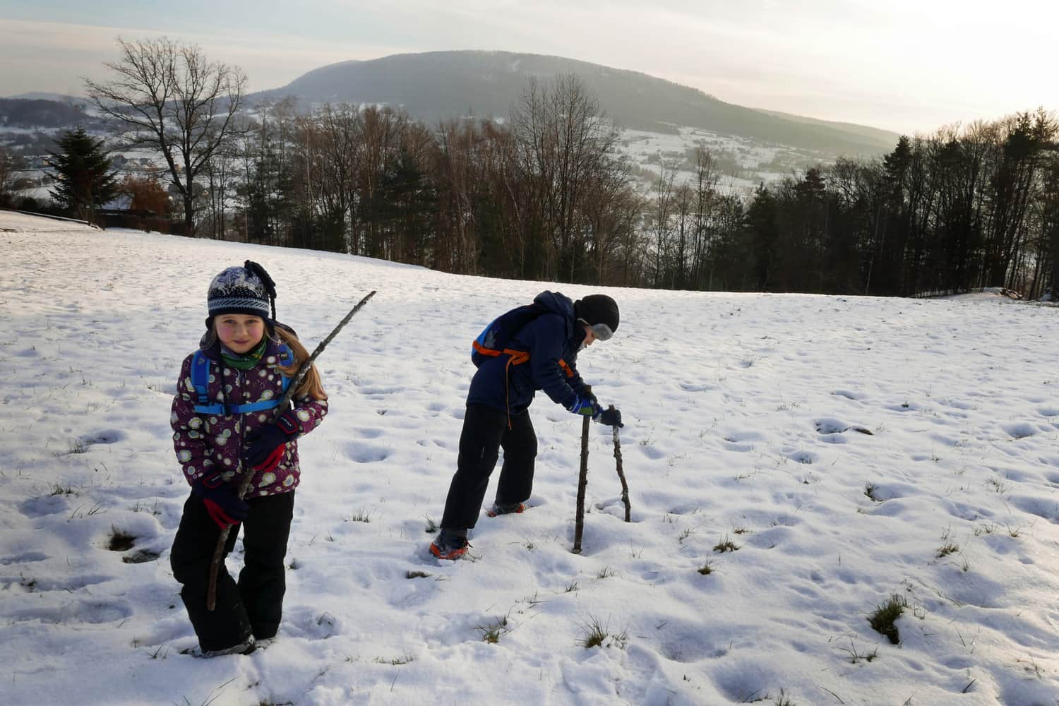
A pleasant route for an easy (yet mountainous) family walk during which we will conquer 3 peaks, with an exciting background!
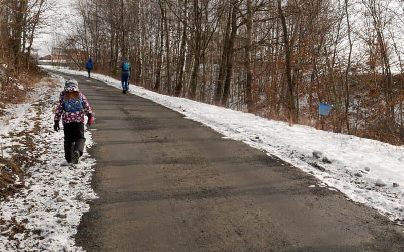
Start of the route: we set off from Trzemeśnia near Myślenice, heading through Os. Brzeg on the blue trail. The initial section is an asphalt road that climbs steeply uphill. This is probably the most challenging part of the route, afterwards it will be much easier: we will walk along a forested ridge, with some uphill and downhill sections, and mostly flat terrain.
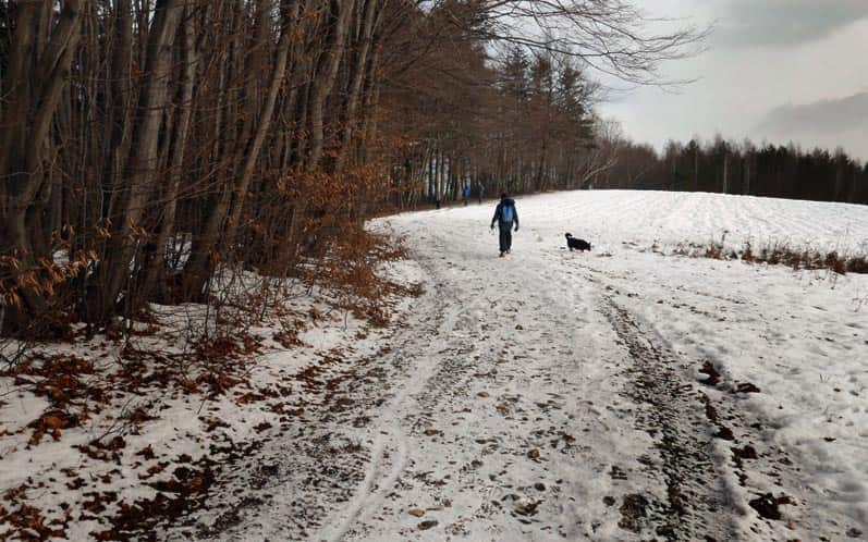
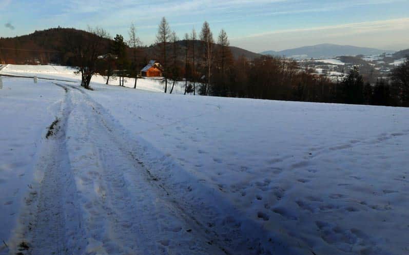
After passing by several farms, we enter a wide forest road, along the edge of the forest, fields, and meadows, until we reach the settlement of Burletka (a hamlet of Kornatka). It is worth stopping here and admiring the panorama: the majestic massif of Kamiennik, the hills of Glichowiec Ridge (our destination for the hike!), and a bit further: Ciecień.
PS. It's also worth visiting there! Check out the route to Kudłacze through Kamiennik and the hike to Grodzisko and Ciecień.
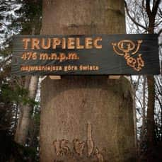
Meanwhile, we continue: through the hamlet of Kornatka and further into the forest, still following the blue trail. The first peak (Trupielec) awaits us shortly after entering the woods. After descending from the peak of Trupielec, there is a small clearing with a table and benches - that's where the Niezapominajka trail from Kornatka joins.
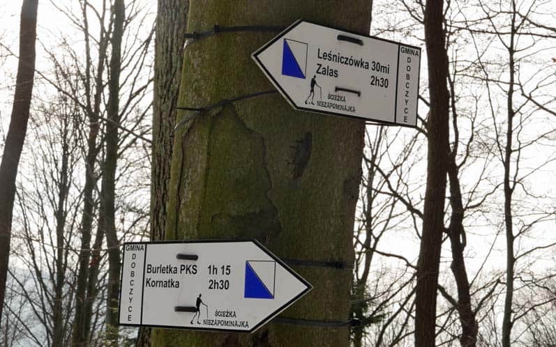
We continue along the blue trail and soon reach another summit - Ostrysz (marked by a small, inconspicuous sign). After briefly joining the yellow trail, we continue on the solitary blue trail and search for Glichowiec. Unfortunately, there is currently no sign for tourists... However, if we conquer a noticeable incline and the path starts to descend, let's look for it a few meters north of the trail's summit. With a bit of luck, we will come across a survey point marked with red paint. Could this be the summit of Glichowiec? We thought so and started our return journey.
A Tale of Trupielec: Graves, Bones, and Corpses
Time for the promised thrilling story. Why such an unusual name for the peak? Locals supposedly call it Trupiarka, and its bad reputation dates back to the Swedish Deluge, when many unburied bodies remained here after fierce battles, followed by numerous human bones lying on the surface... Another major (and likely bloody) battle took place here between the Russian and Austro-Hungarian armies during World War I (December 1914).
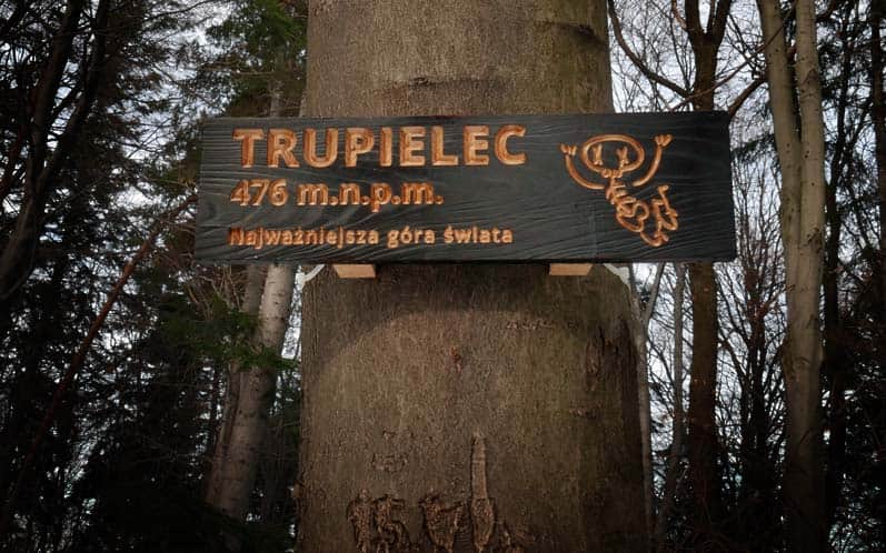
Finally - although we should have started with this - in the 1930s, burial mounds dating from the 7th to 9th centuries were discovered here, and in the 1960s they were examined. There are supposedly about 20-40 of them. One of them is the very summit of Trupielec (a survey pillar stands on it). The rest are said to be located "in the area", for example, in the vicinity of the wood depot. Unfortunately, they are not marked - you'll have to search for them yourself, but it will probably be easier in a different season...
PS. Tę trasę włączyliśmy do artykułu "Górskie trasy na rodzinne wędrówki blisko Krakowa". Poznajcie pozostałe z nich!
Mountain trails for family hikes near Krakow
Where to go from Krakow for a short mountain trip? Hundreds of kilometers of hiking trails south of the capital of Małopolska. ...

More in the Region Beskid Makowski (Beskid Makowski)