Around Kotalnica - Huta Krempska
Nearby: Gorlicedirections_bike Bike route
beach_access Route in the shade
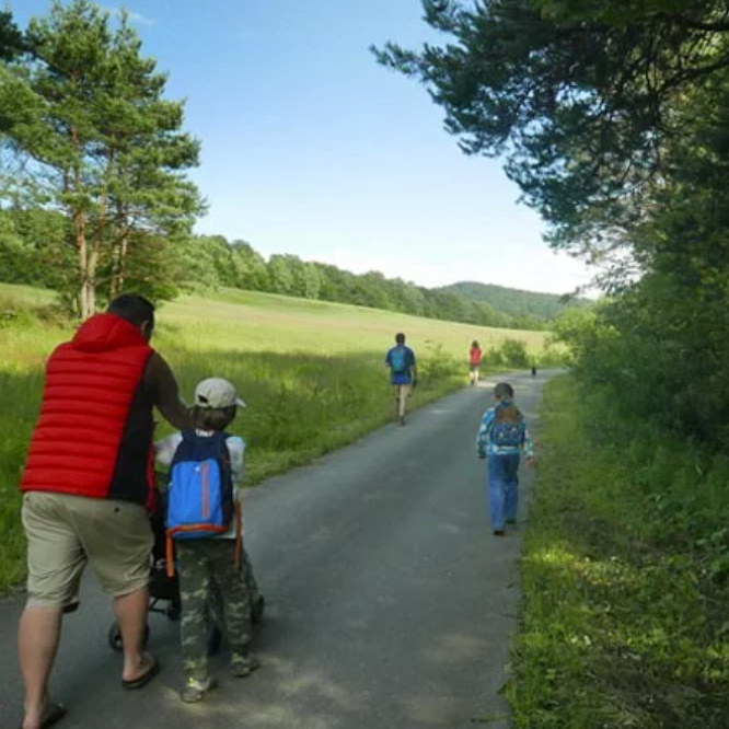
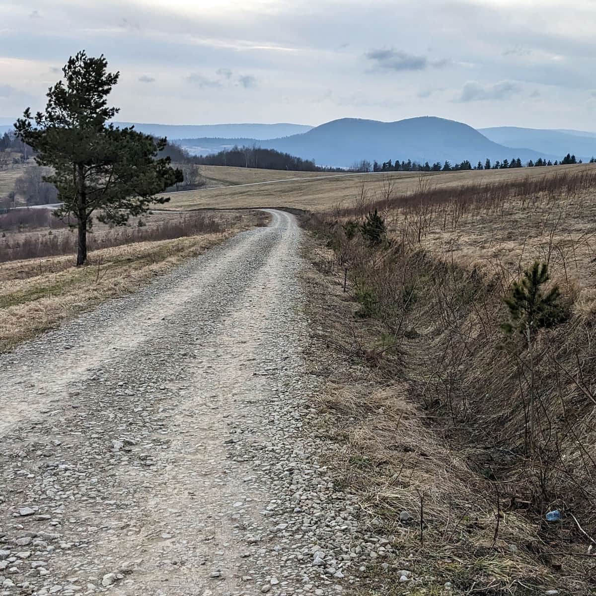
Are you in the mood for a long hike on a wide road, without any climbing? The road around Kotalnica is 9 km long, mostly asphalt or compacted gravel, with an elevation difference of about 150 m (we ascend for half of the way and descend for the other half). You can comfortably walk this route in approximately 3 hours.
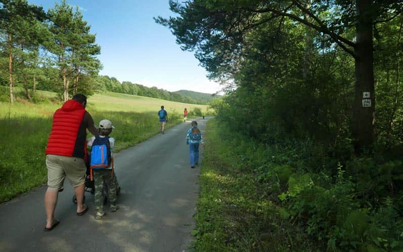
The route is theoretically accessible for cars (we didn't notice any formal traffic ban), but it is rarely used by vehicles. It is suitable for bicycles and baby strollers.
We start from the center of Krempna. We head towards the reservoir and Ożenna on the asphalt road (first on the sidewalk, then on the shoulder) following the green trail markers. After crossing the dam and continuing for a few hundred meters on asphalt, we turn left (the first possible turn after a small bridge, marked as a bicycle trail).

We pass an old wooden hut and after a few hundred meters, we enter the forest. We pass a meadow in the middle of the forest - be sure to look out for golden eagles here! After a while, we reach the highest point of the route - from now on, it's all downhill!
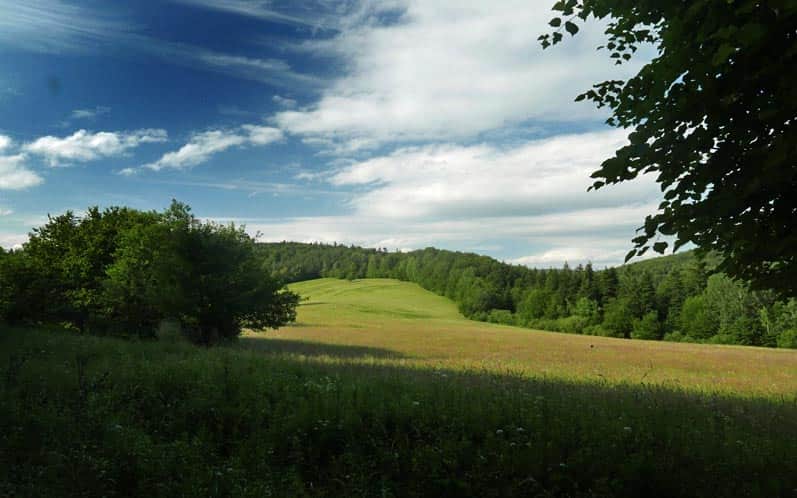
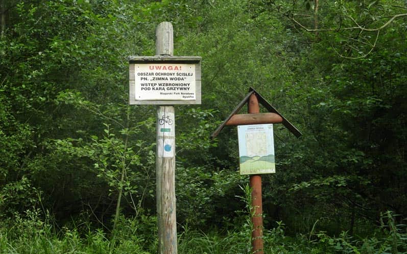
We walk along the edge of the Zimna Woda Strict Nature Reserve, which is one of the most valuable forest fragments in the Magura National Park and also the site of fierce battles during the Battle of Dukla Pass in World War II.
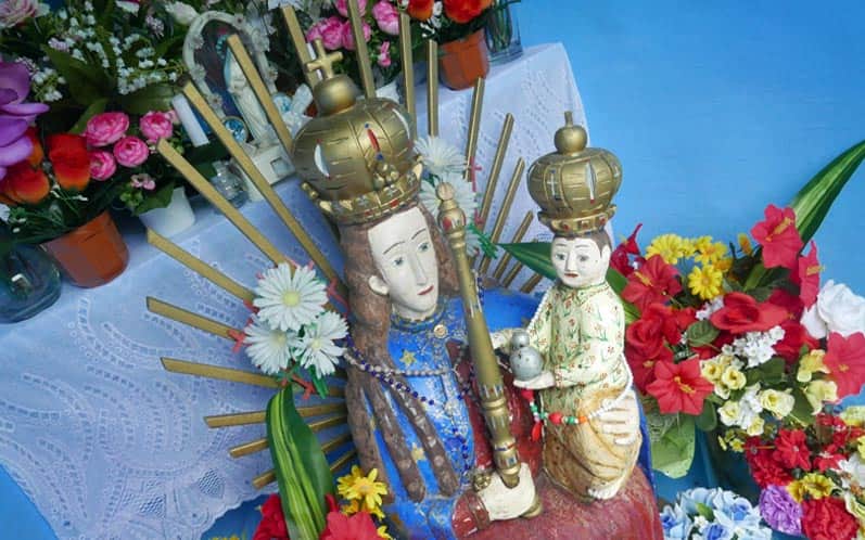
From there, we descend to the village of Huta Krempska, where we are greeted by a charming blue chapel (make sure to open the door!). In the vicinity of the blue chapel, there used to be a glassworks (the glass cross in the chapel is made of glass produced there).

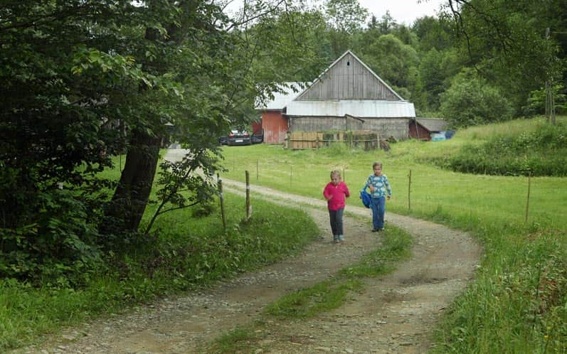
Below, we pass several old and new farms in modern Huta Krempska.
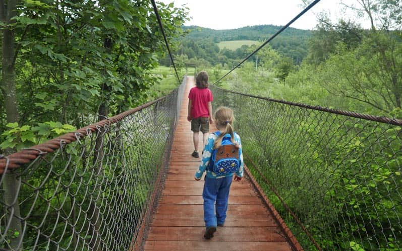
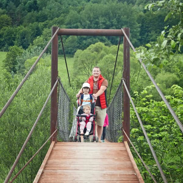
The road to Krempna leads through an interesting hanging bridge (or ford below).
We return to the starting point along the shoulder of the asphalt road.
In Krempna, we recommend visiting the historic Orthodox church, exploring the Museum of Magura National Park, visiting the cemetery from World War I on Łokieć Hill, and taking a rest by the reservoir on the Wisłoka River (it's best to go down to the water just below the dam or at the ford next to the hanging bridge).
Ps. This route has been included in the article "Beskid Niski - the most beautiful scenic trails." Would you like to learn about the others?
Beskid Niski - The Most Beautiful Scenic Trails
The trails in Beskid Niski are not too demanding, perfect for families with children and beginner hikers. ...
...as well as in the article "Beskid Niski - 4 wheelchair-friendly trails":
Low Beskids - 4 Stroller-friendly Trails
For tourists who want to go hiking with a stroller in the Low Beskids, we recommend mainly the flat valleys of former Lemko villages. ...

More in the Region Beskid Niski (Mountain range of the Low Beskids (Beskid Niski))