
Magurka Wilkowicka - shelter, trails to the peak
Magurka Wilkowicka is a peak in the Little Beskids, located between Bielsko-Biała and Wilkowice in the west, and Lake Międzybrodzkie and Lake Żywieckie in the east. In the past, there were shepherd's huts here, but today, on the vast meadows, we can find a network of hiking trails, a PTTK shelter, and a cross-country skiing station.
How to get to Magurka Wilkowicka with a stroller?
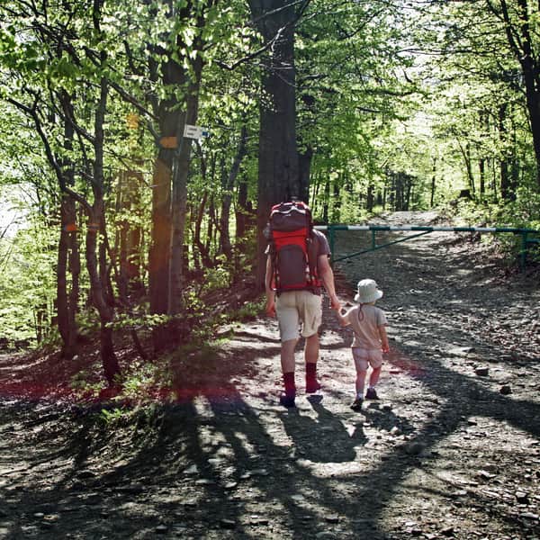
You can reach Magurka Wilkowicka via an asphalt road from Wilkowice (Harcerska Street) - theoretically closed to car traffic but convenient for strollers. It takes about 1.5 hours to walk with a stroller.
Prefer an off-road experience? There are plenty of forest trails to choose from!
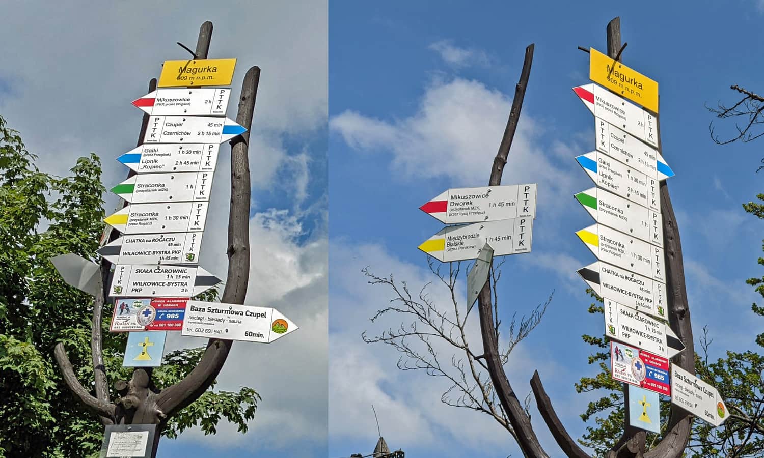
Trails to Magurka Wilkowicka
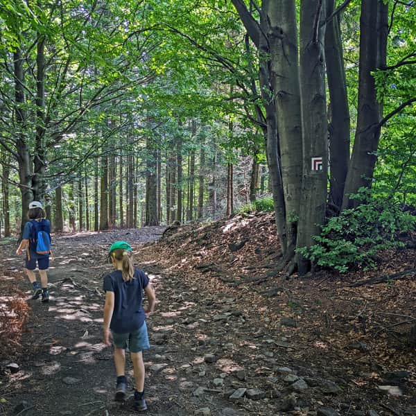
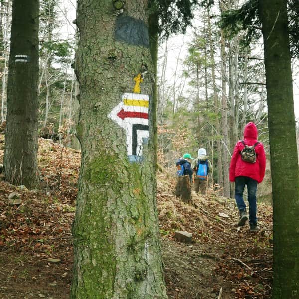
The maze of trails around Magurka Wilkowicka is impressive! You can reach the peak from all nearby towns: Bielsko-Biała, Wilkowice, Łodygowice, Międzybrodzie Bialskie, and Czernichów (via Czupel).
Easiest and shortest trail to Magurka Wilkowicka
The fastest, easiest, and most popular (crowded during the season) route to the peak of Magurka Wilkowicka starts from Przegibek Pass:
Medium
From Przełęcz Przegibek to Magurka Wilkowicka

Trails from Wilkowice to Magurka Wilkowicka
Trails from Wilkowice/Bielsko-Biała are less crowded, and you can combine them into a loop, for example, go up the red trail, descend on the yellow trail, and black trail. Both trails mainly go through the forest, but there are scenic viewpoints along the way:
Medium
Czerwony szlak na Magurkę Wilkowicką

Medium
Czarny szlak na Magurkę Wilkowicką

You can see the described trails to Magurka Wilkowicka on the map above.
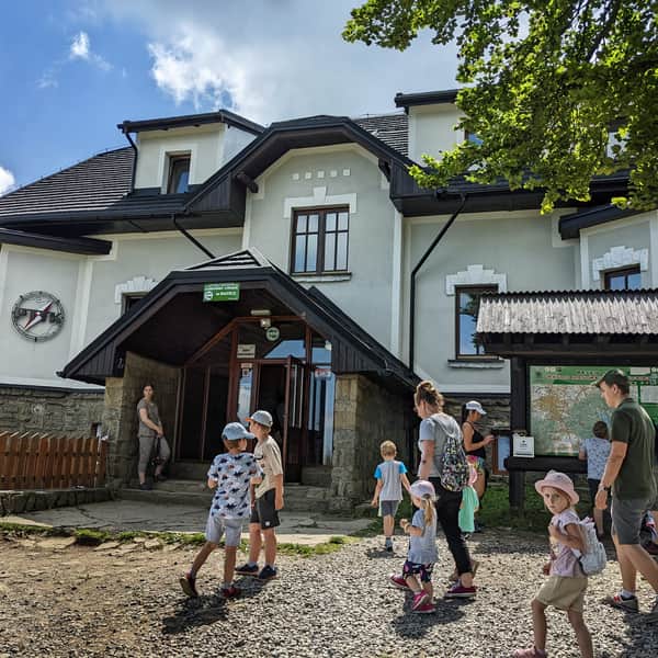
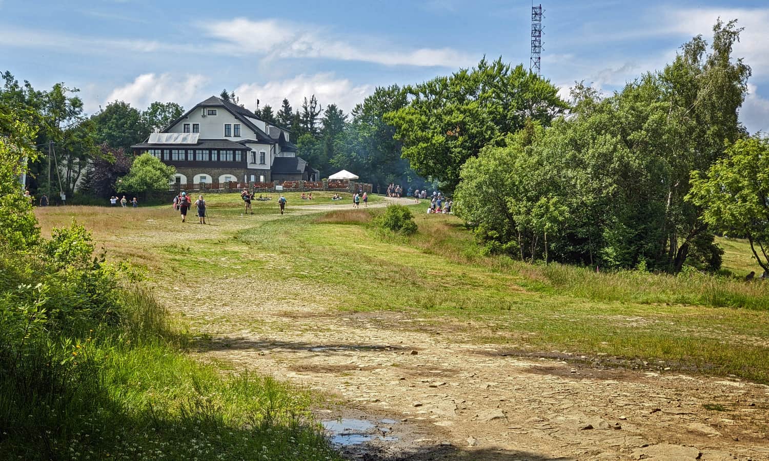
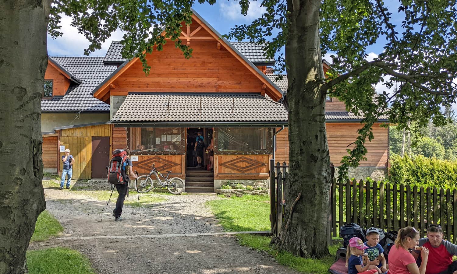
Magurka Wilkowicka - PTTK shelter and attractions
For the youngest hikers, resting at the shelter is the perfect way to end a mountain trip! Additionally, you can collect a stamp in your hiking booklet, buy souvenirs, and enjoy some delicious snacks:
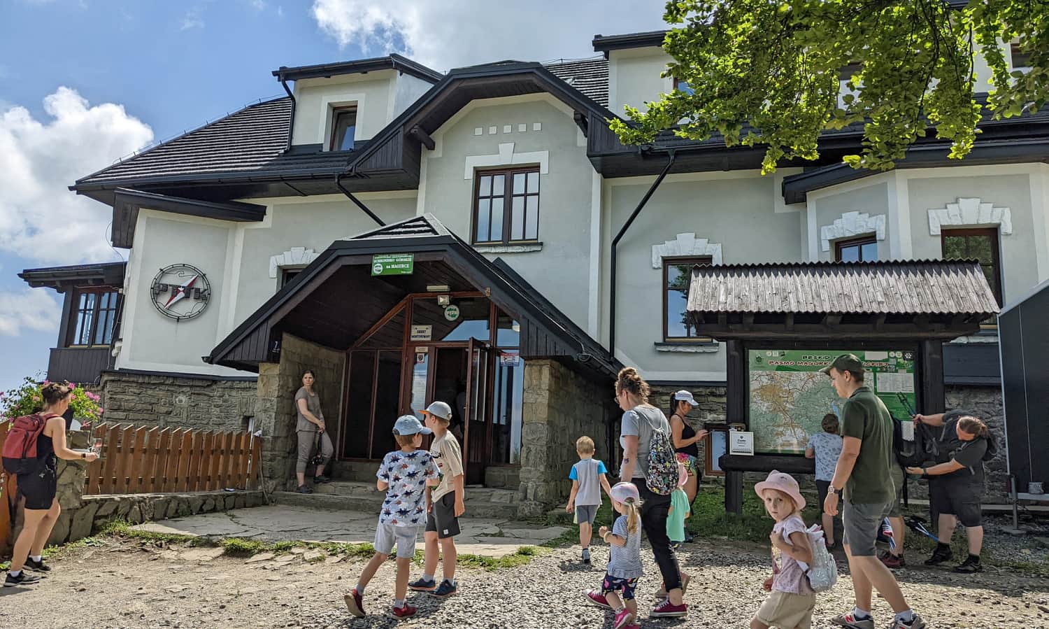
You can also have a bonfire (designated fire pits), play on the meadow. During the season, you can feast on blueberries in the nearby meadows.
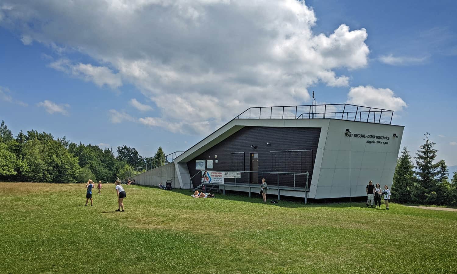
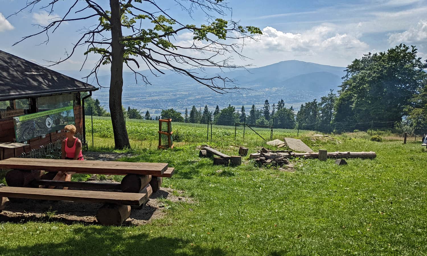
Cross-country skiing station - viewpoint terrace
During winter, Magurka is a cross-country skiing center. In summer, the station supposedly serves as a viewpoint terrace, but unfortunately, it was closed in the summer of 2022. It's a shame because most of the views are blocked by the tree crowns...
Tourist Hut on Magurka
A slightly nicer panorama of Skrzyczne can be seen from a little below the summit, from the Tourist Hut on Magurka: (a gastronomic point, swings, and fewer crowds than at the PTTK shelter):
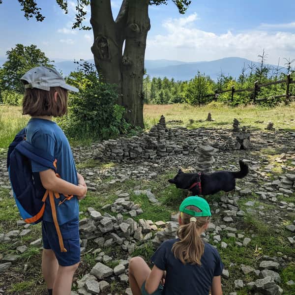
Magurka Wilkowicka - Czupel
Once you're on Magurka Wilkowicka, you might want to conquer the highest peak of the Little Beskids. The trail from Magurka Wilkowicka to Czupel offers a pleasant and easy walk:
Easy
Magurka Wilkowicka - Czupel


Publish Date:
Last Updated: